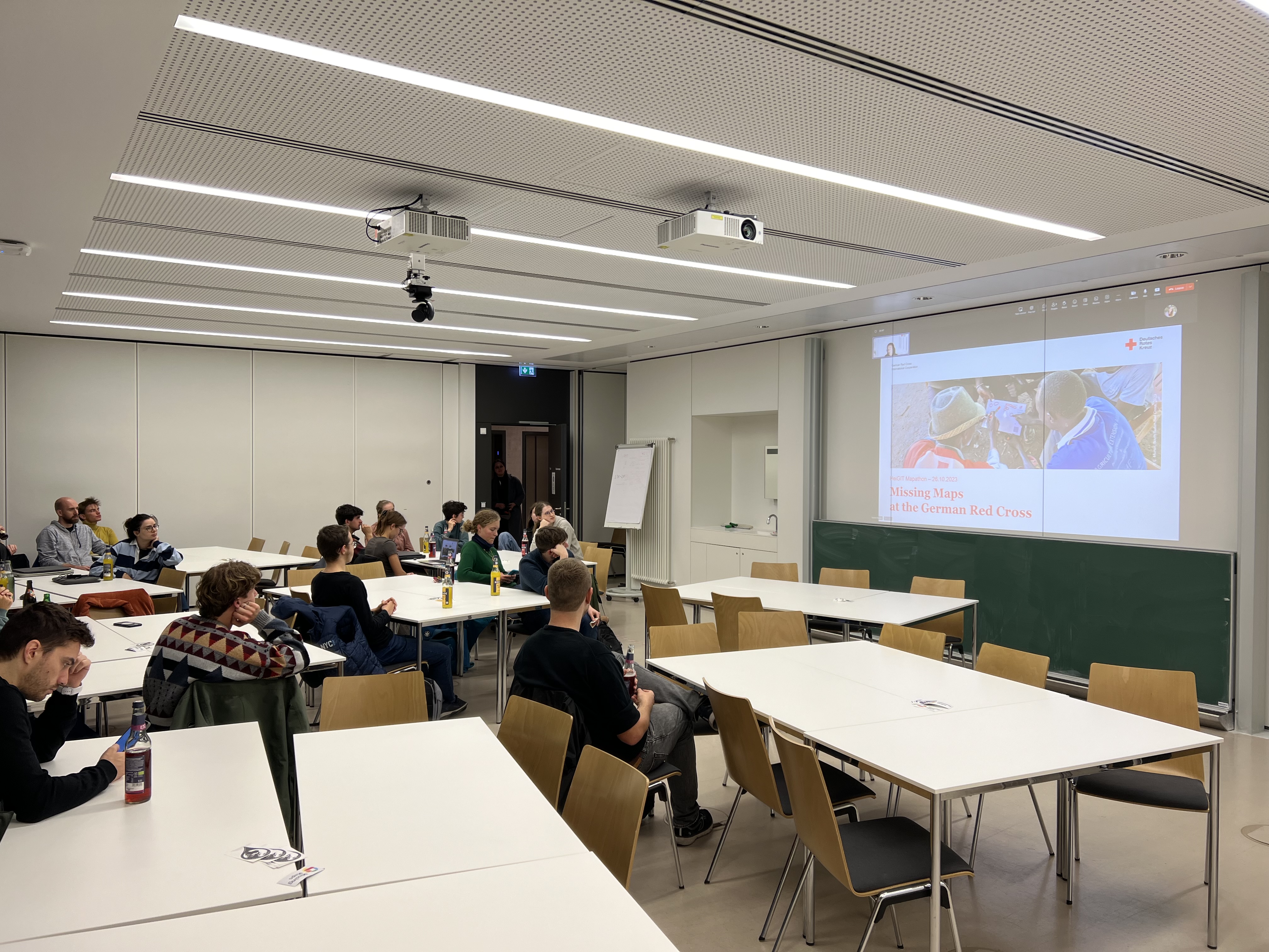
Wir haben am Donnerstag, den 26. Oktober einen Mapathon veranstaltet, an dem sowohl Forschende als auch Studierende teilgenommen haben. Nach einer kurzen Einführung durch Isabell Klipper, in der sie über die Anwendungsbereiche solcher Daten, wie zum Beispiel das Sketch Map … Read More
Deutsch
Private Vehicles Greenhouse Gas Emission Estimation at Street Level for Berlin Based on Open Data
Da der Verkehrssektor einer der größten Verursacher von Treibhausgasemissionen ist, der in den letzten Jahrzehnten keine nennenswerten Emissionssenkungen verzeichnen konnte, muss er von den politischen Entscheidungsträgern besonders berücksichtigt werden. Schätzungen der Verkehrsemissionen beruhen jedoch häufig auf großen Mengen Verkehrsdaten, die … Read More

Open Healthcare Access Map Update and HDX
Im vergangenen Jahr haben wir die Open Healthcare Access Map gestartet. Zunächst waren nur einige Länder und später Kontinente verfügbar. Wir freuen uns heute anzukündigen, dass wir die restlichen, bisher fehlenden Ländern hinzugefügt und damit eine globale Abdeckung erreicht haben. … Read More
A basic guide to OSM data filtering
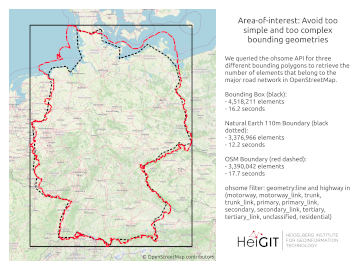
Working with OpenStreetMap data is an exciting topic that often reveals astonishing insights. The free and open nature of the project allows a plethora of analyses topics. We at HeiGIT often concentrate on global quantitative analyses and visualisations powered by … Read More
The future of working with OSM data
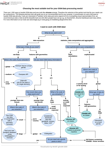
The open, flexible and collaborative nature as well as the benefits and advantages of OpenStreetMap (OSM) lead to the creation of a whole new ecosystem evolving around the project. They range from local and global communities of data and software … Read More
Disaster Risk Reduction, OpenStreetMap and Missing Maps at Global Platform 2019
Global Platform 2019 in Geneva Creating maps helps humanity. Drawing maps together with communities is crucial for effective risk reduction interventions, ensuring no one is left behind. The progress of the implementation of the targets set by the Sendai … Read More

Hello world, openfuelservice!
In addition to our already exciting and fascinating portfolio of open source software we now offer openfuelservice which is a new and very experimental advance in the world of fuel consumption and emission of cars. In the recent political and … Read More

HeiGIT and Humanitarian OpenStreetMap Team at the Geospatial World Forum 2019 in Amsterdam
Beginning of April, Amsterdam will become the gathering place for the global geospatial community. The Geospatial World Forum is organized for the 11th time and builds on previous successes that made it a leading event in sense of innovation, thematic … Read More
openelevationservice: enrich geometries with elevation
We published a new endpoint within the openrouteservice API ecosystem: openelevationservice. It queries a remote DEM for every vertex of a LineString or Point geometry. The underlying DEM is limited to SRTM v4.1 by CGIAR Consortium for Spatial Information as … Read More