We are happy to share that our paper “A Comprehensive Framework for Intrinsic OpenStreetMap Quality Analysis” (Barron, Neis, Zipf 2013) belongs to the top 5 most cited papers of the international journal “Transaction in GIS” (TGIS). Only recently we became … Read More
Deutsch
Conceptual compliance analysis with the OSHDB, Part 2
In a previous blog post we performed a conceptual compliance analysis between OSM data and several tagging-guidelines using the OSHDB API. The results were visualized in a linechart, comparing the different compliance ratio over several months. In this post we explain … Read More
Spatial conceptual compliance analysis with the OpenStreetMap History Database (OSHDB)
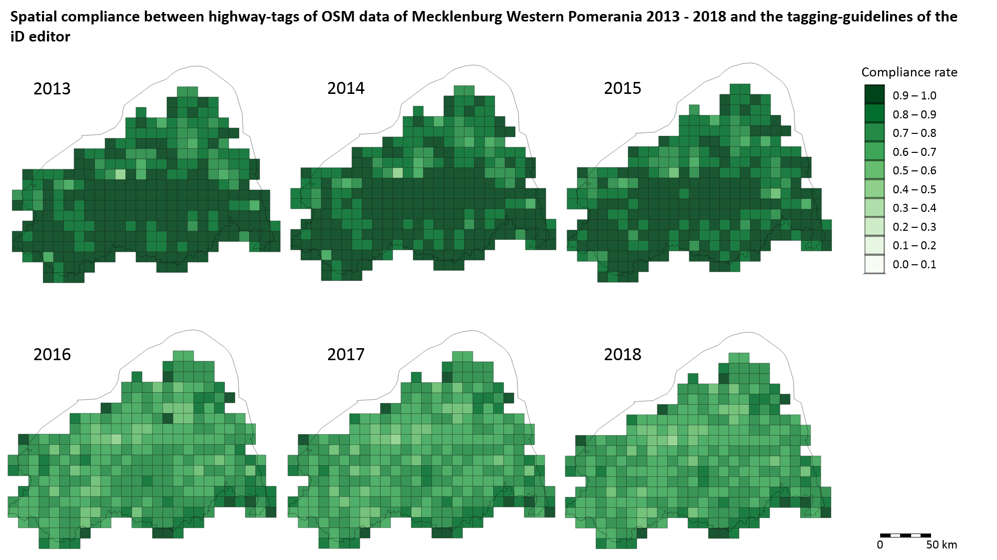
In a previous blog post we performed a conceptual compliance analysis between OSM data and several tagging-guidelines using the OSHDB API. The results were visualized in a line chart, comparing the different compliance ratio over several months. The following analysis … Read More
Explore the ohsome OSM History of whole Germany
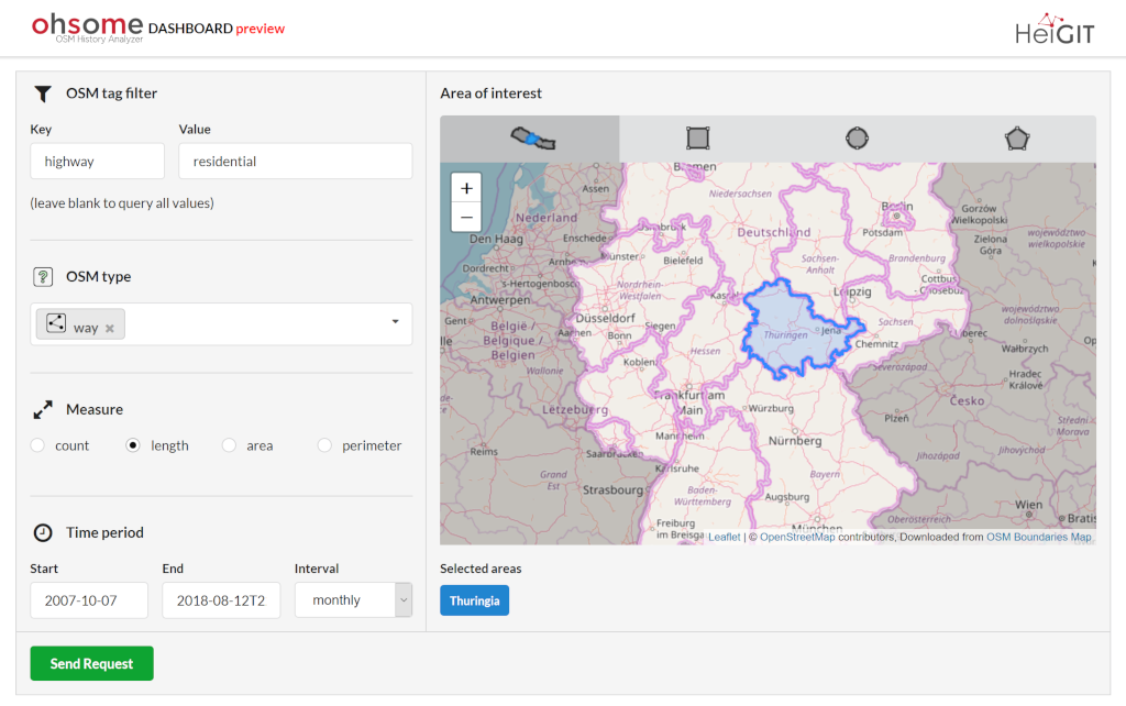
Our new ohsome dashboard is another preview on what is and will be possible with our ohsome OpenStreetMap history analytics platform. Behind the scenes, we added support for the Apache Ignite big data framework and deployed an instance using the … Read More
OpenStreetMap Analytics Development for OpenCities Africa
Recently a consultancy and development agreement about OpenStreetMap Analytics Development has been reached with the World Bank in the context of the Open Cities Africa project and the Global Facility for Disaster Reduction and Recovery (GFDRR) Open Data for Resilience … Read More
HeiGIT/GIScience Heidelberg partnership with Humanitarian OpenStreetMap Team (HOT)
We are happy to hereby announce the official partnership of the HeiGIT/GIScience Research Group Heidelberg and the Humanitarian OpenStreetMap Team (HOT)! The GIScience Research Group at Heidelberg University has been supporting the use of OpenStreetMap for humanitarian and disaster management … Read More