
State of the Map US 2023, a conference all about OSM where mappers, businesses, government agencies, and non profits come together to exchange ideas, learn, and work together on OSM related topics, took place from June 8th to June 12th … Read More
Blog
Senior Spatial Data Scientist for Climate Action (m/f/d, up to 100%)
You are a highly motivated person who loves spatial data science? You want to use your expertise for the benefit of society and the environment – in particular stimulating Climate Action? You want to improve the availability and quality of … Read More

Release of openrouteservice version 7 – Callisto
figure from CC-BY 2.0 – NASA/JPL-Caltech/Kevin M. Gill – original version at Callisto – July 8 1979 For some time now, the developers of openrouteservice at HeiGIT gGmbH have been hard at work updating the core libraries of openrouteservice … Read More

Call for Papers: Workshop on Geocomputational Analysis of Socio-Economic Data
Figure from ACM SIGSPATIAL You have published an original research contribution on Geocomputational Analysis of Socio-Economic Data, or have a work-in-progress paper that would fit the topic? We invite you to contribute to the workshop on Geocomputational Analysis of Socio-Economic … Read More
OEV: Indicator Correlations (4/4)
After introducing the OSM Element Vectorisation Tool last week, we now want to show possible use cases and specific examples of what the tool can do. This third and last example will look at the correlations between indicators. The goal … Read More
Heigit at the Land and Carbon Summit in Brussels
This week’s Land and Carbon Summit in Brussels promises to unite policymakers and researchers to address major climate-related topics in the areas of supply chains, food, land stewardship, urban resilience, and more. Through a packed agenda with livestreaming available, sessions … Read More
OEV: Quantifying differences between imports (3/4)
After introducing the OSM Element Vectorisation Tool last week, we now want to show possible use cases and specific examples of what the tool can do. This second of three use cases (see use case 1) compares the data in … Read More
2022 #30DayMapChallenge Round-Up Part 4: The Whole Wide World
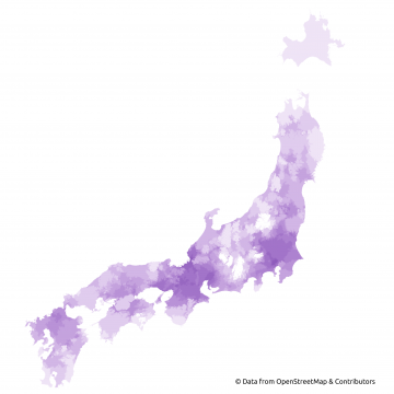
Featured Map: Isochrones (areas reachable within 2 hours from larger Japanese cities) by HeiGIT’s openrouteservice for bigger cities on the main islands of Japan, Marcel Reinmuth’s submission for Day 3 (“Polygons”) of Topi Tjukanov’s Twitter event #30DayMapChallenge. Map derived from OpenStreetMap … Read More
2022 #30DayMapChallenge Round-Up Part 3: Home Sweet Heidelberg
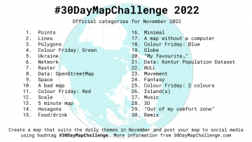
Featured photo: A listing of last year’s prompts from Topi Tjukanov’s Twitter event #30DayMapChallenge. This past November, our teams at HeiGIT and GIScience participated in Topi Tjukanov’s Twitter event #30DayMapChallenge, where mappers display their creativity and ingenuity with a set … Read More
OEV: Analysing attributes of remarkable elements (2/4)
After introducing the OSM Element Vectorisation Tool earlier this week, we now want to show possible use cases and specific examples of what the tool can do. This first of three use cases takes a closer look at the data … Read More
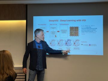
HeiGIT and GIScience at AGILE 2023
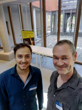
Photo: Simon Groß and apl. Prof. Dr. Sven Lautenbach at the 2023 AGILE conference. Earlier this month, the Association of Geographic Information Laboratories in Europe (AGILE) held its 2023 conference, and GIScience and HeiGIT team members contributed presentations, analyses and … Read More
OSM Element Vectorisation Tool Version 1
The IDEAL-VGI research project is nearing its end. And while that won’t be the end of our research into social data sources, data quality analyses and land-use information, we are happy to announce a major outcome: the version 1 release … Read More
New app for identifying invasive Mosquito species – A local case study
Prof. Dr. Alexander Zipf and Charlie Hatfield from HeiGIT contribute with their expertise on participatory science to an interdisciplinary case study by IDAlert on the monitoring of invasive mosquito populations in Heidelberg and the Rhine-Neckar-Region. One part of the case … Read More
Funding for initial phase of GEHIPED project secured
Heat stress has emerged as an increasing concern for Germany. Since 1881, the number of days per year with a maximum temperature above 30°C has nearly tripled and a further increase of this trend driven by climate change is anticipated. … Read More
FOSS4G conference 2023
This years FOSS4G conference will take place from 26 June – 2 July 2023 in Prizren, Kosovo. And HeiGIT will participate again! Since 2006 FOSS4G, the largest global gathering for geospatial software, is organized by the Open Source Geospatial … Read More
Paper presentation at AGILE: “Exploring MapSwipe as a Crowdsourcing Tool for (Rapid) Damage Assessment: The Case of the 2021 Haiti Earthquake”
Under the main theme “Spatial data for design” the 26th AGILE conference will be held this week in Delft, Netherlands. Besides a variety of geo-spatial related themes, disaster mapping still plays a crucial role in GIScience. Simon Groß and Sven … Read More
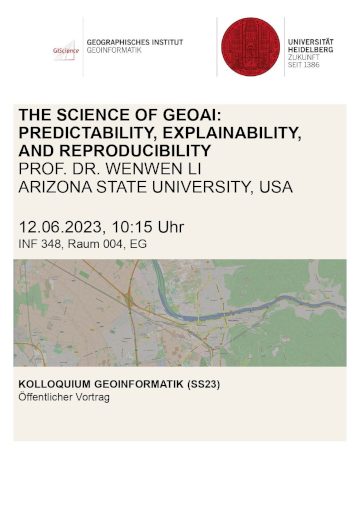
“Max-Kade Visiting Professorship” of Wenwen Li
Beginning May 20, 2023, Professor Wenwen Li from the Arizona State University (ASU) will teach at the Heidelberg University for two months. Professor Li received her PhD in Earth System and Geoinformation Science from the George Mason University in 2010 … Read More
Guest lectures on Volunteered Geographic Information at UC Chile
In May 2023, Prof. Dr. Alexander Zipf visited the UC Chile (Pontificia Universidad de Catolica de Chile) and the Heidelberg Center for Latin America (HCLA) in Santiago (Chile) together with Anne Schauß, giving two open lectures that showcased past and … Read More
Participatory Mapping taken one step further – The new version of the Sketch Map Tool
Sketch Map Tool (SMT) – An easy-to-use way to create and digitalize paper maps for offline data collection in the field The HeiGIT (Heidelberg Institute for Geoinformation Technology) team recently launched a new version of the Sketch Map Tool – … Read More
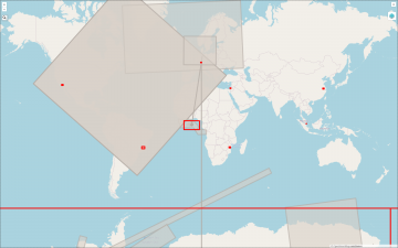
2022 #30DayMapChallenge Round-Up Part 2: Deleted Maps
Featured photo: The deleted map displays all deleted elements within the analyzed areas (red). Gray rectangles represent deleted buildings. This past November, our teams at HeiGIT and GIScience participated in Topi Tjukanov’s Twitter event #30DayMapChallenge, where mappers display their creativity … Read More