A new month – a new post of the how to become #ohsome blog series. Welcome to part 7, in which we will show you 7 different ways how you can send a request to the ohsome API using different … Read More
English

How to become ohsome part 6: Introducing the magical filter parameter
We are back again with a fresh part of the How to become ohsome blog series. In case this 6th part of the series is your first one, or you have not heard from our awesome OpenStreetMap History Data Analytics … Read More
Becoming ohsome is simple: Adding support of simple feature types to the ohsome API
It’s been a while, since we have published the last blog post about the awesome ohsome platform, but don’t worry, there’s always something happening of course in the spatial analytics team of HeiGIT. So here we are, back on track … Read More
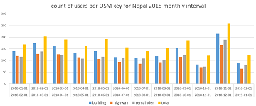
How to become ohsome part 5: Measuring numbers of users editing different OSM features
Besides dealing with a snake, making quality assessments, or generating comparable statistics, one needs to know how to handle the whole functionality provided by the ohsome API to really become ohsome. And to achieve exactly that, this blog presents the … Read More
How to become ohsome part 4: handling a snake in a notebook on another planet
Welcome back to a new episode of how to become ohsome. Yes, you’ve read the heading correctly. We are really talking about a snake in a notebook on another planet. If you are familiar with one of the most used … Read More
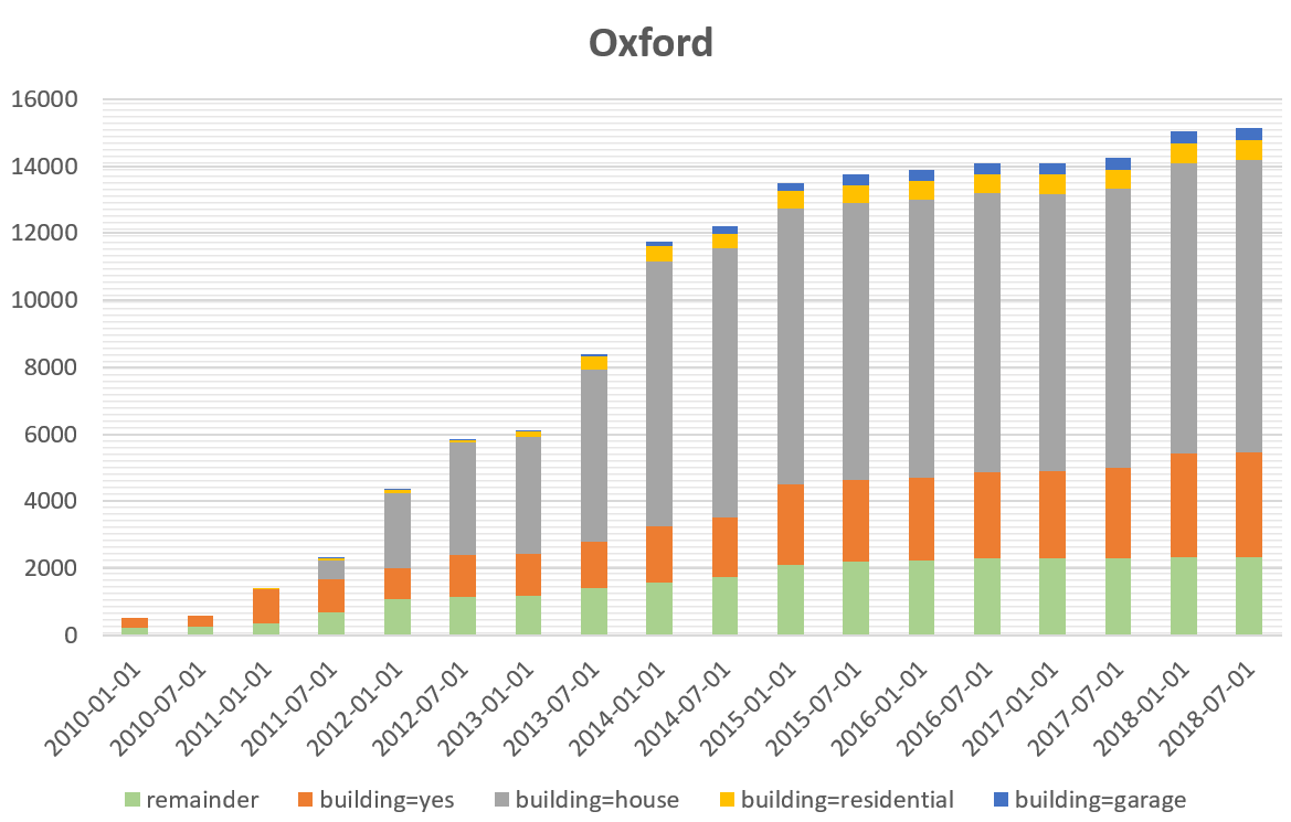
How to become ohsome part 3: Identifying different mapping schemes
This is your first blog of the ohsome series? Before you might be confronted with any potential spoilers, you should better check out the first and the second part of this blog series (or the intro to the idea and … Read More
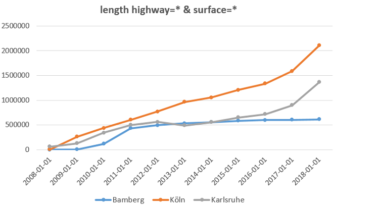
How to become ohsome part 2: Comparing different regions based on their attributive completeness of OSM data
Welcome back to the second part of the blog series how to become ohsome. If you have not read the first part yet, better go and check it out now. It explains how you can create an ohsome visualization of … Read More
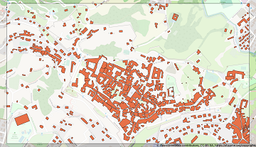
How to become ohsome part 1: Visualizing the historical evolution of OSM buildings of your city
This blog post is the start of a series of posts, which describe what you are able to do using the ohsome framework developed at the Heidelberg Institute of Geoinformation Technology (HeiGIT). OpenStreetMap (OSM), the biggest open map of our … Read More