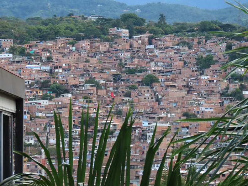
The Sketch Map Tool was strategically used within Colombia’s National Disaster Management System to steer community mapping in the southern city of Cali.
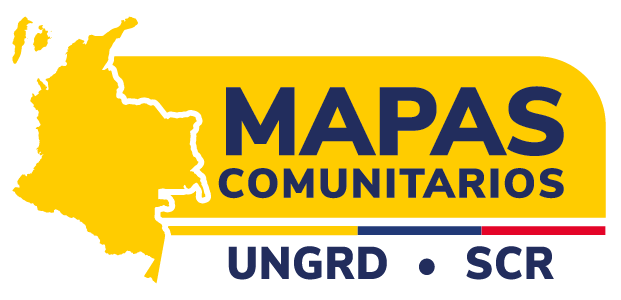
The National Unit for Disaster Risk Management commissioned (UNGRD) the Risk Knowledge Sub-Directorate to lead a nationwide Community Maps Project (“Mapas Comunitarios”). Such an effort aims at strengthening local capacities and processes for socialization, analysis, and risk reduction at the territorial level.
The project has high national relevance and promotes participatory mapping to integrate technical knowledge with local knowledge, while recognizing the environment, existing hazards, available resources, and safe routes in the event of emergencies. This approach places communities at the center of risk analysis, ensuring that local perspectives directly inform disaster risk management processes.
The project has generated more than 270 community maps, prioritizing different risk scenarios based on community input, and has involved 4,092 people across 147 municipalities in Colombia. These maps reflect a wide range of locally identified risks and priorities across urban and rural contexts.
The mapping process was part of the activities organized by the national government, in coordination with the prioritized municipalities, which facilitated the participation of community leaders, representatives of organizations and local governments, and members of local risk management committees. This coordination aligned community-generated information with institutional planning and decision making.
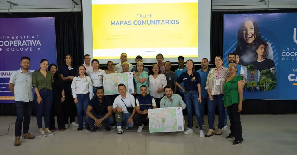
In Cali, Colombia, the mapping exercises were conducted in two areas with ongoing risk management processes: Pance and Comuna 18. Project facilitators guided the development of maps using the Sketch Map Tool, which was specifically adapted for these urban areas where smaller scales are required. The activities directly contributed to the development of community-based risk management plans while promoting the equitable participation of women, young people, and ethnic groups to ensure inclusion and diverse perspectives.
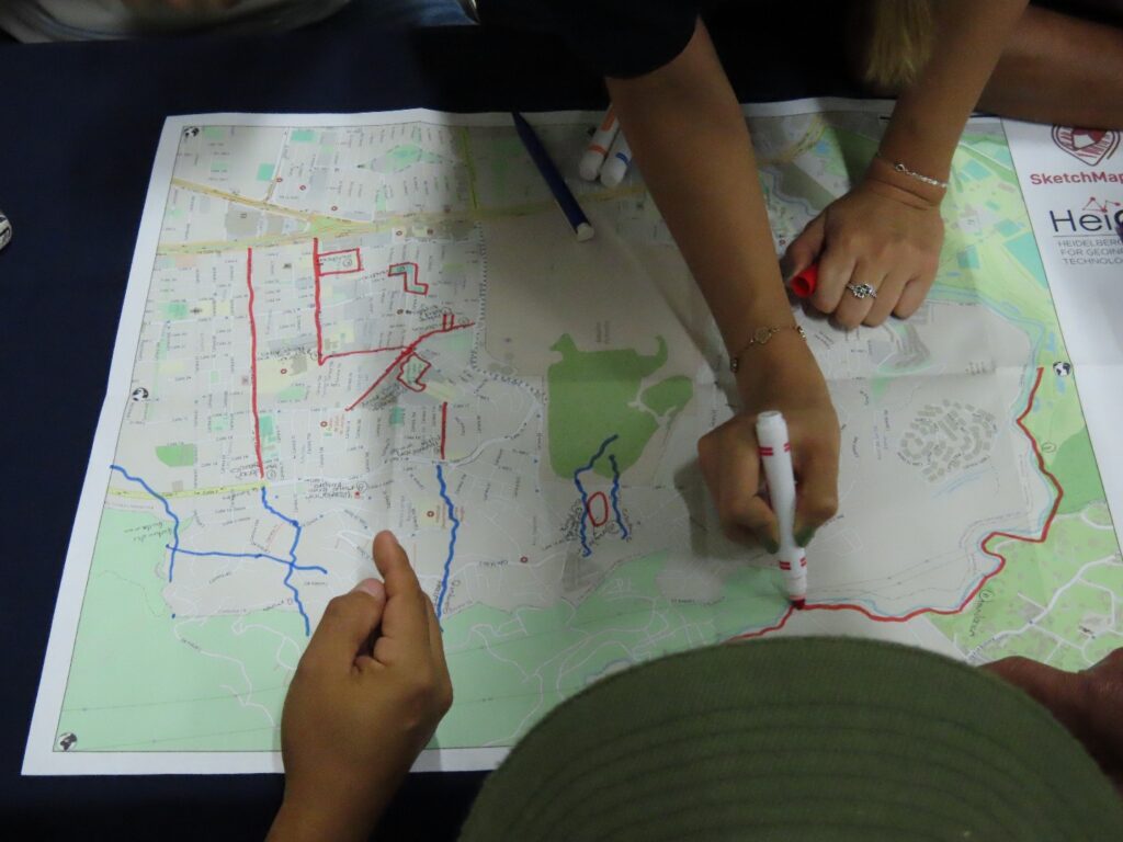
The maps produced by the communities were digitized using Sketch Map Tool and analysed using other Geographic Information System (GIS) tools, such as MapHub, which allows information, text, areas and colors to be added, making them easier for communities to use. The analysis enabled the identification of spatial patterns of threat and vulnerability, the prioritization of areas for intervention, and the strengthening of municipal planning instruments. This process also supported dialogue between communities and authorities around local risks and ongoing initiatives.
The project succeeded in generating up-to-date and relevant information for communities and authorities in two areas of the city of Cali. The activities help consolidate a network of communities with strengthened risk management capacities, generating updated, validated community maps in a participatory manner. The information generated with the communities was digitized and integrated into the territorial planning processes known as “Municipal Disaster Risk Management Plans (PMGRD)” and “Community Risk Management Plans.” As a result, community knowledge became recognized as an input to formal risk management frameworks.
Among the main impacts are:
- Active participation of over 60 people from Pance and Comuna 18 in Cali, as well as delegates from the local government and other entities of the local risk management system.
- The appropriation of local knowledge as a source of information for risk management.
- A stronger, more active connection has been established between communities and local institutions, fostering ongoing collaboration in risk management.
- The strengthening of resilience and community response capacity in emergencies.
- The process also enabled direct interaction between residents and local authorities on risk-related concerns and planned interventions.
Key takeaways and significant lessons learned from the process include:
- Active community participation is essential to ensure the accuracy and legitimacy of the maps.
- Digital tools such as the Sketch Map Tool must be accompanied by training and awareness-raising processes to ensure their appropriate use.
- It is essential to establish mechanisms for updating and maintaining maps to ensure their validity over time.
- To ensure an up-to-date base map, the strategy should include OpenStreetMap mapping and updating activities. This additional effort not only improves map quality but also enables communities to develop data management skills. Facilitators can help communicate limitations and manage potential frustrations during these activities.
- The mapping activities revealed the participants‘ preference for representing objects directly using symbolic stickers rather than abstract lines or areas. To accommodate this, a critical success factor was the pre-validation of these materials.
- Testing various icon sizes and stickers to fine-tune the methodology ensures the preferred mapping style is seamlessly detected by the SMT.
- Overall, the experience highlighted the importance of combining technical tools with strong facilitation and continuous community engagement.
The full case study is available in English and Spanish.
To learn more about how the Sketch Map Tool works, watch this quick video tutorial or directly visit the project webpage. To stay up to date on new Sketch Map Tool releases and case studies, you can subscribe to the Sketch Map Tool Newsletter.
Questions or ideas on how to next use the Sketch Map Tool? Write us at sketch-map-tool@heigit.org. We are looking forward to getting in touch.