Why Measuring Access Matters
Access to healthcare and education influences health outcomes, social inclusion, and community resilience. In emergency situations, travel time to a hospital can be a matter of life or death, for example in cases of severe injuries or obstetric complications. In addition, long travel times reduce the likelihood that people will use available services at all.
OpenAccessLens provides transparent information on access to essential services worldwide, to support open research, strategic planning, and policy making.
OpenAccessLens: An Open Platform for Worldwide Accessibility Data
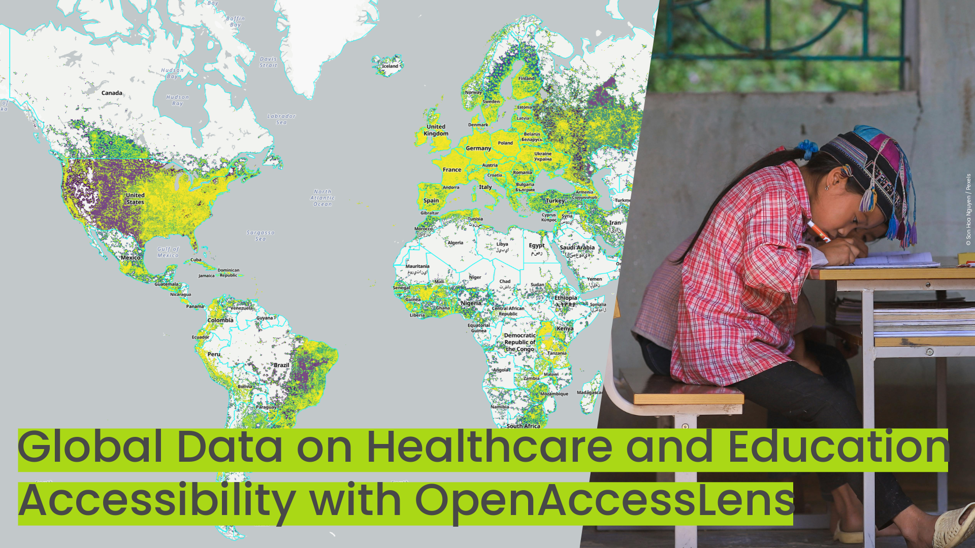
OpenAccessLens is an open dataset platform that provides worldwide insights into spatial accessibility to healthcare and education services. It shows how far populations are from the nearest facilities, expressed in travel time or distance. The dataset is fully open, transparent, and based entirely on OpenStreetMapdata.
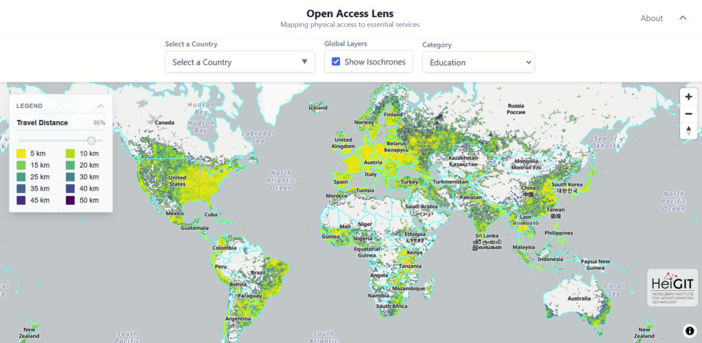
Accessibility analysis can be run and visualized with the OpenAccessLens web app. The full dataset can be downloaded from the Humanitarian Data Exchange.
How OpenAccessLens Works
The OpenAccessLens dataset is created using free and open-source tools, primarily openrouteservice and OpenStreetMap. Accessibility is assessed through travel-time isochrones, which represent areas reachable by car within defined time or distance thresholds. For healthcare, time intervals from 10 to 120 minutes to hospital services are calculated; for education, distance intervals from 5 to 50 kilometers to schools are used. These isochrones are overlaid with WorldPop population data at 100-meter resolution to estimate how many people fall within each interval. Results are aggregated by country borders and, where available, by administrative units. The routing, graph construction, and performance optimization are handled within openrouteservice, allowing the accessibility analysis itself to remain methodologically simple and reproducible.
At present, the dataset focuses exclusively on motorized travel and does not account for public or non-motorized transport, which is crucial in many regions. Moreover, travel time values are based on the general infrastructure state and currently do not consider real-time traffic conditions. While it provides a simplified overview and does not distinguish between facility types, ownership, or capacity, OpenAccessLens allows users to analyze access as an indicator of vulnerability: the farther a population is from essential services, the higher the potential risk.
Accessibility Analysis for Climate Research, Humanitarian Vulnerability Assessments, Public Health Strategic Planning, and Data-Based Policy Making
The kind of accessibility analysis provided by OpenAccessLens is crucial for a broad range of stakeholders. Humanitarian organizations use such data in Anticipatory Action projects to identify vulnerable populations before crises occur. Researchers use access data in correlation analyses, for example linking health outcomes from survey data to spatial accessibility and examining how these relationships change under climate-related stressors. Governmental organizations use the dataset as a resilience indicator, as it can show how accessibility changes when infrastructure is disrupted or areas become temporarily unreachable. More broadly, access data supports strategic planning in different areas, such as monitoring targets that define acceptable travel times to hospitals, and helps policymakers allocate resources more efficiently without relying on costly, case-by-case consultancy studies.
An Example: Education Access in São Tomé and Príncipe
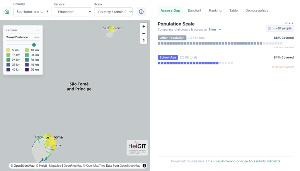
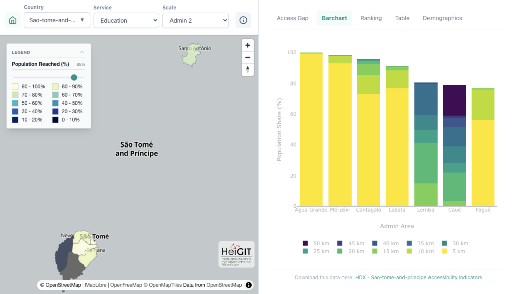
To demonstrate education access analysis with OpenAccessLens, we look at the island state of São Tomé and Príncipe. Here, we see clearly that true accessibility behaves like a living organism, not a geometric shape. By calculating travel-time isochrones along the actual road network, OpenAccessLens maps reveal that travel-time isochrones spreads like coral reefs or dendrites, clinging to the coastal ring and winding deep into valleys, but stopping at the central mountain range. By intersecting these isochrones with population data and aggregating results by administrative units, the dataset identifies which communities experience the greatest barriers to healthcare and education. This can support targeted policy interventions and planning at relevant administrative levels.
Outlook (and More Datasets)
OpenAccessLens is still at its beginning, with further developments already being planned. Future steps will include expanding coverage, refining methods, and exploring additional use cases such as accessibility to markets or larger urban centers, as well as more detailed analyses of service diversity within defined travel-time ranges. As an open dataset built on OpenStreetMap, its quality and relevance can improve continuously through community contributions.
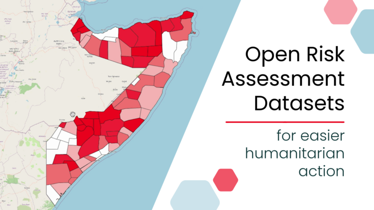
OpenAccessLens is the latest addition to the HeiGIT dataset collection, which includes open global data on road surface, risk assessment indicators, climate action, and more.