Searching for early warning systems during the COVID-19 pandemic, the researchers explored how digital data sources such as geo-social media (e.g. posts on platforms like X, formerly Twitter, that include location data) could improve the disease’s transmission dynamics. This data offers a valuable tool for local event detection.
The study investigated how geo-social media topics might provide early signals of COVID-19 outbreaks, focusing on regions with different political leanings. The researchers analyzed over 420 million geo-references posts from the United States, collected through X’s APIs. Only posts that contained precise location information (points or polygons fully within U.S. states) were included in the analysis.
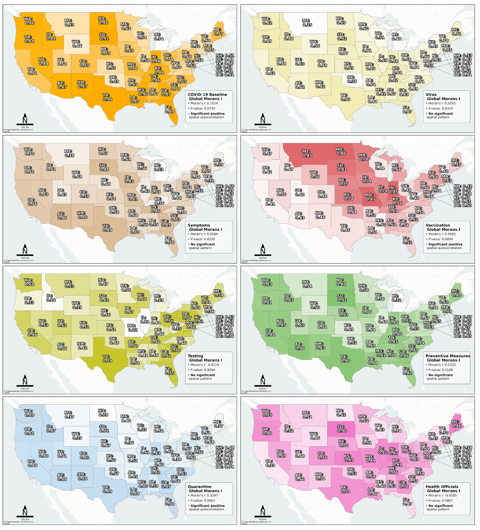
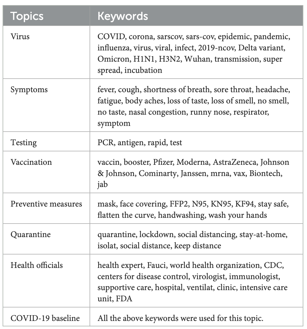
The study focused on eight COVID-related topics, described by different keywords, that were primarily derived from prior research on COVID-19-related geo-social media content (Figure 1). In addition, the analysis was conducted across six waves of the pandemic. The researchers assessed the ability of geo-social media topics to provide early warning signals for COVID-19 cases within a 7 to 42 day window.
For information on the different political leanings, they classified US states as republican, democrat, or swing states based on the MIT county-level voting data for the 2020 election, which were aggregated to the state level.
The results showed that certain topics correlated more strongly with case trends in specific regions. For example, vaccination-related posts were a leading indicator in the Northern Central states, while quarantine-related posts were more predictive in the Southeast and West. The researchers also found that early warning effectiveness varied with a state’s political leaning.
This research is part of the geoEpi project, which explores the spatio-temporal dynamics of emerging viruses, including SARS-CoV-2, Dengue, Chikungunya, Yellow Fever, Zika, and Ebola. By combining geodata and official health surveillance records, geoEpi seeks to enhance early disease detection and provide more accurate predictions about the spread of infectious diseases.
More information about geoEpi: GeoEPI
Arifi D., Resch B., Santillana M., Knoblauch S., Lautenbach S., Jaenisch T. and Morales I. (2025). How politics affect pandemic forecasting: spatio-temporal early warning capabilities of different geo-social media topics in the context of state-level political leaning. Front. Public Health 13:1618347. https://doi.org/10.3389/fpubh.2025.1618347