neuer globaler Datensatz zeigt Lücken beim Zugang zu Bildungseinrichtungen und der Gesundheitsversorgung auf Zahlen allein erzählen selten die ganze Geschichte – etwa darüber, ob ein Kind zur Schule geht oder…
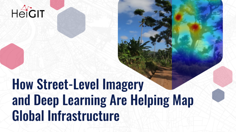
Street-level imagery combined with deep learning methods is transforming how we detect and map critical infrastructure characteristics that are often missing from existing datasets. Applications range from road surface classification…
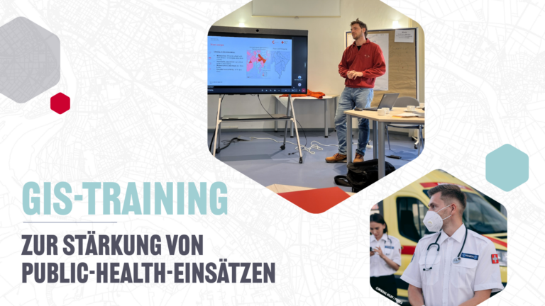
Geodatenanalysen sind von zentraler Bedeutung im Public-Health-Sektor, zum Beispiel bei Notfalleinsätzen und Krankheitsausbrüchen. Mit einer Pilot-GIS-Schulung haben wir gezeigt, wie Gesundheitsfachkräfte und Informationsmanager gemeinsam komplexe Daten in wirksame Entscheidungsgrundlagen überführen…
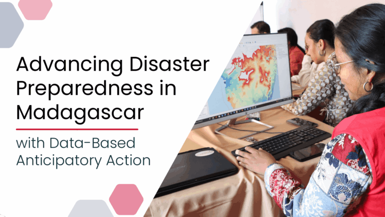
Anticipatory Action (AA) is becoming an increasingly vital approach in humanitarian and disaster risk management. By leveraging forecasts and risk data, AA enables timely interventions before extreme events occur. Geoinformation…
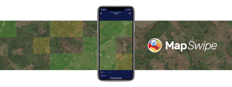
Die Crowdmapping App MapSwipe nutzt nun auch Straßenbilder. Diese neue Funktion ermöglicht Kartierungsprozesse, die eine hohe Präzision erfordern, wie beispielsweise die Erkennung von Müll auf der Straße. Die MapSwipe App…
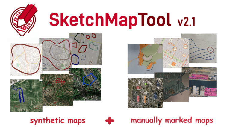
Die neu veröffentlichte Version des Sketch Map Tool v2.1 bietet eine höhere Genauigkeit bei der Digitalisierung von handgezeichneten Markierungen auf Sketch Maps. Dies ist möglich dank eines neuen größeren Training-Datensatzes…
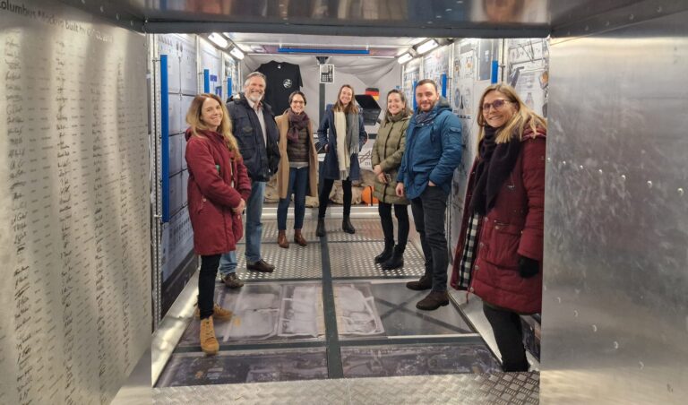
Titelbild: Teamvertreter von DRK, DRL und HeiGIT in dem Nachbau der europäischen Forschungskapsel COLUMBUS, die einen Teil der internationalen Raumstation (ISS) bildet. Foto: Anne Schneibel, 24.01.2023. Welche Gebäude sind nach…
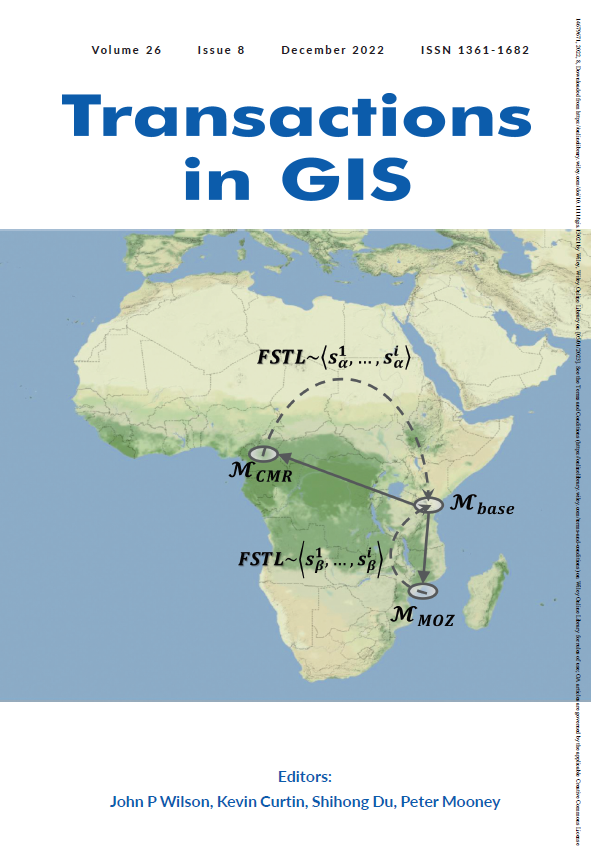
Volume 26, Ausgabe 8 von Transactions in GIS, die im Dezember 2022 erschien, hat eine Titelgeschichte, und zwar einen unserer Artikel. Wir wollen darin nicht nur unsere Liebe zur Mathematik,…
Einladung Vortrag Online: Dienstag, 14. Dezember 2021, 19:15 Uhr Melanie Eckle-Elze, Benjamin Herfort, Dr. Carolin Klonner Digitale Geographie im Katastrophenmanagement Klimawandel, Bevölkerungswachstum, Verstädterung und weitere zunehmende Landnutzungsveränderungen führen dazu, dass…
Recently videos with our contributions by HeiGIT to the FOSS4G conference were put online. Did you miss the event? Now you can watch whenever you like 🙂 Benni by HeiGIT…
On October 12th the “25 Mapathon project” was finalized with an exceptionally successful public online mapathon. Around 20 participants with various professional backgrounds mapped 2273 buildings in three hours to…
Recently, a new research paper “Detecting OpenStreetMap missing buildings by transferring pre-trained deep neural networks” (Pisl, J., Li, H., Herfort, B., Lautenbach, S., Zipf, A. 2021) has been accepted at…
The Heidelberg Institute for Geoinformation Technology (HeiGIT) and the international humanitarian geospatial charity MapAction have signed a Memorandum of Understanding (MoU) outlining their plans to collaborate in a number of…
The project “25 Mapathons“ goes into the next phase. Based on the experience of until today 17 OSM mapathons with German Red Cross (GRC) chapter and an extensive literature review…
Volunteered Geographic Information (VGI) such as OpenStreetMap (OSM) is often defined as the collaborative acquisition of geographic information and local knowledge by volunteers, amateurs or professionals (Goodchild, 2007). The increasing…
Gemeinsam mit dem Deutschen Roten Kreuz (DRK) hat das HeiGIT heute das Dokument “Die häufigsten Fehler beim „mappen“ mit dem iD-Editor & deren Lösung” veröffentlicht. Das Dokument ist komplementär zum…
Hello dear friends of the disastermappers heidelberg! At the moment, the Heidelberg International Weeks against Racism 2021 are running – and the disastermappers are also taking part! Why? The unequal…
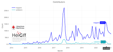
Since 2010 organized humanitarian mapping has evolved as a constant and growing element of the global OpenStreetMap (OSM) community. With more than 8,000 projects in 150 countries humanitarian mapping has…
Extreme natural events create catastrophic situations for cities and their populations. Due to climate change and anthropogenic activities, the number and intensity of these events has steadily increased at the…
Since 2010, organized humanitarian mapping has evolved as a constant and growing element of the global OpenStreetMap (OSM) community. With more than 7,000 projects in 150 countries, humanitarian mapping has…