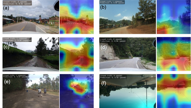
Heidelberger Forschende liefern detaillierten Datensatz zu Straßenbelägen weltweit Heidelberger Forschende haben einen einzigartigen weltweiten Datensatz erstellt, der Informationen über die Beschaffenheit von Straßen liefert. Ob die Straßen befestigt oder unbefestigt…
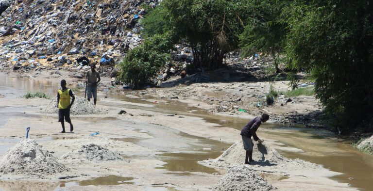
Solid waste pollution is the cause of many environmental and health risks, especially in areas where waste is generated in large quantities but cannot be properly disposed of. Knowledge of…
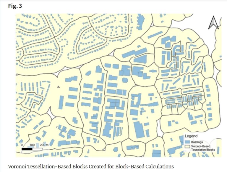
Rapid global urbanization is placing immense pressure on planners to make informed decisions that promote sustainable growth. A crucial aspect of this challenge is understanding how urban buildings are used….
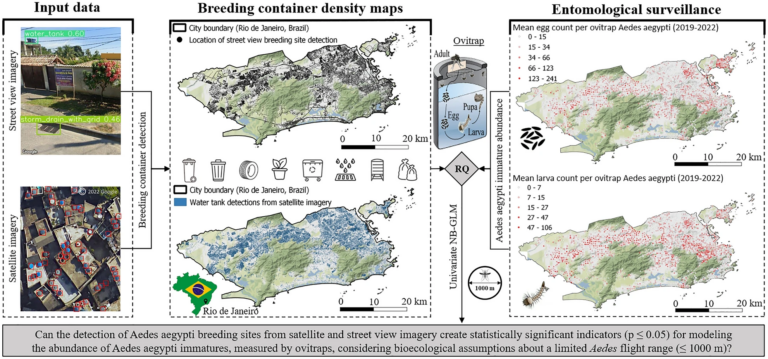
„High-resolution Mapping of Urban Aedes Aegypti Immature Abundance Through Breeding Site Detection Based on Satellite and Street View Imagery“ Knoblauch, S; Su Yin, M.; Chatrinan, Krittin; Rocha, Antonio A. de…
Together with collaborators from Urban Analytics Lab Singapore and CICI Lab, we are organising a special issue in Environment and Planning B: Urban Analytics and City Science, on the topic…
The completeness of the OpenStreetMap (OSM) road network has been an ongoing focus for researchers for more than 15 years. For instance, Neis et al. (2011) investigated the OSM street…
Volume 26, Ausgabe 8 von Transactions in GIS, die im Dezember 2022 erschien, hat eine Titelgeschichte, und zwar einen unserer Artikel. Wir wollen darin nicht nur unsere Liebe zur Mathematik,…
The AGILE 2021 conference is taking place this week. It is the the 24rd AGILE conference on GIScience. AGILE is the Association of Geographic Information Laboratories in Europe and the…
Die Folgen des Klimawandels sind besonders stark in den höheren Breiten unseres Planeten zu spüren. Die Arktis erwärmt sich derzeit überdurchschnittlich schnell. Dies führt zum Auftauen von Permafrost (dauerhaft gefrorenen…
A couple of viruses are of global interest with respect to human health and well-being. These pathogens include the novel coronavirus SARS-CoV-2, Dengue, Chikungunya, Yellow fever, Zika and Ebola. These…
During the EuroSDR workshop we will present our OSMlanduse product (earlier post) to the land use (LU) and land cover community (LC) and highlight class accuracies and a benchmark comparison…
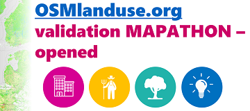
We launched a validation campaign of our new 10meter resolution OSMlanduse product for the member states of the European Union. Please contribute to the validation here. A technique where contributions…
Accurate and detailed geographical information digitizing human activity patterns plays an essential role in response to natural disasters. Volunteered geographical information, in particular OpenStreetMap (OSM), shows great potential in providing…
Already in October 2019 Prof. Zipf was invited to give a keynote on “User Generated Geoinformation for Smart Cities” at the “Smart Cities, Smart Data, Smart Governance” ISPRS Conference at…
The Center for Spatial Studies, Department of Geography at the University of California, Santa Barbara is hosting the Spatial Data Science Symposium 2019 this coming week with the title “Setting…
Gerade beendete die MS Wissenschaft ihre Tour durch 31 Städte zwischen Berlin und Wien in diesem Wissenschaftsjahr zum Thema “Künstliche Intelligenz“. 85.000 Menschen – Schulklassen, Familien und Interessierte aller Altersklassen…
Seit einiger Zeit findet sich das gemeinsame Exponat des HeiGIT und des Alfred-Wegener-Instituts Helmholtz-Zentrum für Polar- und Meeresforschung für die Ausstellung “Künstliche Intelligenz” auf der “MS Wissenschaft” auch auf dem…
Global Platform 2019 in Geneva Creating maps helps humanity. Drawing maps together with communities is crucial for effective risk reduction interventions, ensuring no one is left behind. The progress…
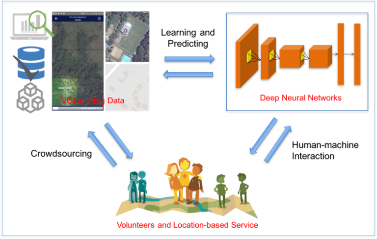
We are always happy to support citizen science projects at the HeiGIT. HeiGIT/ GIScience efforts already range from tools that assess the data quality of citizen science projects (see, e.g.,…
Satellite images are widely applied in humanitarian mapping which labels buildings, roads and so on for humanitarian aid and economic development. However, the labeling now is mostly done by volunteers….