The paper, published in Nature Scientific Data, presents the first high-resolution (10m or finer) land use map of the European Union derived from a large-scale fusion of OpenStreetMap (OSM) and…
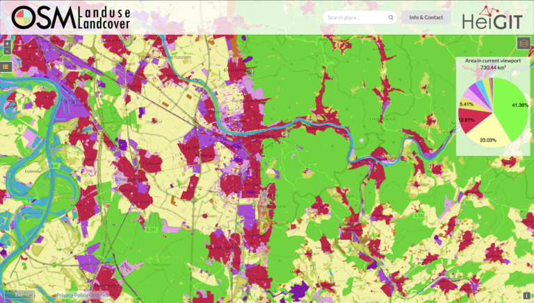
Wir freuen uns ankündigen zu können, dass https://osmlanduse.org ein Funktionalitätsupdate erhalten hat. Dank der Kooperation von GIScience und HeiGIT im IDEAL-VGI Projekt, konnten unsere Forscher die interaktive Karte um eine…
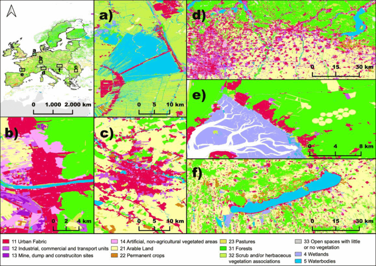
Large-scale mapping activities can benefit from the vastly increasing availability of earth observation (EO) data, especially when combined with volunteered geographical information (VGI) using machine learning (ML). High-resolution maps of…
The Horizon 2020 LandSense project was concluded successfully. Please find a selection of the produced publications and deliverables here. The project has enabled our group to pursue quality aspects of…
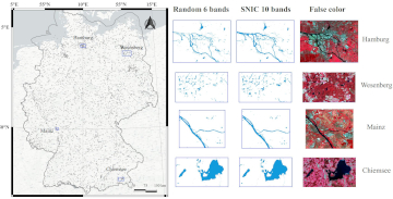
During the EuroSDR workshop we will present our OSMlanduse product (earlier post) to the land use (LU) and land cover community (LC) and highlight class accuracies and a benchmark comparison…
Am am 29.10.20, 16:30 Uhr veranstaltet das Netzwerk Geoinformation der Metropolregion Rhein-Neckar GeoNet.MRN zum Thema: Flächennutzung und Flächenmanagement: Ein Geoinformation Meetup Teilnahme: Kostenlos und ohne Anmeldung mit Teams unter diesem…
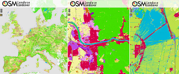
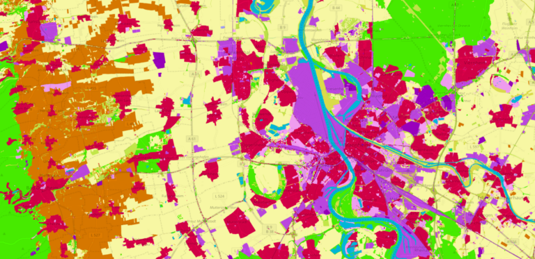
We launched a validation campaign of our new 10meter resolution OSMlanduse product for the member states of the European Union. Please contribute to the validation here. A technique where contributions…
Last week, GIScience Heidelberg successfully held two collaborative workshops about OpenStreetMap (OSM) at the Department of Earth Observation in Jena. Dr. Chistian Thiel and his team from the University of…
Land use data created by humans (OSM) was fused with satellite remote sensing data, resulting in a conterminous land use data set without gaps. The first version is now available…