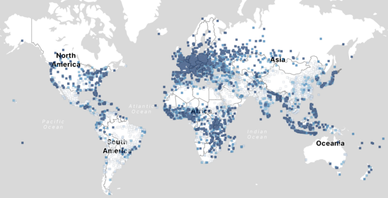
The COVID-19 pandemic highlighted the importance of understanding human behavior in cities to develop effective public health interventions. Crowd-sourced geospatial data available online can therefore serve as a valuable resource…
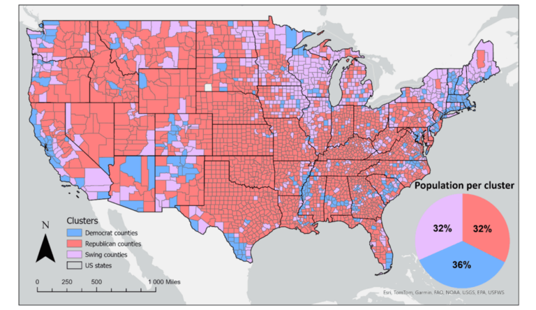
To what extent does crime potentially inhibit geographical access to schools, measured by cumulative average travel time? Education is recognized globally as a fundamental human right and essential for promoting…
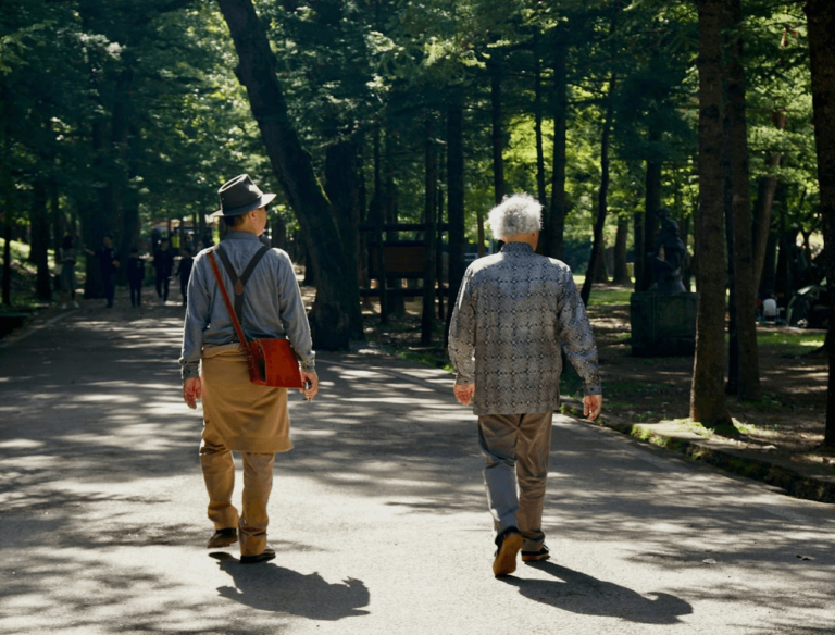
The 15-minute city concept is gaining traction in urban planning, aiming to ensure that essential services are within a short walk or bike ride. As the older population grows, walking…
The novel coronavirus disease (COVID-19) generated significant health concerns worldwide, leading policymakers and health care experts to implement nonpharmaceutical public health interventions to mitigate the spread of the virus. While…
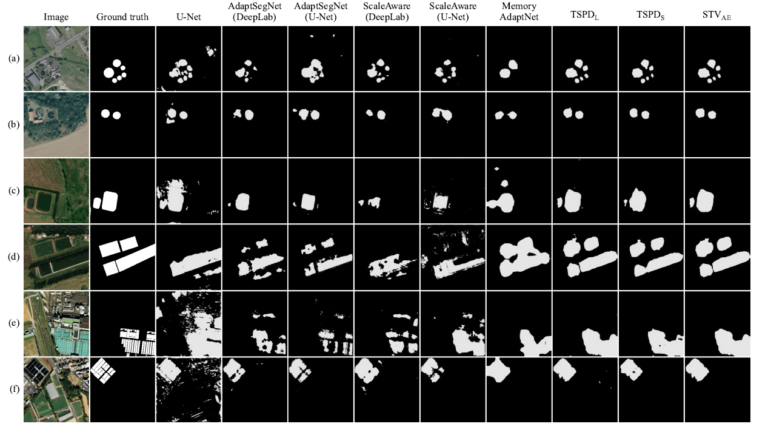
Wastewater treatment plants (WWTPs) play a crucial role in maintaining ecological balance and public health and are essential for advancing social sustainable development goals. However, the diverse architectural styles, scales,…
The renewable energy (RE) sector is a cornerstone of global climate action, yet its workforce remains marked by gender inequality. Women are significantly underrepresented, often relegated to lower-paid, non-technical roles….
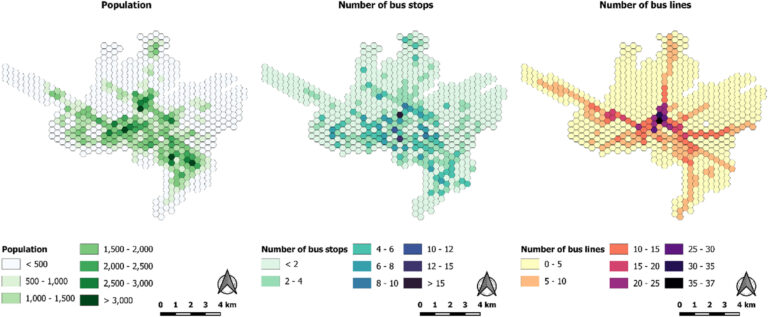
Studies have long assessed people’s accessibility to amenities through public transportation, typically using General Transit Feed Specification (GTFS) data. GTFS reflects planned transportation schedules, detailing the intended services and routes…
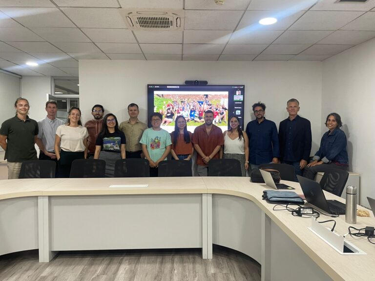
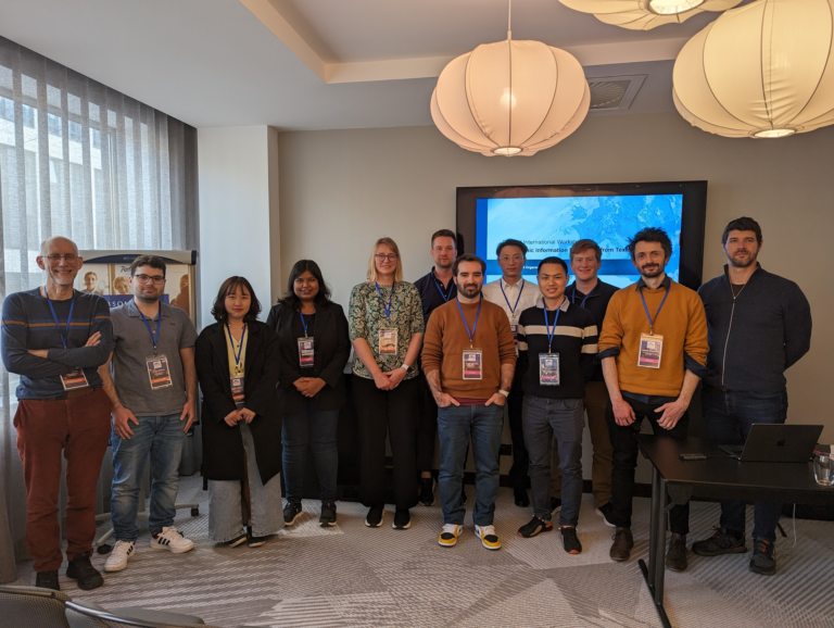
Recently, our colleagues traveled to Chile as part of our ongoing collaboration with the Heidelberg Center Latin America. During their visit, they hosted a block course, met with local research…
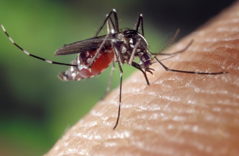
On December 18, 2024, GIScience PhD candidate Steffen Knoblauch will present his research on “Habitat-Scale Environmental Suitability Mapping for Aedes aegypti.” The public lecture will take place at 9:00 AM…
Building on ongoing efforts to enhance urban health management and mosquito-borne disease monitoring in the municipality of Rio de Janeiro, PhD candidate Steffen Knoblauch returned to the city for a…
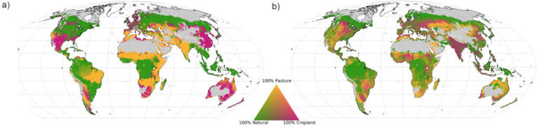
How can humanity meet the growing demand for food while addressing climate change and preserving vital water resources? A recent lecture by Sven Lautenbach, based on a paper addressing global…
GeoAI integrates AI, geospatial big data, and high-performance computing for solving data- and computation-intensive geospatial problems. This field has gained continuous momentum, driven by strong demands in geography and the…
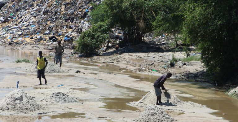
Solid waste pollution is the cause of many environmental and health risks, especially in areas where waste is generated in large quantities but cannot be properly disposed of. Knowledge of…
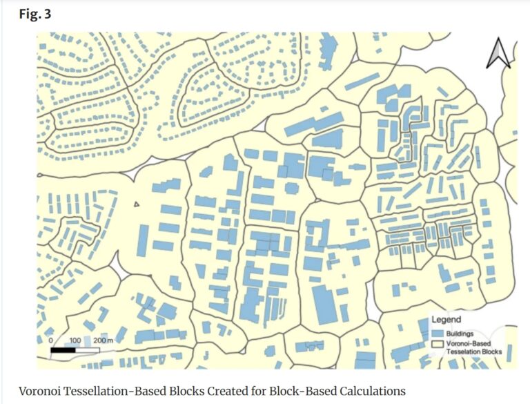
Rapid global urbanization is placing immense pressure on planners to make informed decisions that promote sustainable growth. A crucial aspect of this challenge is understanding how urban buildings are used….
Jeden Tag kartieren tausende Menschen in OSM, wodurch die Anzahl der fehlenden Gebäudedaten in urbanen Zentren kontinuierlich zurückgeht. OSM ist eine weit verbreitete Ressource für Projekte, die die Besonderheiten urbaner…
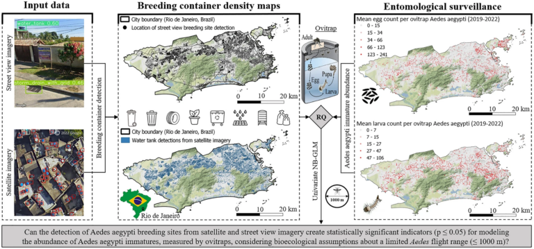
„High-resolution Mapping of Urban Aedes Aegypti Immature Abundance Through Breeding Site Detection Based on Satellite and Street View Imagery“ Knoblauch, S; Su Yin, M.; Chatrinan, Krittin; Rocha, Antonio A. de…
Together with collaborators from Urban Analytics Lab Singapore and CICI Lab, we are organising a special issue in Environment and Planning B: Urban Analytics and City Science, on the topic…
Recent studies primarily view Large Language Models (LLMs) in geography as tools for linking natural language to geographic information systems. However, Roberts et al. (2023) demonstrated GPT-4’s inherent ability to…
Insights from Steffen Knoblauch’s talk at The Program of Scientific Computing (PROCC) at FIOCRUZ On May 15th, the Program of Scientific Computing (PROCC) at Fiocruz hosted Steffen Knoblauch, a GIScience…
Wenn durch Erdbeben Schäden an der Infrastruktur verursacht werdend, ist es von entscheidender Bedeutung, das Ausmaß der Schäden rasch und präzise einschätzen zu können. Die Bewältigung dieser Herausforderung war Ziel…