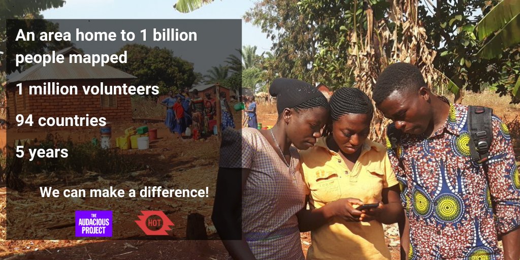
The Humanitarian OpenStreetMap Team (HOT) has announced major financial support from the Audacious Project, which will be provided over the next five years. HOT aims to use this funding to grow OpenStreetMap (OSM) communities in 94 countries. By engaging one million volunteers the goal is to map an area home to one billion people living in poverty and at high risk of disaster.
Congratulations! This is not only a big step for HOT as an organization but also an award for the humanitarian and general OSM community.
At GIScience Research Group and HeiGIT, we’ve accompanied HOT’s way over the past decade. Starting with the response to the Haiti earthquake in 2010 and the mapping efforts which followed after, the Fukushima Tsunami in 2011, Typhoon Haiyan in 2013 or the Nepal Earthquakes in 2015, to name a few, we’ve seen how valuable HOT’s mission is towards better decisions in natural and humanitarian disasters. We’ve also taken part in HOT’s journey towards disaster risk reduction and pre-emptive mapping of vulnerable regions through our common support of the Missing Maps project. The research we’ve conducted on the Missing Maps project for last year’s State of the Map conference shows how HOT and the other Missing Maps members have scaled the remote mapping in OSM. The Audacious Project is the next destination on that journey.
HOT’s audacious vision comes with four goals:
First, we will grow our global volunteer contributor community by adding regional “hubs” to the existing network of OpenStreetMap communities in each region. Hubs will act as connectors to facilitate exchange of ideas and expertise across countries and provide financial and technical support to OSM communities in 94 countries (20-25 per region).
Second, we’ll make significant investments in technology that enhances mapping contributions on mobile to enable scaling of local contributions to OpenStreetMap.
Third, we’ll invest in map data quality and ethical collection and use of map data.
Fourth, we’ll ensure the data we create has a tangible impact by expanding our national and regional partnerships with humanitarian organizations, governments, and other actors to help them use OpenStreetMap to deliver more effective and efficient aid.
It’s encouraging to see that this vision is shared by the Audacious Project. It underpins what we’ve been working on in Heidelberg for the last couple of years as well. Especially when it comes to OSM data quality, we’ve built the basis to analyze the growth of OSM and its community in almost unlimited spatial and temporal dimensions. HeiGIT and GIScience offer a growing set of open source tools and services that support humanitarian aid and we are curious to see how we can further support through our research and development.
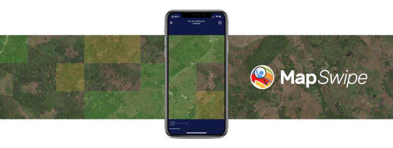
Examples include work in the context of the Missing Maps initiative, such as conceptualising and extending microtasking apps like the award-winning MapSwipe, the combination with AI to improve its effectiveness, as well as services to analyse MapSwipe data and making it usable through a workflow integration in the HOT Tasking Manager. The data is also used in deep learning applications for generating settlement layers and feedback for microtasked mapping or for finding unmapped areas in OSM. Improving and analysing the data quality of OSM as a major data set for humanitarian aid is supported through the growing ohsome framework (OpenStreetMap History Analytics platform), including an API for related analysis (e.g. also: Towards Using the Potential of OpenStreetMap History for Disaster Activation Monitoring or Analyzing the spatio-temporal patterns and impacts of large-scale data production events in OpenStreetMap), and map dashboards like the first versions of the OSM History Explorer, that already includes some selected map layers relevant for HOT, such as WASH-related OSM tags.
Of course, the openrouteservice for disaster management combined with realtimeOSM already offers OSM logistics and routing solutions within disasters based on the latest OSM data, but needs enhancements or modifications according to the needs of the real-world users and further coverage for relevant world regions. Similarly, the ORS isochrones for accessibility analysis are a relevant tool for project and disaster management and humanitarian contexts (e.g. analysing the healthcare system in Africa).
Apart from the tools and services that support remote contributions, analyses, planning and coordination as well as monitoring of open geodata, GIScience is also increasingly supporting local mapping approaches. These are fostered through our work within the Missing Maps initiatve as well as in the Waterproofing data project. In the scope of the Waterproofing data project, an extension of FieldPaper tools, which are commonly used for local data collection, has been developed which bundles several intrinsic analyses to evaluate a study region’s fitness for usage and therefore facilitates quality-aware participatory mapping in the field.
Furthermore, the Audacious Project is another accelerator towards the further assessment of automated mapping. Examples for our first approaches with HOT include the assessment of AI-assisted mapping in comparison to traditional mapping in which we build on previous research in our group (e.g. Exploration of OpenStreetMap Missing Built-up Areas using Twitter Hierarchical Clustering and Deep Learning in Mozambique, Estimating OpenStreetMap Missing Built-up Areas using Pre-trained Deep Neural Networks, Mapping Human Settlements with Higher Accuracy and Less Volunteer Efforts by Combining Crowdsourcing and Deep Learning, Deep Learning from Multiple Crowds: A Case Study of Humanitarian Mapping etc.). Doing this not only in an efficient but also high quality and ethical way poses challenges for the entire OSM community. We believe that this is a field where good research is the needed basis for an acceptable solution.
And last but not least we support capacity building with many workshops, conferences and mapathons or research projects and related activities. Further information can be found in our publications in journals and conferences (e.g. about Identifying Elements at Risk from OpenStreetMap: The Case of Flooding to A taxonomy of quality assessment methods for volunteered and crowdsourced geographic information or Open land cover from OpenStreetMap and remote sensing….).
We are looking forward to cooperate with relevant stakeholders to further advance GI tools and open geoinformation for humanitarian aid and disaster risk reduction.
There are exciting times ahead. Let’s use this great opportunity to strengthen the entire OSM ecosystem and bring digital humanitarian aid to the next level.
Overview:
Scholz, S., Knight, P., Eckle, M., Marx, S., Zipf, A. (2018): Volunteered Geographic Information for Disaster Risk Reduction: The Missing Maps Approach and Its Potential within the Red Cross and Red Crescent Movement. Remote Sensing, 10(8), 1239, doi: 10.3390/rs10081239.