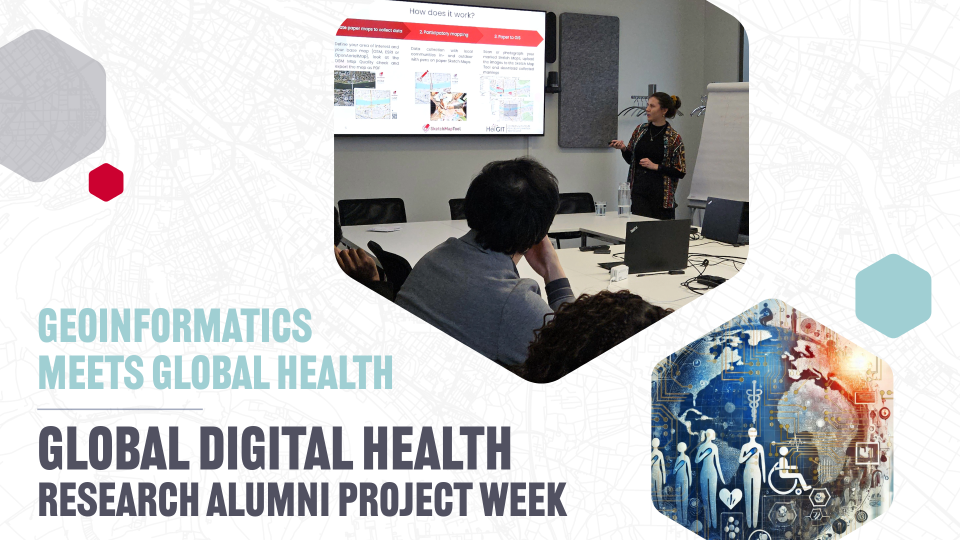
Last week, the “Global Digital Health” Research Alumni Project Week 2025 brought together international researchers and local experts to discuss advancements in global digital health. HeiGIT joined the discussion on this growing topic and shared its tools and research in geoinformatics applications to global health.
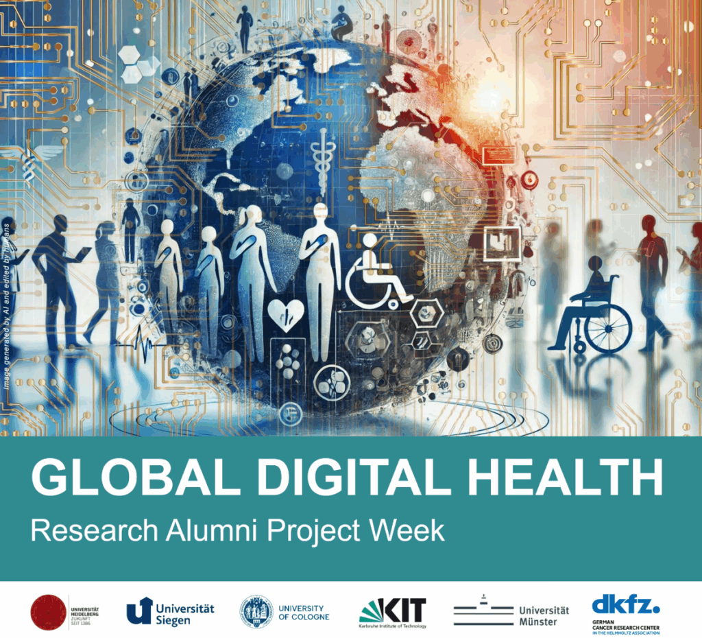
The GLOBAL DIGITAL HEALTH Research Alumni Project Week, held from 20 to 26 November 2025 in Cologne and Heidelberg, focused on various aspects of global (digital) health, including approaches to digitalization, society and health economics, data and ethics, technology and prevention, diagnostics and therapy, and the role of artificial intelligence in health. Researchers and alumni from DKFZ, KIT and the Universities of Cologne, Münster, Siegen and Heidelberg took part. HeiGIT’s involvement highlighted the growing importance of geoinformatics in addressing global digital health challenges.
Panel Discussion on “Environmental Factors and Climate Change Related to Human Health” and Lab Tour at HeiGIT
As part of the event, Sven Lautenbach, our Chief Scientist, participated to a panel discussion on “Environmental Factors and Climate Change Related to Human Health” and provided an overview of our work at HeiGIT and the GIScience research group with a special focus on “Health Relevant Effects of Climate Change on Accessibility and Walkability”. He addressed how heat-avoiding routing might help to mitigate climate change impacts and how this relates to the walkability and route choice modelling activities in the project Silver Ways and on the Climate Action Navigator. In addition, he touched upon the modelling of accessibility to health sites under disaster conditions.
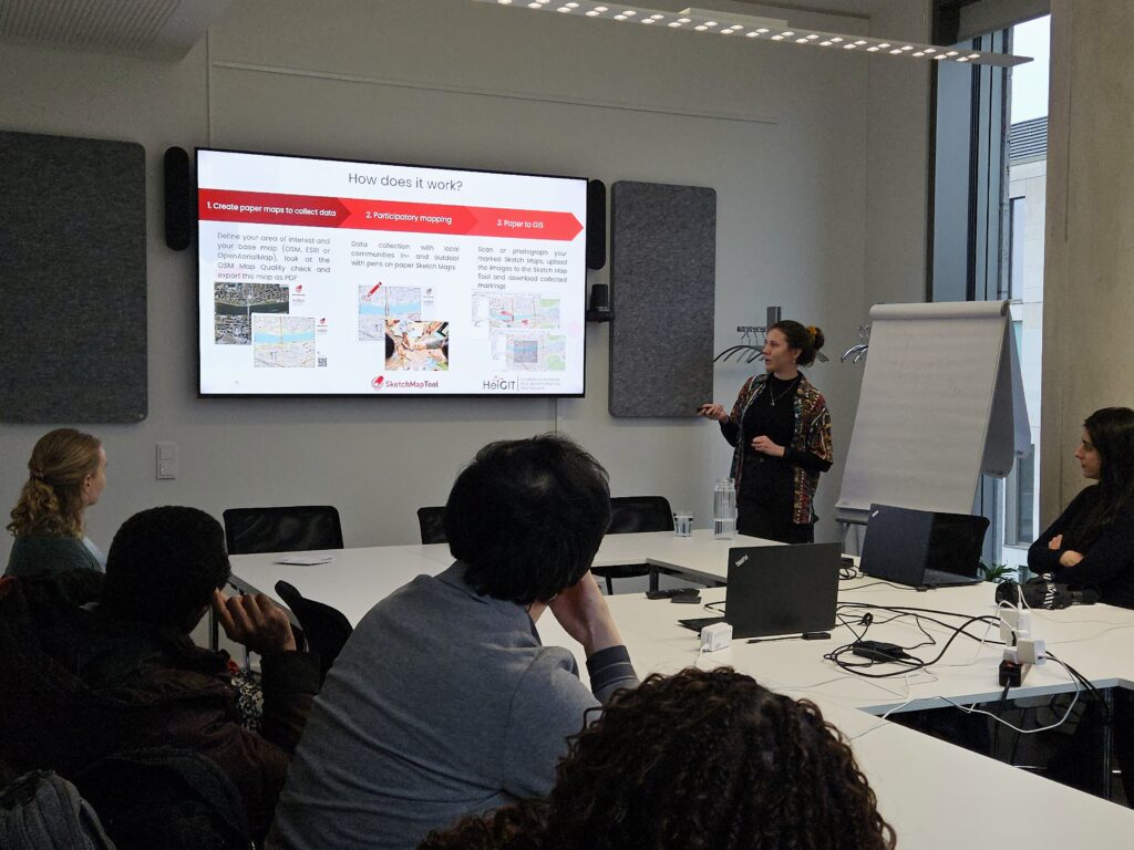
The following day, we were pleased to welcome event attendees to the HeiGIT offices for a “lab tour”. Emily Wilke presented active mobility indicators from the Climate Action Navigator, while Marcel Reinmuth provided insights on heat-avoiding routing and accessibility analysis, and Maximiliane Kitzinger discussed participatory mapping with the Sketch Map Tool. This tour provided insights into HeiGIT´s research areas and sparked discussions on the use of geodata and GIS technologies to support Global Digital Health.
Open-Source GIS Tools for Global Digital Health
Global Digital Health research can profit from GIS-based technologies and data on many levels.
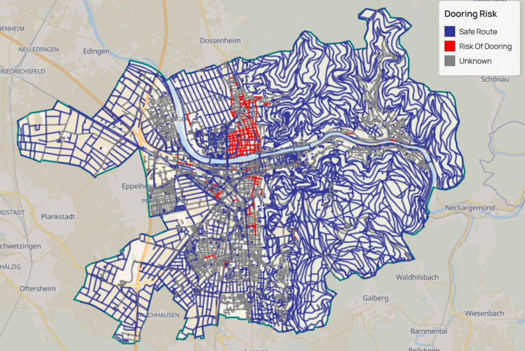
For instance, effectively promoting active mobility instead of motorized mobility presents benefits not only for the climate and environment, as less carbon is released into the atmosphere, but also for the individuals´ health, as they do more moderate physical activity through walking or cycling. The Climate Action Navigator offers high-resolution, open data-based insights into the quality and accessibility of walking and cycling infrastructure in cities worldwide. It shows how smooth the street pavements are, if pedestrians and cyclists have to share their path with others (such as cars), if there are drinking fountains or benches to rest, if there is a high dooring risk for bikes passing by, and more. This kind of actionable, high-resolution data for Climate Action can support a data-informed, targeted urban planning measure that promote better public health, e. g. making it safer and easier to walk or cycle instead of driving.
Another public health concern is hot weather, especially in urban areas: when the temperature is very high, being outdoors can pose health risks, especially for vulnerable groups like the elderly, children, and citizen with pre-existing conditions. The HEAL project launched a routing app to help citizens avoid heat stress, supporting climate adaptation and public health during hot weather periods. With the HEAL app (currently available in Germany in the cities of Heidelberg, Walldorf, and Worms), users can calculate alternative routes that steer away from main roads with little shade, suggesting routes through parks and shaded areas instead.
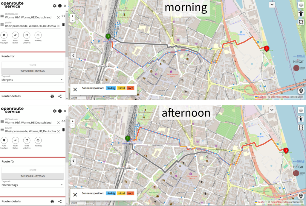
The HEAL app showing walking routes in Worms, Germany: slightly different routes are suggested in the morning and afternoon to avoid heat stress.
The HEAL app is based on openrouteservice, an open-data routing service based on OpenStreetMap data, which offers routing for various transport modes like walking, cycling, driving, and wheelchair routes. Different openrouteservice features can be useful for various health-related use cases, from calculating the accessibility of healthcare facilities to supporting humanitarian logistics during disaster relief efforts.
Sometimes, however, the issue is that the geographical information needed to act is not available to researchers and organizations, even though local communities usually possess this knowledge. The Sketch Map Tool is a means to close this gap, as an easy-to-use tool for participatory mapping through offline collection, digitisation and georeferencing of local data. Via the Sketch Map Tool website, users can very easily collect local spatial knowledge using pens and paper maps. This can be particularly useful in all situations where harnessing knowledge from the local community is essential, e. g. for identifying areas susceptible to flooding, mapping perceived heat in urban areas, and pinpointing critical infrastructure and civil facilities within vulnerable zones.
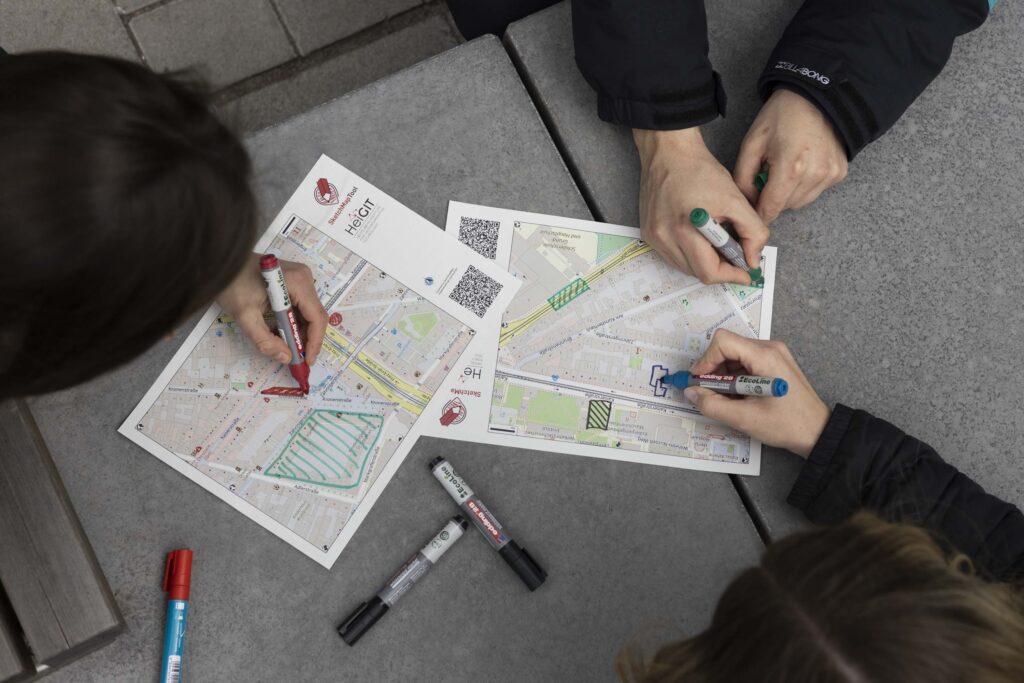
With the Sketch Map Tool, it is possible to draw on paper maps and digitize the markings later on.
The Growing Importance of Global Digital Health
As research on global digital health continues to evolve, the integration of geoinformatics methods and resources plays an increasingly relevant role. The Global Digital Health Research Alumni Project Week 2025 underscored the importance of interdisciplinary collaboration in addressing complex health challenges. We look forward to future collaborations and research that will drive the field of global digital health forward.