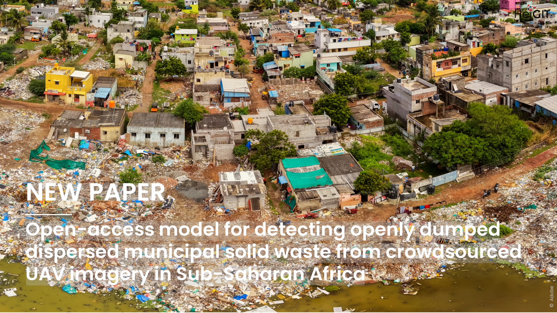
In many fast-growing cities in Sub-Saharan Africa, waste collection often cannot keep up with the pace of urban expansion. As a result, waste can build up in streets, along waterways and drainage systems, and in other public spaces. These smaller, scattered piles are difficult to track through conventional surveys and are often too small to detect reliably in openly available satellite imagery. High-resolution drone imagery can provide the level of detail needed to identify them.
To address this problem, the researchers created an open-access deep learning model that can automatically detect small and scattered areas of openly dumped municipal waste in crowdsourced drone imagery. They trained and tested the model using imagery from OpenAerialMap covering 29 regions in 10 Sub-Saharan African countries, including a range of urban and peri-urban settings. The imagery was divided into 5 × 5 metre tiles, and for each region, about 100 waste examples and 100 background examples were labelled by hand. This resulted in a dataset of 5,800 labelled tiles.
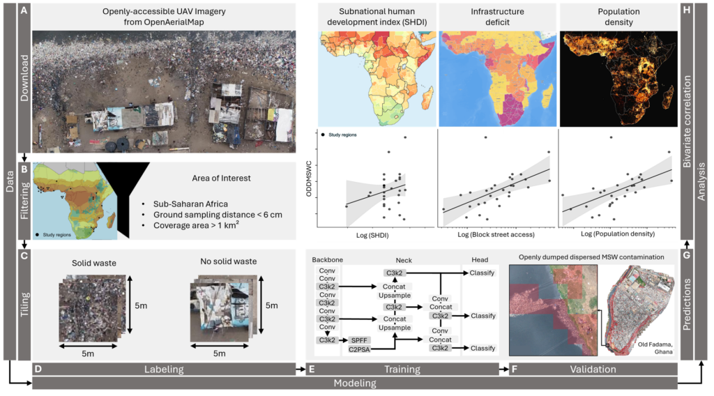
The model reached an overall accuracy of 92.87% on the test data, with an F1 score of 92.76% for detecting openly dumped waste. The researchers then applied the model to more than 13 million image tiles across the study areas. The resulting maps show that predicted waste patterns vary considerably between locations. In some places, waste is more evenly scattered, while in others, it forms clear hotspots, including along pathways and waterways in some areas.
The study also examined how waste patterns relate to local conditions. Higher levels of detected waste were linked to greater population density and greater infrastructure deficits, particularly limited road access to buildings. However, the researchers did not find a clear link with the Subnational Human Development Index. The findings suggest that detailed local indicators may be more helpful for understanding where waste builds up than broader regional development measures. These results show correlations, not cause-and-effect relationships.
There are still some limitations. Materials like rubble, patterned surfaces, or other objects can sometimes be mistaken for waste from above, while waste hidden by vegetation or roofing can be missed. In an initial experiment, the researchers also tested openly available satellite imagery and found that it performed poorly at detecting small, scattered waste. This highlights the advantage of the much finer detail provided by drone imagery.
By making the model openly available, the study aims to help municipalities, local mapping communities, and other practitioners turn drone imagery into useful information for waste management. The maps created with the model can help identify hotspots and guide decisions about where to prioritize collection or cleanup. In the future, the team plans to make the approach easier to use, including integrating the model into fAIr, the Humanitarian OpenStreetMap Team’s open AI-assisted mapping service.
Reference: Knoblauch, S., Muthusamy, R. K., Bettencourt, L. M. A., Velis, C., Chrzanowski, P., Anderson, E. C., Masters, P., Maholi, I., Inguane, A., Szamek, L., & Zipf, A. (2027). Open-access model for detecting openly dumped dispersed municipal solid waste from crowdsourced UAV imagery in Sub-Saharan Africa. Computers, Environment and Urban Systems, 131, 102517. https://doi.org/10.1016/j.compenvurbsys.2026.102517