Im Mai diesen Jahres haben wir den Climate Action Navigator (CAN) veröffentlicht. Er ist ein interaktives Dashboard, das hochauflösende Daten zu Klima-Schlüsselfaktoren bietet. Dazu zählen unter anderem Daten zur Qualität…
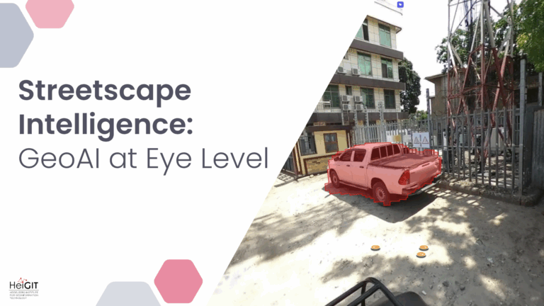
Crowdsourced street-level imagery can be used to detect and map humanitarian-relevant features in near real time. We have developed a machine-learning-based analytical pipeline that integrates with the open-source imagery catalogue…
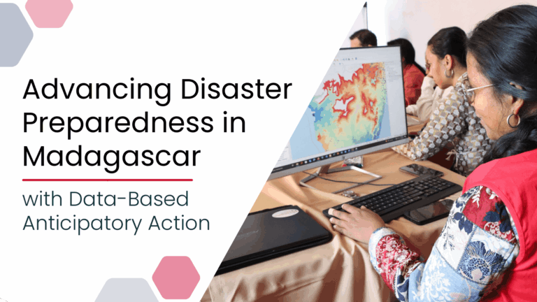
Anticipatory Action (AA) is becoming an increasingly vital approach in humanitarian and disaster risk management. By leveraging forecasts and risk data, AA enables timely interventions before extreme events occur. Geoinformation…
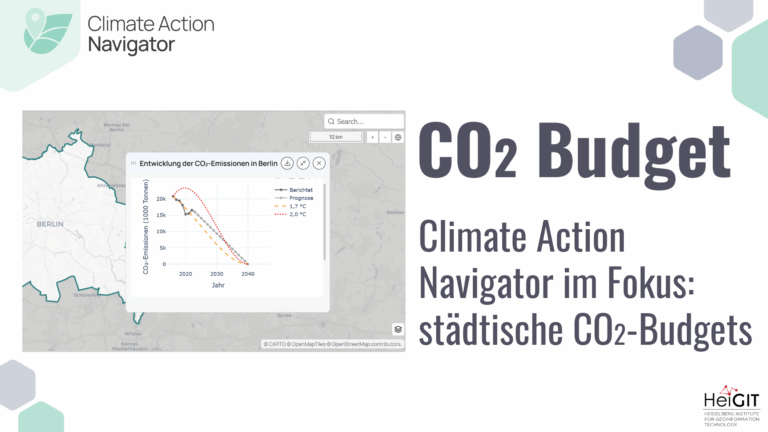
Dank der neuesten Ergänzungen des Climate Action Navigators (CAN) ist es nun möglich, das verbleibende CO2-Budget für mehrere deutsche Städte (Berlin, Bonn, Hamburg, Heidelberg und Karlsruhe) zu berechnen, um bestimmte…
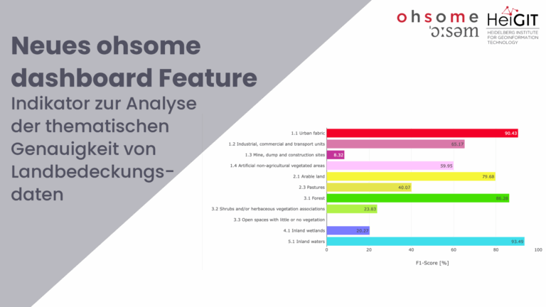
Zusammen mit dem deutschen Bundesamt für Kartographie und Geodäsie (BKG) haben wir eine neue Version des ohsome-Dashboards veröffentlicht, mit der wir einen neuen Indikator zur Analyse der thematischen Genauigkeit von…
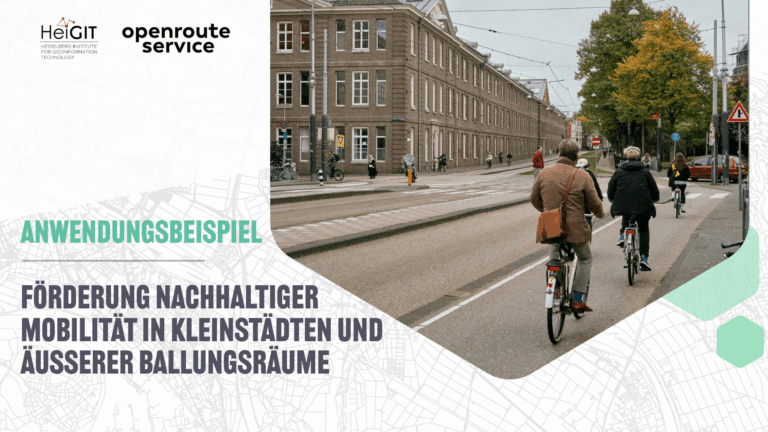
Das ENHANCE Projekt untersucht mit Hilfe von Kartierung, Verhaltensforschung und Simulationswerkzeugen, wie das Konzept der 15-Minuten-Stadt auch über Metropolregionen hinaus Anwendung finden kann. Somit soll die Entwicklung von nachhaltigeren und…
Das Robert und Christine Danziger Stipendium unterstützt herausragende Doktorand*innen aus West- und Zentralafrika (mit besonderem Schwerpunkt auf Bewerbende aus Ghana), die eine Promotion an der Universität Heidelberg im Bereich der…
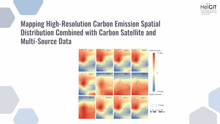
This study develops a framework integrating satellite observations with spatial proxy data to produce high-resolution urban carbon emission maps. The method is applied to Urumqi, China, demonstrating accurate and timely…
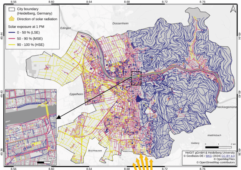
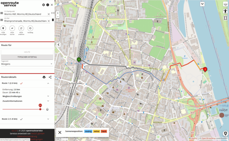
Using Heidelberg as a case study, researchers modeled time-dependent solar exposure for the entire pedestrian network by combining high-resolution DEM/DSM building and vegetation data with OpenStreetMap road data. Adapting to…
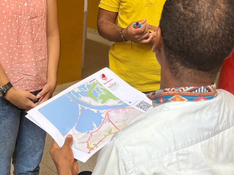
Das Sketch Map Tool wurde in Cartagena, Chile, eingesetzt, um geographische Informationen für eine effektive Katastrophenvorsorge zu sammeln. Es ist ein einfach anwendbares Tool für partizipatives Sketch-Mapping, das bei der…
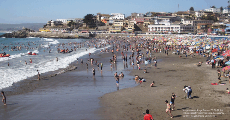
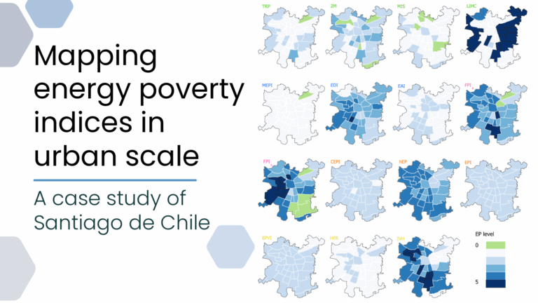
This study evaluates the applicability of macro-scale energy poverty indices in an urban context, using Santiago de Chile as a case study. Energy poverty (EP), understood as the inability of…
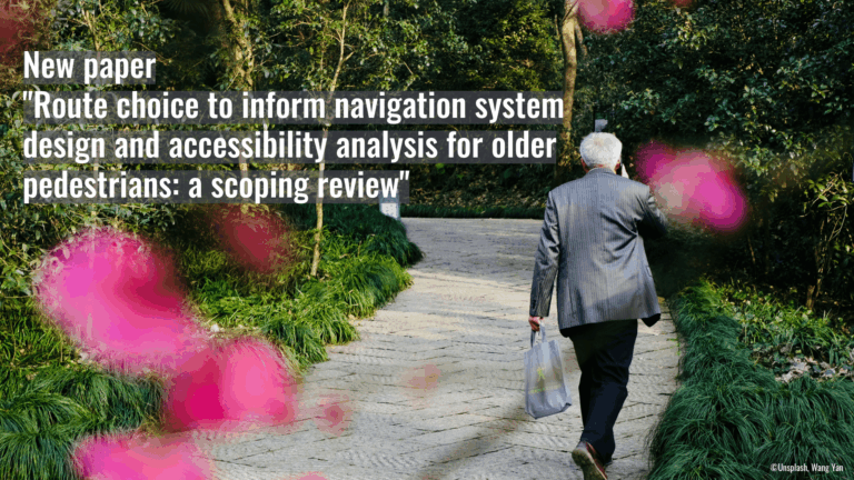
Walking supports healthy aging, but older adults often prioritize safety and comfort over speed. This study uses a scoping review to examine these preferences and guide age-inclusive routing systems. Walking…
Mit steigenden Sommertemperaturen wächst auch das Gesundheitsrisiko beim Aufenthalt im Freien. Davon sind vor allem in Städten besonders vulnerable Gruppen wie ältere Menschen, Kinder oder Personen mit Vorerkrankungen betroffen. Im…
Im Juni 2025 führten Wissenschaftler*innen des Urban Big Data Centre (UBDC) und HeiGIT (Heidelberg Institute for Geoinformation Technology) eine gemeinsame Exkursionen nach Kolumbien durch, um dort die Zusammenarbeit für partizipative…
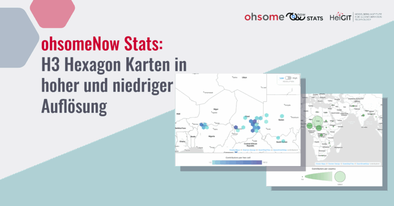
Das ohsome Now Stats Dashboard wurde zur Verbesserung der visuellen und funktionalen Elemente aktualisiert. Dies erleichtert die Analyse von OpenStreetMao (OSM)-Kartierungsaktivitäten über Raum und Zeit. Neue H3-Hexagon-Karte in hoher und…
Bei einer gemeinsamen Aktion des Honduranischen Roten Kreuzes und der Gemeindeverwaltung ist das Sketch Map Tool genutzt worden, um den kommunalen Notfallplan zu überarbeiten und eine Anlage zu entwickeln, die…
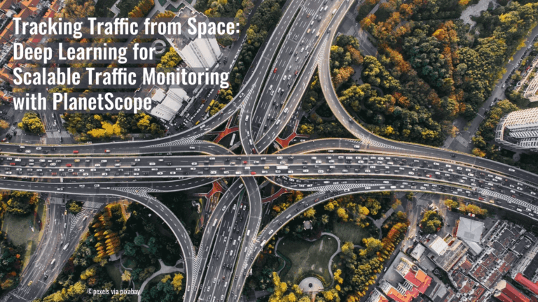
A recent study has demonstrated a novel approach to the large-scale monitoring of road traffic. Rather than relying on radar or mobile sensors, the team used PlanetScope’s Super Dove satellite…
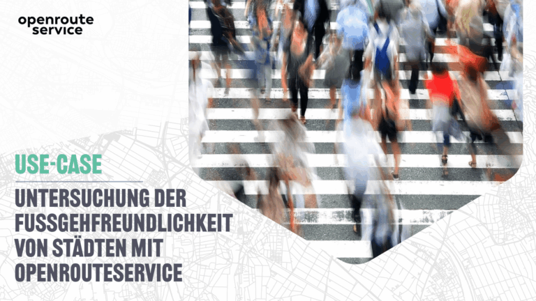
Diese Studie analysiert den fußläufigen Zugang zu zentralen Infrastruktureinrichtungen, die mit sozialen Einflussfaktoren von Gesundheit verknüpft sind. Mithilfe von openrouteservice werden räumliche Ungleichheiten beim Zugang zu essenziellen Angeboten, die Gesundheit…
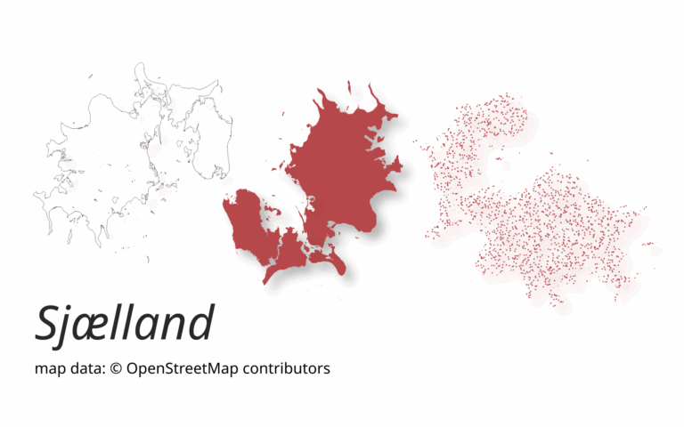
A new version of ohsome-planet (codename “Sjælland”) has been released. It is the newest version of HeiGIT´s command line tool, which transforms OpenStreetMap (history) PBF files into into an analysis-ready…
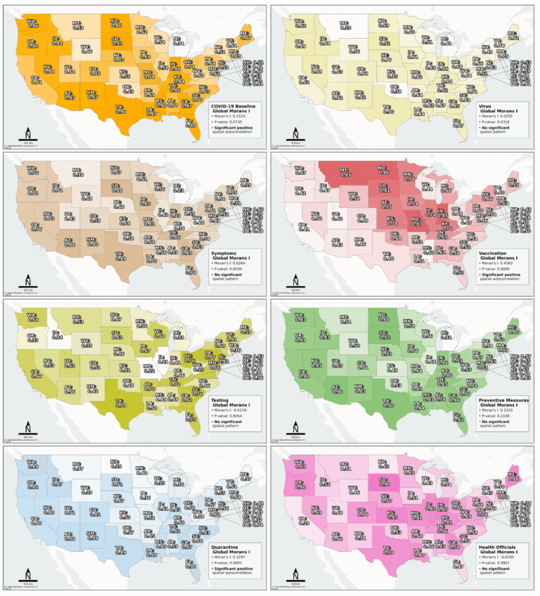
Searching for early warning systems during the COVID-19 pandemic, the researchers explored how digital data sources such as geo-social media (e.g. posts on platforms like X, formerly Twitter, that include…