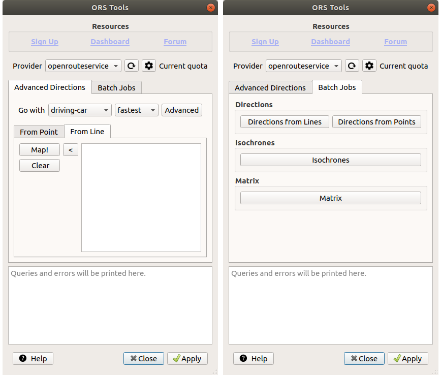
Finally there is a new version of the QGIS plugin for OpenRouteService: ORS Tools. It gives easy access to our directions, isochrone and matrix API’s from within QGIS.
The old plugin OSM Tools plugin has been deprecated due to its name being too generic. However, the name is not the only thing that changed:
- Create routes from LineString data: this is helpful when you want to create a route along multiple waypoints
- Batch jobs via Processing algorithms: Using QGIS layers, it’s now possible to leverage the power of QGIS’ Processing framework with all its benefits (non-freezing background jobs etc)
- Support for multiple providers: if you host ORS yourself, you can now set up new providers in the GUI
- Automatic generation of total population statistics in isochrones
- Queries and errors are printed in GUI for easier debugging
- Logs queries and errors also to QGIS log
- revamped GUI
- resolved many registered issues
The new GUI can be considered a control center. From here you can access all functionalities including the batch jobs:
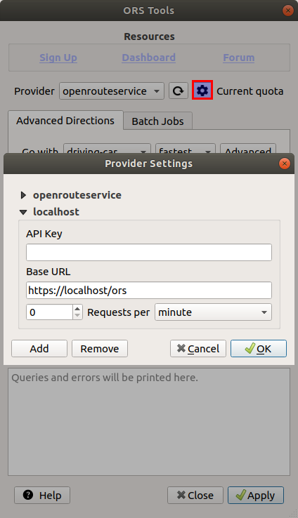
The new functionality to use other providers than OpenRouteService API’s is very handy for anyone self-hosting a ORS instance or even for core OpenRouteService developers. API key is an optional field, which can be omitted if the provider does not control access to the API:
If you encounter an issue or have an improvement suggestion, please use our issue tracker. In case of questions, our forum will be helpful.
As always, we highly appreciate other developers to contribute to our projects and ORS Tools is no different. Fork the repository and ask if something is unclear.
This adds to the growing ecosystem of routing libraries for different languages such as python, R stats or JavaScript. Find the sources on GitHub/GIScience.
See also our related research on healthy, quiet and green routing, wheelchair accessibility or Landmark navigation or routing through open spaces etc. Stay tuned for updates.
Happy routing!


