Bis zum 01.09.2019 kann die Austellung auf der MS Wissenschaft zum Thema “Künstliche Intelligenz” in Heidelberg besucht werden. Wir waren da und sind begeistert! Für die Ausstellung hat das HeiGIT…
Seit einiger Zeit findet sich das gemeinsame Exponat des HeiGIT und des Alfred-Wegener-Instituts Helmholtz-Zentrum für Polar- und Meeresforschung für die Ausstellung “Künstliche Intelligenz” auf der “MS Wissenschaft” auch auf dem…
Am 16. und 17. August öffnet das Auswärtige Amt in Berlin die Tore für die Öffentlichkeit. An diesen Tagen kann nicht nur das Auswärtige Amt selbst besichtigt werden, verschiedene Diplomaten,…
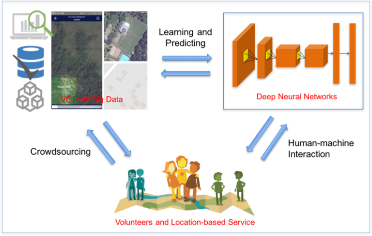
Our new paper on Machine Learning and Humanitarian Mapping Nowadays, Machine Learning and Deep Learning approaches are steadily gaining popularity within the humanitarian (mapping) community. New tools such as the…
Global Platform 2019 in Geneva Creating maps helps humanity. Drawing maps together with communities is crucial for effective risk reduction interventions, ensuring no one is left behind. The progress…
Middle of May, Geneva becomes the gathering place for citizens, political leaders, government institutions, private sector, civil society, and scientific and technical institutions, that all jointly work towards a big…
The Humanitarian OpenStreetMap Team (HOT) , the Heidelberg Institute of Geoinformation Technology (HeiGIT) , and the wider MapSwipe Community started working on an MapSwipe extension to monitor changes in satellite…
Recently, earth observation by satellites has shown great capability in supporting a range of challenges such as disaster assessment, agriculture monitoring, and humanitarian mapping. MapSwipe, as a humanitarian mapping app,…
Humanitarian organizations can’t help people if they can’t find them. This was the simple reason to create MapSwipe back in 2016 and it is still as pressing as in the…
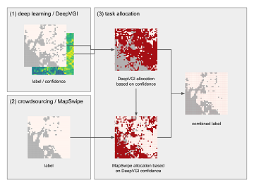
Satellite images are widely applied in humanitarian mapping which labels buildings, roads and so on for humanitarian aid and economic development. However, the labeling now is mostly done by volunteers….
We are happy to hereby announce the official partnership of the HeiGIT/GIScience Research Group Heidelberg and the Humanitarian OpenStreetMap Team (HOT)! The GIScience Research Group at Heidelberg University has been…
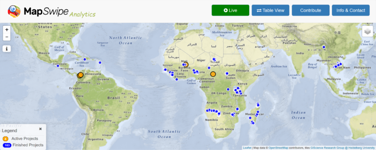
Since the launch of the MapSwipe Analytics webpage three month ago we were able to improve our service and offer more detailed information on each project in MapSwipe. MapSwipe is…