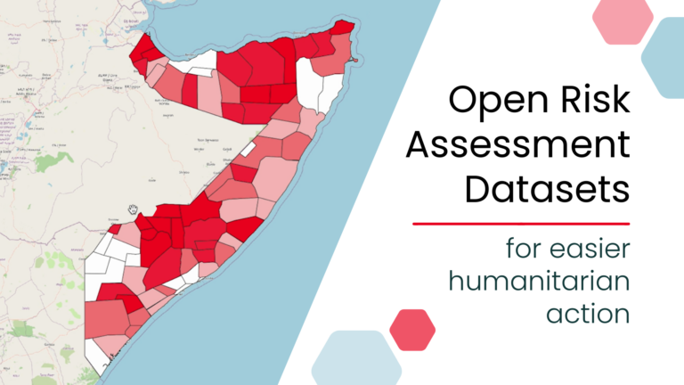
New open, ready-to-use global risk assessment datasets can simplify risk analysis by removing major technical barriers to data preparation. Designed for easy use with the Risk Assessment QGIS Plugin, the…
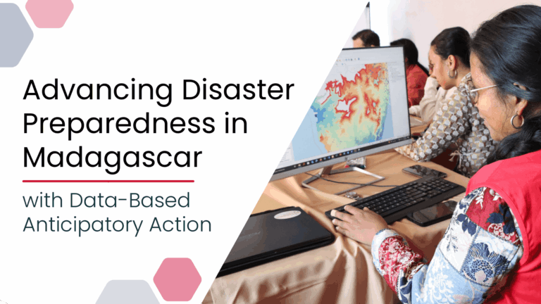
Anticipatory Action (AA) is becoming an increasingly vital approach in humanitarian and disaster risk management. By leveraging forecasts and risk data, AA enables timely interventions before extreme events occur. Geoinformation…
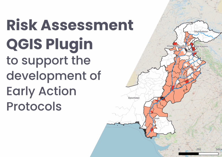
Dieses QGIS-Plugin ist im Rahmen unserer fortlaufenden Arbeit zu vorausschauender humanitärer Hilfe (Anticipatory Action, AA) entwickelt worden. Das Ziel ist, es lokalen Akteuren zu ermöglichen, zuverlässige Risikoanalysen eigenständig durchzuführen. Das…
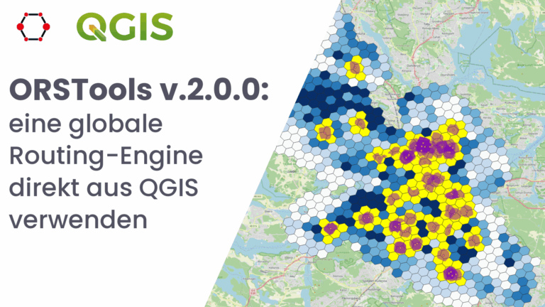
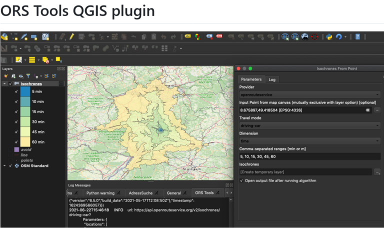
Was ist ORSTools? Mit ORSTools sind die meisten Funktionen von openrouteservice direkt in QGIS zugänglich. Das Plugin bietet ein umfassendes Toolset, das Routing, Isochronen- und Matrizenberechnungen umfasst. Diese Funktionen können…
We are excited to share the release of the ohsome-planet – a new software library on GitHub, marking a significant step toward the development of ohsome 2.0. This tool is…
The openrouteservice (ORS) QGIS plugin continues to evolve, bringing a suite of new features, improvements, and fixes that enhance its functionality and user experience. This update incorporates significant changes that…
Das openrouteservice Team freut sich, pünktlich zum neuen Jahr die Veröffentlichung des ORS Tools QGIS Plugin v1.7.0 bekanntgeben zu können! Es hat sich einiges getan. Zunächst wurde das GUI überarbeitet:…
Using the ohsome dashboard, it is possible to explore quality estimation for OpenStreetMap (OSM) data from the ohsome quality analyst (OQT) for arbitrary regions. Also, OQT does provide an API…
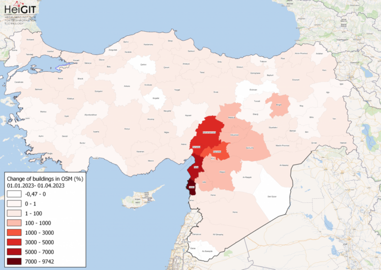
Gezeigte Karte: Prozentuale Veränderung von Gebäuden in jeder Provinz der Türkei und Syriens in OSM. Daten von OpenStreetMap, visualisiert mit QGIS und dem ohsome API Plugin. Willkommen zurück zu unserer…
Diesen Juni fand die GIS-Woche 2022 von Ärzte ohne Grenzen (MSF) wieder im schönen Prag statt. Nahezu das gesamte MSF-Team, das sich mit Geodaten und Geodatenanalyse befasst, nahm an der…
Openrouteservice für komplexe Routenoptimierung in neuer QGIS-Erweiterung des Regionalverband Ruhr Der Regionalverband Ruhr (Team 9-2 Geodaten-Technik) hat mit einer neuen QGIS-Erweiterung das Potenzial von openrouteservice (ORS) von HeiGIT genutzt und…
We’re happy to announce a new version of our QGIS Plugin ORS Tools. Additionally to the core services of giving easy access to our directions, isochrone and matrix API’s, the…
Finally there is a new version of the QGIS plugin for OpenRouteService: ORS Tools. It gives easy access to our directions, isochrone and matrix API’s from within QGIS. The old…
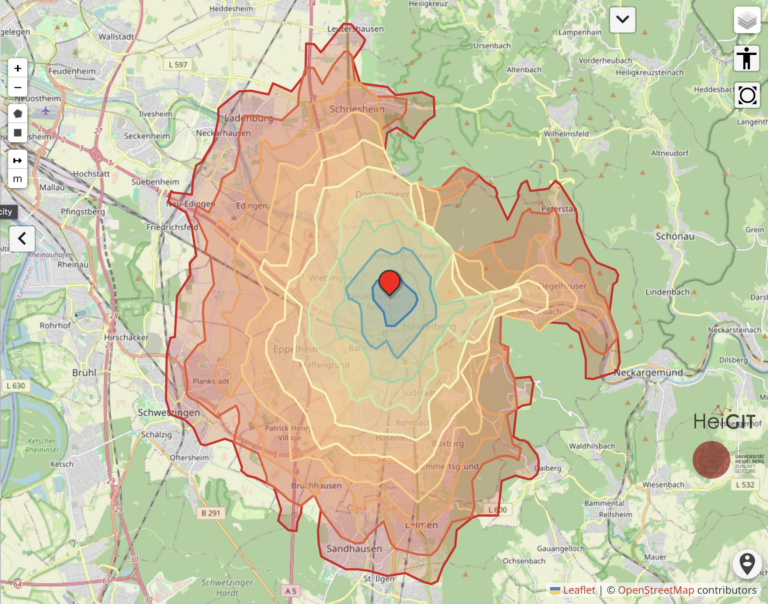
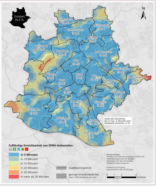
The Statistical Office of the City of Stuttgart determined the walking time to the nearest public transport stop for every place in the city using our QGIS plugin OSM Tools….
This blog post is the start of a series of posts, which describe what you are able to do using the ohsome framework developed at the Heidelberg Institute of Geoinformation…