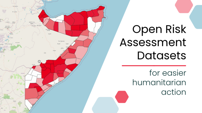
New open, ready-to-use global risk assessment datasets can simplify risk analysis by removing major technical barriers to data preparation. Designed for easy use with the Risk Assessment QGIS Plugin, the…
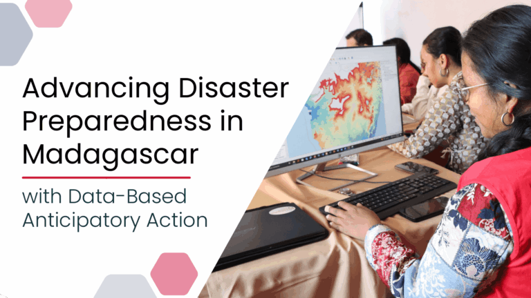
Anticipatory Action (AA) is becoming an increasingly vital approach in humanitarian and disaster risk management. By leveraging forecasts and risk data, AA enables timely interventions before extreme events occur. Geoinformation…
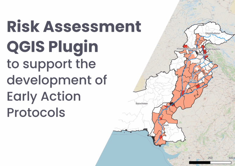
As part of our ongoing work in Anticipatory Action, a QGIS plugin for risk assessments was developed with the goal of enabling local actors to carry out risk assessments independently…
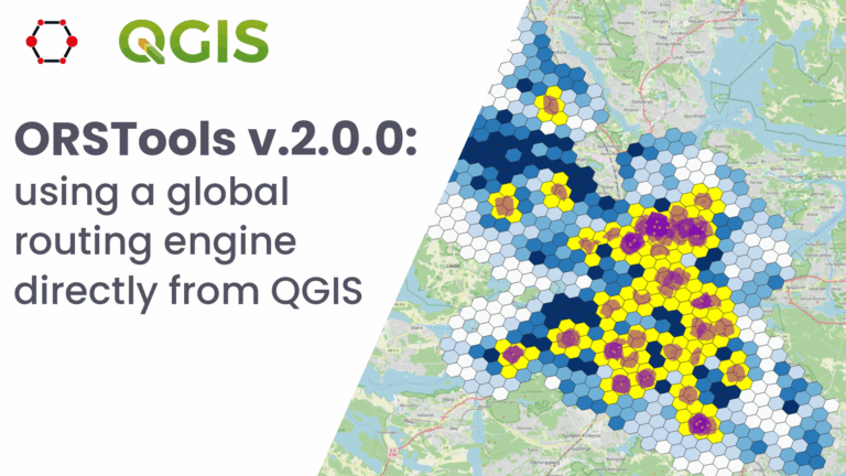
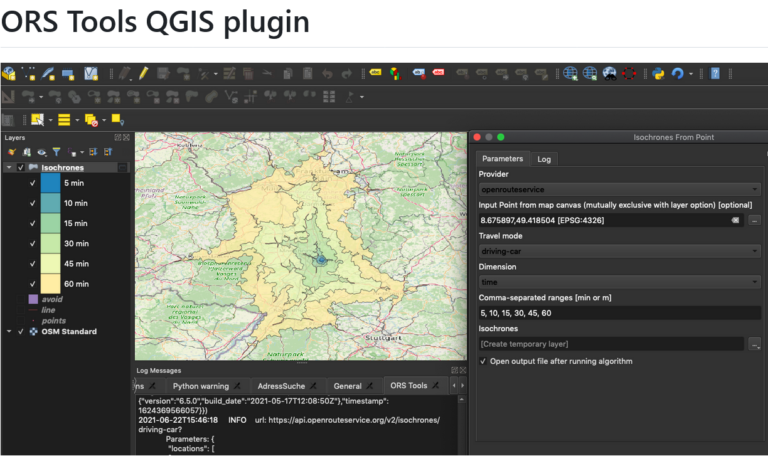
What is ORSTools? With ORSTools, most of the functionalities of openrouteservice are directly accessible in QGIS. The plugin offers a toolset, including routing, isochrone generation and matrix calculations. These functions…
We are excited to share the release of the ohsome-planet – a new software library on GitHub, marking a significant step toward the development of ohsome 2.0. This tool is…
The openrouteservice (ORS) QGIS plugin continues to evolve, bringing a suite of new features, improvements, and fixes that enhance its functionality and user experience. This update incorporates significant changes that…
The use of open-source geospatial data, exemplified by services like openrouteservice (ORS), proves to be beneficial for both academic research and use case studies. Witnessing our technologies applied in unanticipated…
Just in time for the new year, the openrouteservice team proudly announces the release of v1.7.0 of the ORS Tools QGIS plugin! Quite a lot has happened. First, the GUI…
Using the ohsome dashboard, it is possible to explore quality estimation for OpenStreetMap (OSM) data from the ohsome quality analyst (OQT) for arbitrary regions. Also, OQT does provide an API…
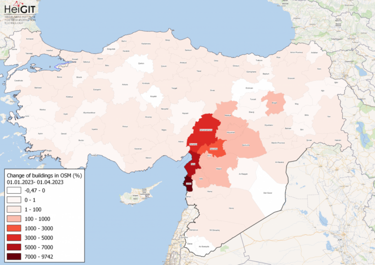
Featured Map: Percent change in each province of Türkiye and Syria of buildings in OSM. Data from OpenStreetMap, visualized using QGIS and the ohsome API plugin. Welcome back to the…
From our team, Benjamin Herfort and Marcel Reinmuth participated in sessions, offered a hands-on workshop concerning accessibility analysis, and facilitated a discussion round on participatory mapping….
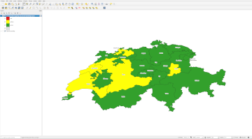
The Regionalverband Ruhr (Team 9-2 Geodata Technology) has used the potential of HeiGIT’s openrouteservice (ORS) in a new QGIS extension and thereby created another possible application for the ORS: The…
We’re happy to announce a new version of our QGIS Plugin ORS Tools. Additionally to the core services of giving easy access to our directions, isochrone and matrix API’s, the…
Finally there is a new version of the QGIS plugin for OpenRouteService: ORS Tools. It gives easy access to our directions, isochrone and matrix API’s from within QGIS. The old…
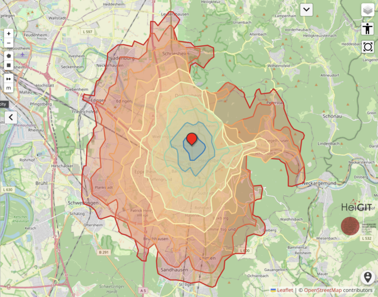
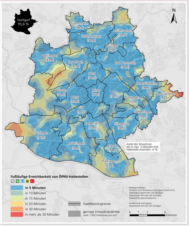
The Statistical Office of the City of Stuttgart determined the walking time to the nearest public transport stop for every place in the city using our QGIS plugin OSM Tools….
This blog post is the start of a series of posts, which describe what you are able to do using the ohsome framework developed at the Heidelberg Institute of Geoinformation…