In addition to our already exciting and fascinating portfolio of open source software we now offer openfuelservice which is a new and very experimental advance in the world of fuel…
Finally there is a new version of the QGIS plugin for OpenRouteService: ORS Tools. It gives easy access to our directions, isochrone and matrix API’s from within QGIS. The old…
You can also use Openrouteservice via the self-service data analytics plattform alteryx, when you are a user of that data science product. Pablo Sáenz de Tejada (The Information Lab) has…
The most optimal route through Germany’s 15 biggest citys. It’s the shortest route of exactly 43.589.145.600 different alterations. In a Vehicle Routing Problem (VRP, an example is the Traveling Salesman…
The new year started in the openrouteservice team at HeiGIT with the release of openrouteservice 4.7.2. In this release there were a number of bug fixes, but also some new…
In addition to our previously released and highly appreciated python and R libraries we now offer an additional JavaScript API making the usage of the openrouteservice ecosystem covering the entire…
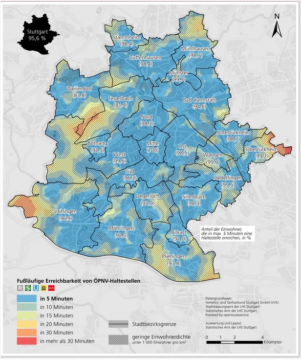
The Statistical Office of the City of Stuttgart determined the walking time to the nearest public transport stop for every place in the city using our QGIS plugin OSM Tools….
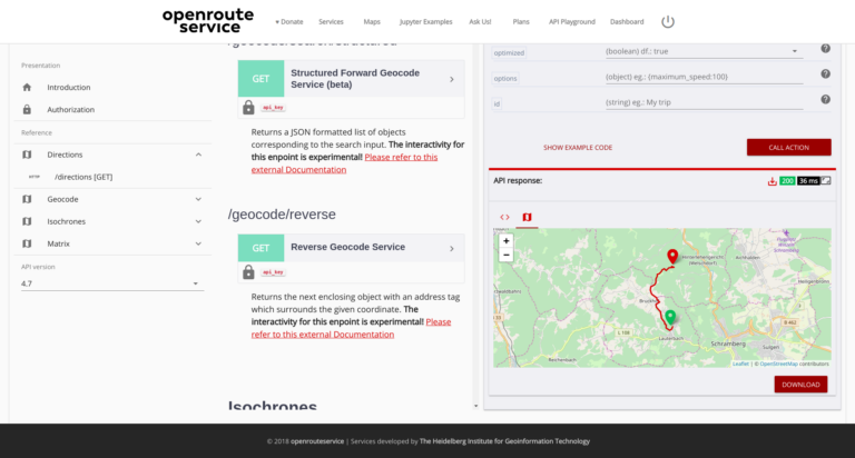
After the release of the new OpenRouteService dashboard the team has worked on a new interactive API documentation application named API Playground , that allows the users to explore all…
In a newly published open access paper, we present a system that generates customized pedestrian routes entirely based on data from OpenStreetMap (OSM). The system enables users to define to…
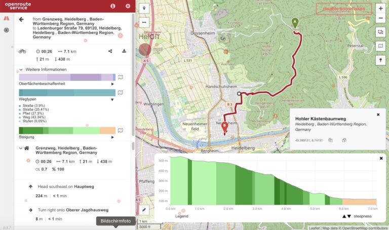
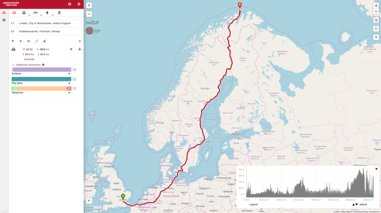
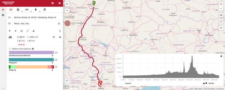
Last week we have been upgrading the openrouteservice, and with that has come the ability to include elevation information in routing pretty much anywhere on the globe (sorry people on…
Informationen und Navigation zu urbanen Grünflächen in Städten – meinGrün Neues mFund Kooperations-Projekt meinGrün wird vom BMVI gefoerdert. Problemstellung Um in Städten trotz Wachstum und Nachverdichtung eine hohe Lebensqualität zu…
Exactly 10 years ago openrouteservice.org came online for the very first time. Back then it was the very first online routing service consuming data from OpenStreetMap.org covering larger areas. So…
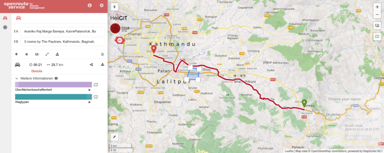
The Humanitarian OpenStreetMap Team (HOT) provides immediate support for disaster or humanitarian responses by coordinating and activating a global network of mappers that contribute up-to-date geodata to the OSM database….
We have finally developed a pretty handy python API for all of you pythoniasts out there. This library makes requests to the openrouteservice API extremely simple. With this you will…