Skip to content
Who We are
About
Careers
Team
Organization
Contact
What We Do
Focus
Geoinformation for Humanitarian Aid
Smart Mobility
Big Spatial Data Analytics
Climate Action
What We Offer
Overview
Projects
Technology
Datasets
Workshop and Teaching Materials
Publications
Partner with us
Newsroom
Blog
Events
Press
EN
DE
Who We Are
About
Team
Careers
Organization
Contact
What We Do
Focus
Geoinformation for Humanitarian Aid
Big Spatial Data Analytics
Smart Mobility
Climate Action
What We Offer
Overview
Technologies
Projects
Datasets
Workshop and Teaching Materials
Publications
Partner with us
Newsroom
Blog
Events
Press
English
Deutsch
February, 2026
In category:
General
Related tags:
AILAS
,
Deep Learning
,
GeoAI
,
Humanitarian Mapping
,
Red Cross
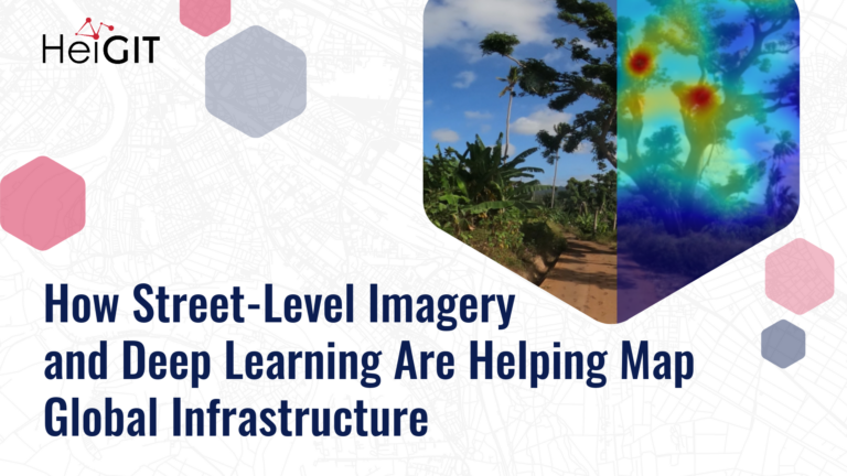
How Street-Level Imagery and Deep Learning Are Helping Map Global Infrastructure
February 26, 2026
Street-level imagery combined with deep learning methods is transforming how we detect and map critical infrastructure characteristics that are often missing from existing datasets. Applications range from road surface classification…
Read more