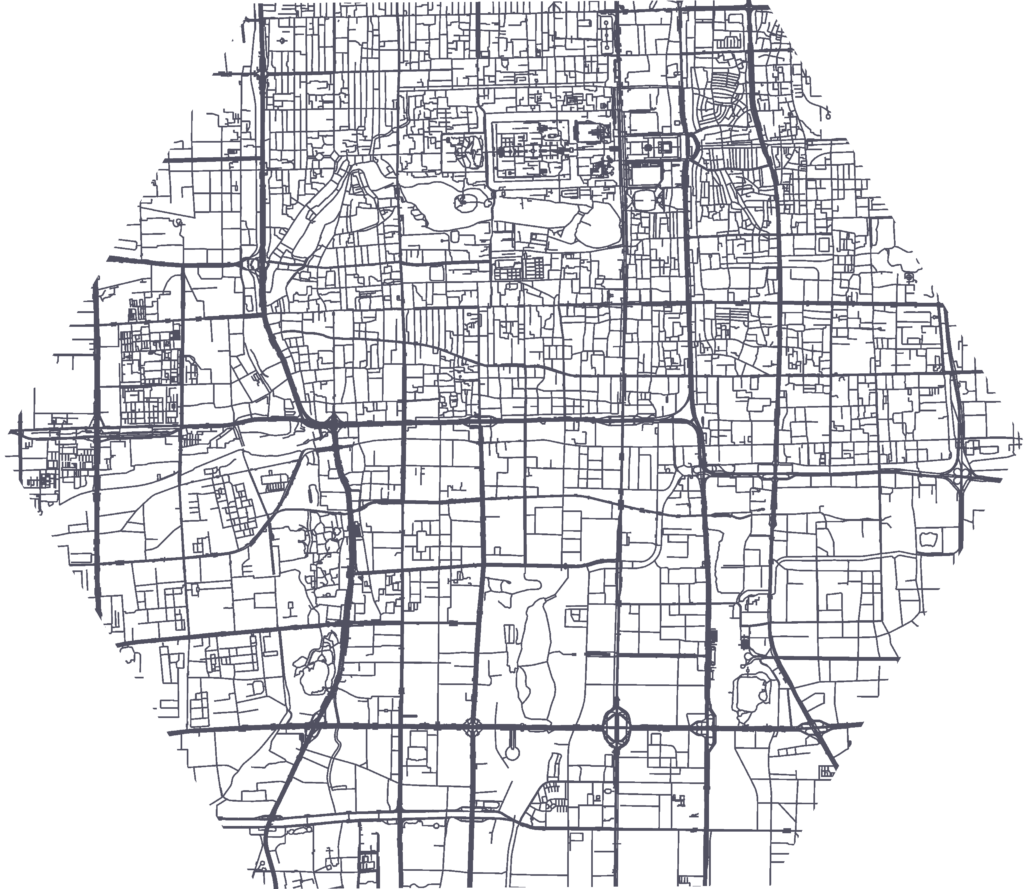
The Silver Ways project strives to enhance the mobility of senior citizens in urban environments. This project introduces a unique approach that combines the development of a walkable navigation system with an age-friendly 15-Minute Neighborhood Index. This index diverges from conventional shortest path methods, focusing instead on walking paths that reflect the preferences of older adults.
Driving Urban Transitions and co-funded by the European Union
Cooperation partners
HeiGIT, the GIScience Research Group of Heidelberg University, and the TdLab Geography of Heidelberg University, Uppsala University and Abdullah Gül University
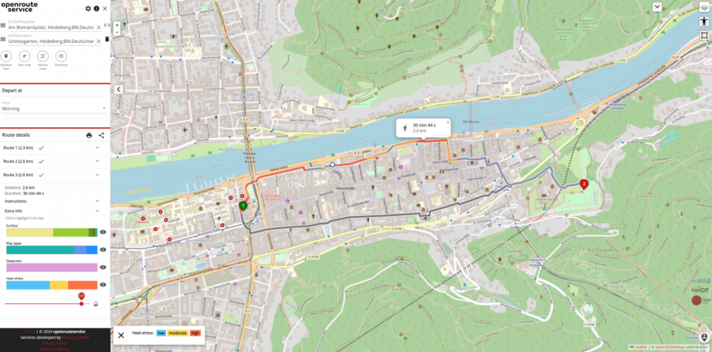
The HEAL project is a transdisciplinary initiative that develops adaptation strategies to protect at-risk groups during hot weather. It involves stakeholders and integrates public smart city data into a routing system. The project’s goal is to enable heat-adapted mobility for vulnerable populations through a dedicated app.
We are planning to expand the project to other cities and welcome inquiries from interested parties.
The project team will develop a proof-of-concept routing solution to support humanitarian and logistical operations. Based on the results of a Gap and Needs Analysis (GNA) and a rapid assessment, the collaboration will identify optimal primary transport routes and suitable alternatives to ensure continuity of operations during potential disruptions.
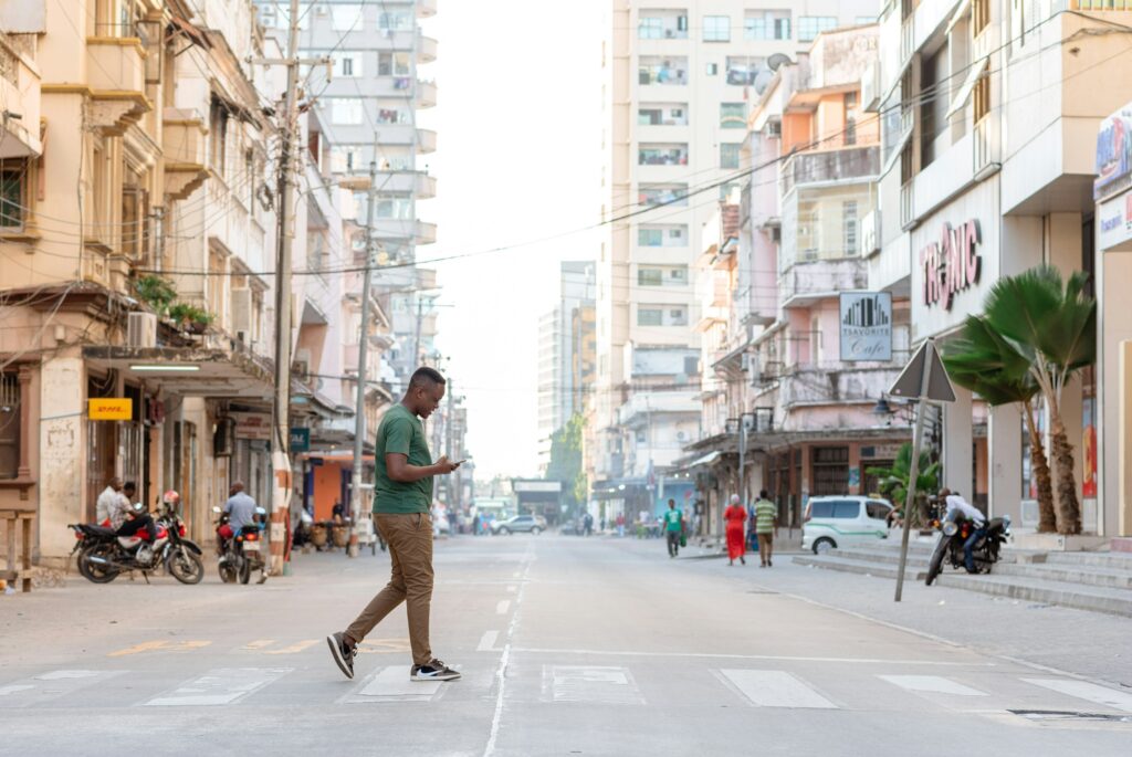
HAMM-Dar addresses a gap in Dar es Salaam’s urban planning around the growing heat exposure faced by the city’s pedestrians. The project builds a tool that combines satellite data with ground-level climate measurements to model how heat affects people walking through the city, and allows decision-makers to simulate the cooling effect of interventions like trees or shade structures before they are built.
This project will develop a decision-support tool to identify areas at risk of natural resource overuse, track the effectiveness of existing solutions, and assess how ecosystem changes affect migration patterns.
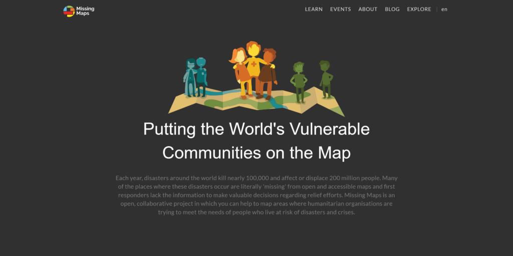
Our team supports Missing Maps by monitoring and visualizing its achievements and impact using information from the HOT Tasking Manager and our ohsome framework. Missing Maps creates detailed maps to aid humanitarian efforts in disaster-prone regions.
The project pilots an AI-driven, weather-adaptive routing system for unpaved roads. Using deep learning, street-level imagery, and dynamic data, it predicts road passability from global geodata, factoring in current and forecasted precipitation. These assessments feed into routing software, allowing planners to generate routes that reflect real-time and anticipated conditions.
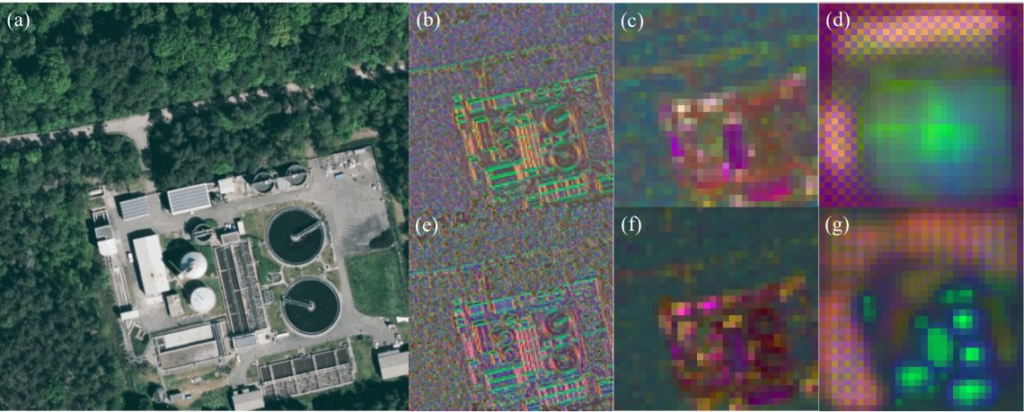
GeoAI4Water is a series of projects focused on developing advanced Machine Learning and Deep Learning models to identify and map Wastewater Treatment Plants (WWTPs). The project supports disaster preparedness and response by providing governments and responders with accurate data and resources to mitigate the impacts of such events.
The project team is assessing the feasibility and developing key components of a service portal for uploading, managing, and sharing data on disaster-affected infrastructure and transport networks. Focused on events like floods, the portal will be co-designed with humanitarian actors to ensure usability and meet their specific needs.
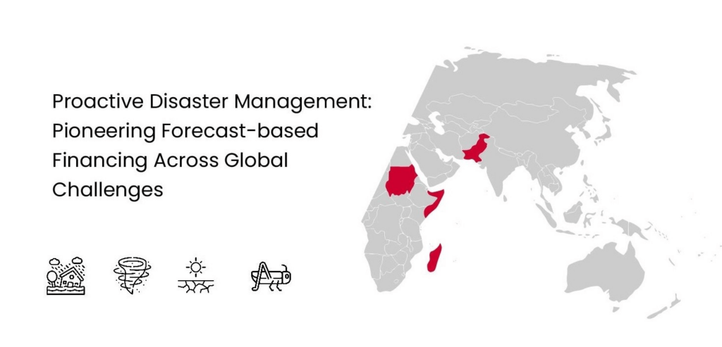
We support Anticipatory Action (AA) by providing technical expertise and tools for data collection, risk assessment, and the development of effective triggers. We also collaborate with local partners to facilitate knowledge transfer and capacity building, helping them to sustain and scale these efforts independently. AA is an approach in humanitarian aid that uses weather forecasts and risk analyses to prepare for disasters before they strike.
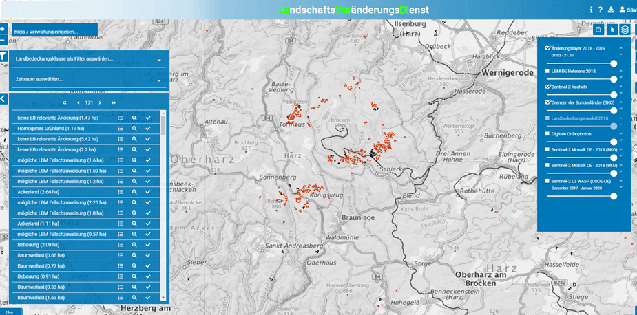
The project aims to provide continuous updates on landscape changes by combining satellite data with OSM data. To achieve this, it focuses on developing machine learning techniques for real-world change detection in OSM. LaVerDi (Landschaftveränderungsdienst) is a service that offers free access to geodata on landscape changes in Germany, available to both institutions and citizens.
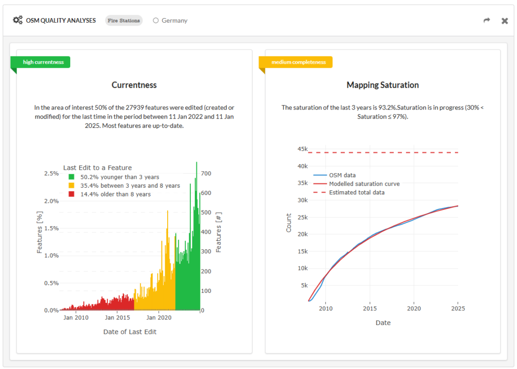
The project focuses on developing advanced methods to assess the quality of OpenStreetMap (OSM) data in a structured and standardized way. Using the ohsome dashboard as a foundation, it provides tools for analyzing data quality globally or within selected regions. The project supports users in making informed decisions by delivering insights into the suitability of OSM data for various purposes.
The OSM Road Monitor project aims to create a real-time system that monitors road network changes using OpenStreetMap (OSM) and remote sensing data. It processes updates, detects errors, assesses routing impact, and notifies users at defined intervals, triggering actions like updating routing graphs or recalculating evacuation routes.