This project aims to develop a decision-support tool that not only identifies areas at risk of natural resource overexploitation and degradation, but also monitors the effectiveness of already implemented solutions and assesses how changes in ecosystem services influence migration patterns.
ECO-ARISE builds on the existing ARICA online geospatial platform, developed in the Polish-led ARICA project. This platform currently provides data on environmental changes around selected refugee and IDP camps, highlighting interactions between migration and the surrounding habitat.
The ECO-ARISE project will expand the platform by incorporating new tools tailored to user needs identified during the system evaluation in the ARICA project. These enhancements will enable the analysis of environmental and infrastructure changes. New functionalities, including advanced analysis and measurement tools, will be integrated to support more effective monitoring and decision-making.
ARICA Platform
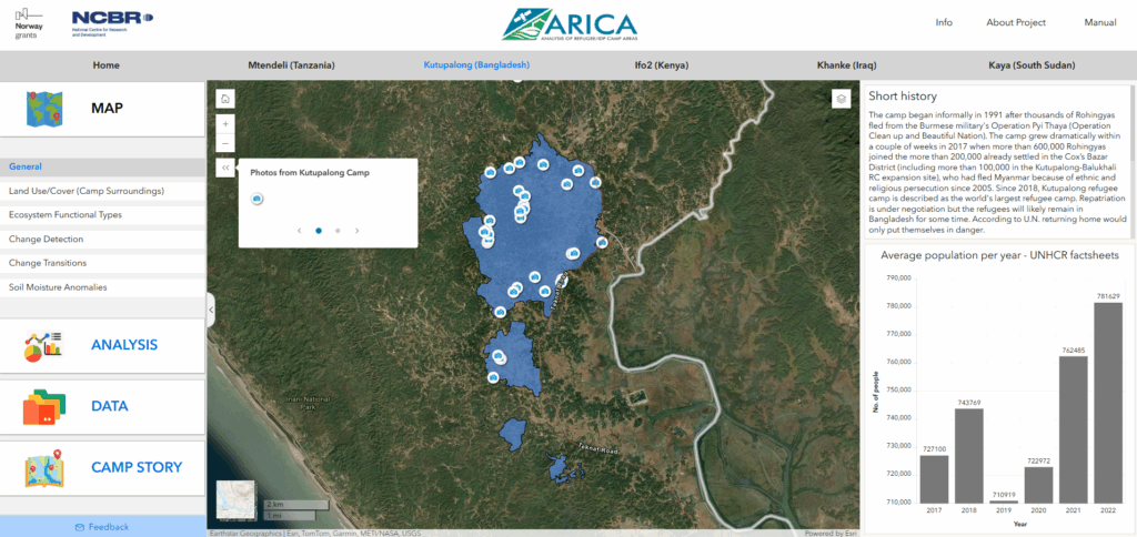
Example 1: General information
The platform provides background information about the camp, its history, estimated population figures, environmental pressures, and key humanitarian challenges.
General map of the Kutupalong Camp
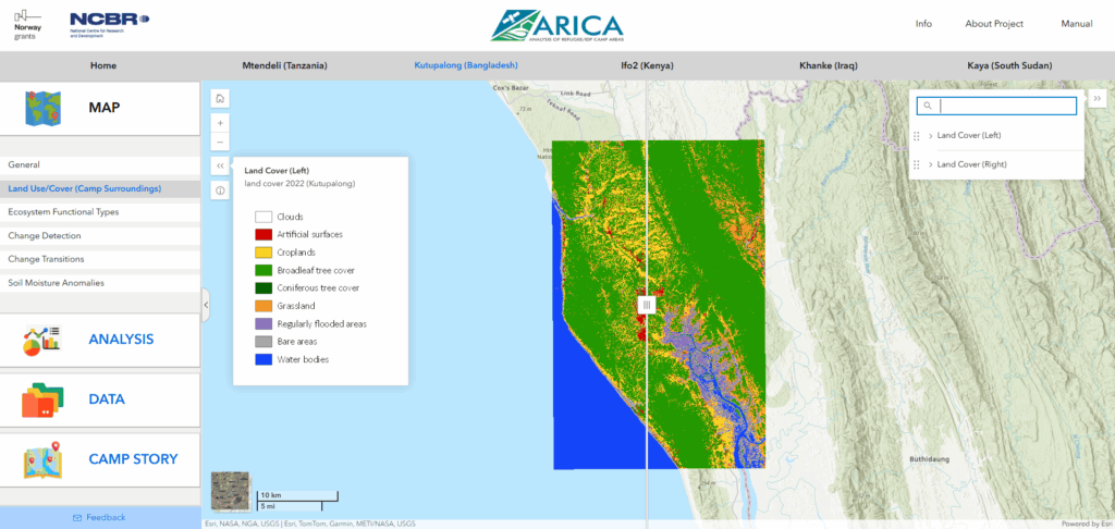
Example 2: Land Use/Cover
The platform presents information on land use and land cover in and around the camp, showing the distribution of forests, vegetation, water, agricultural areas, and built-up zones.
Land Use/Cover map of the Kutupalong Camp
Stages
Data collection
Road quality
Healthcare accessibility
Regional accessibility
Vulnerability analysis
Modelling
Support for on-site data collection
Extension of the Sketch Map Tool with drone images
Evaluation of local data from the Sketch Maps
Mapping the road quality
Data collection and pre-processing
Road surface mapping development
Validation
Integration in existing road network
Monitoring accessibility of healthcare facilities
Incorporating external data into the analysis of the road network
Accessibility analyses for public services
Development of indices
Regional accessibility to Ecosystem Services
Integrate enhanced OSM road data into ORS
Perform various accessibility analysese using ORS
Publish derived accessibility datasets to project website
Vulnerability Analysis
Perform vulnerability analysis based on citizen science data and accessibility
Document methodology for performing vulnerability analysis
Modelling of future scenarios
Use collected data to perfrom future scenario modelling
Visualise and analyse changes through geospatial data analysis
Project Partners
Space Research Centre of the Polish Academy of Sciences
Centre of Migration Research of The University of Warsaw
UNEP/GRID-Warsaw Centre
HeiGIT
German Aerospace Center
Funding
This project is supported by the Federal Ministry for Economic Affairs and Climate Action (BMWE) on the decision by the German Bundestag.
Project period: October 2025 – October 2028
Expected Outcome
By expanding and enhancing the ARICA platform, ECO-ARISE will deliver a decision-support tool that equips stakeholders with the ability to anticipate risks, evaluate the success of interventions, and better understand the links between environmental change and human mobility.