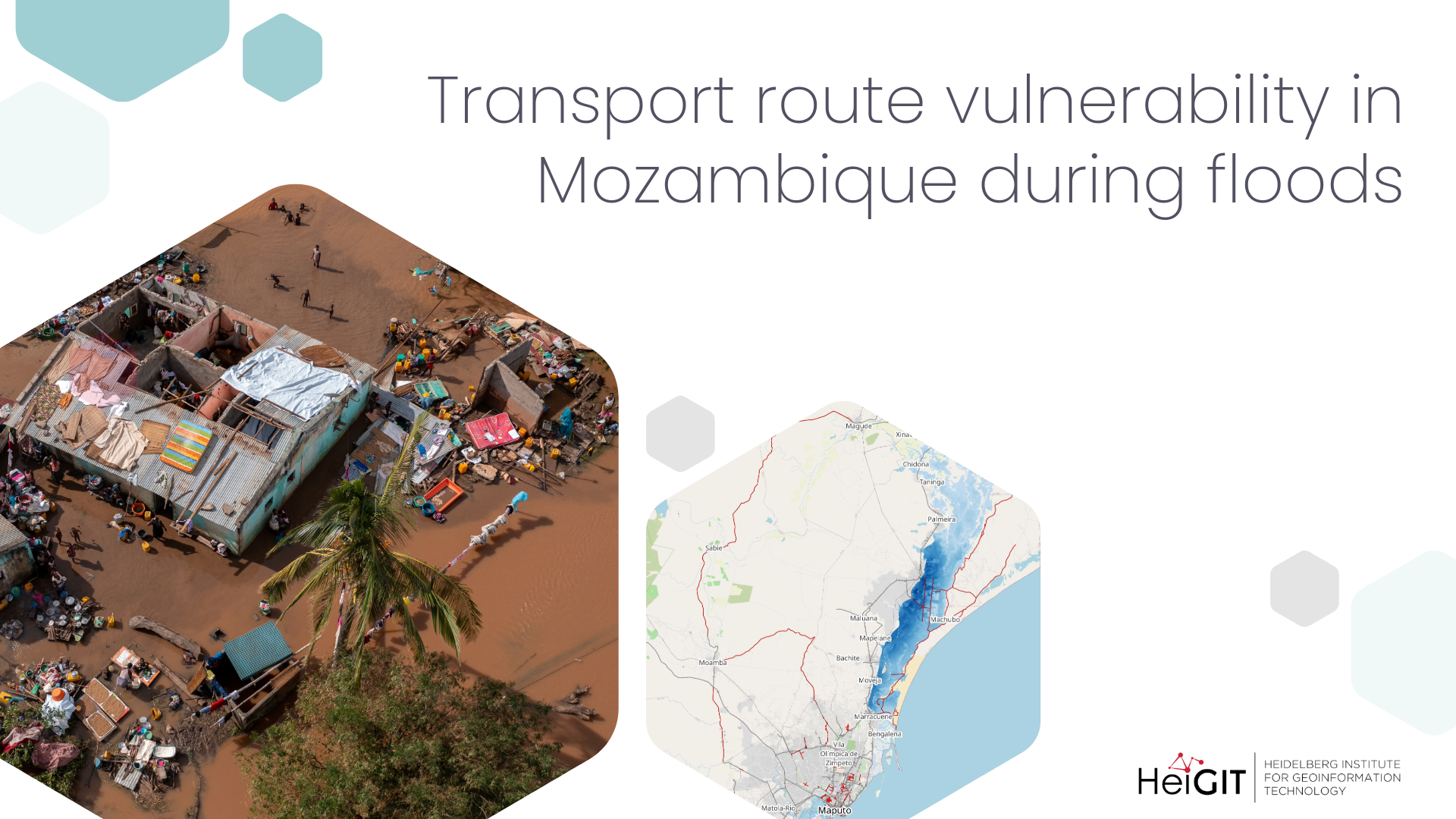
Humanitarian operations rely on local infrastructure to deliver aid and evacuate affected populations. Road conditions often determine whether assistance can reach communities in need. When roads are damaged or flooded, access can quickly become limited.
The analysis highlights how open data can support humanitarian decision-making both before and during crises. By combining infrastructure and hazard data, humanitarian actors can identify which areas are most at risk of losing access and should be prioritized for response.
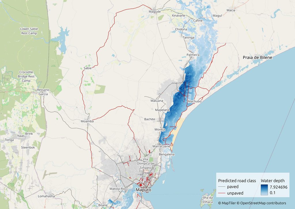
Flood exposure of road infrastructure in the Maputo area
Mozambique is one of the most disaster-prone countries globally. Its low-lying terrain and long coastline increase exposure to floods and storms, while infrastructure remains vulnerable to damage.
Recent flooding in southern Mozambique between December 2025 and January 2026 affected up to 800,000 people and damaged more than 5,000 kilometres of roads, disrupting transport and complicating humanitarian access.
Reflecting priorities in the HumData data grids, where infrastructure and climate impact are key categories, researchers from HeiGIT combined multiple datasets to show how open data can support decision-making. Flood extent data from the Copernicus Emergency Management Service (EMS) for the January 2026 flood event was integrated with two road surface datasets available on HDX: the Mozambique Road Surface Data and the Mozambique Planet Road Surface Data.
| Road class | Length (km) | Length flooded (km) | % flooded |
| paved | 1638.17 | 37.33 | 2.3 |
| unpaved | 544.84 | 76.75 | 14.1 |
The road network was created by merging two datasets that complement each other: major roads detected from satellite imagery and additional routes derived from OpenStreetMap and Mapillary, providing broader coverage of both primary corridors and smaller local roads. The Planet dataset also includes road width and a Humanitarian Passability Index (HPI), which combines both attributes to estimate how accessible a road is under different conditions, helping assess infrastructure quality and vehicle suitability.
The analysis focuses on Maputo Province and Maputo city. Road segments were intersected with flood extent polygons where estimated water depth reached 10 cm or more, a level that can already disrupt traffic, particularly on unpaved roads.
Although most of the mapped road network in the Maputo metropolitan area is paved, flooding affects a much larger share of unpaved roads. About 14 percent of unpaved roads intersect flooded areas, compared with just over 2 percent of paved roads.
While paved roads form the main transport corridors, unpaved roads often provide the last connections between communities and these corridors. Similarly, districts with a high share of unpaved roads in flood-prone zones are more likely to experience local access disruptions.
For humanitarian responders, this means that access constraints are likely to emerge at the local level first, particularly in areas dependent on unpaved roads. Identifying these segments in advance can support route planning, pre-positioning of supplies, and prioritization of assessments.
Healthcare accessibility as a preparedness tool
Accessibility analysis adds another layer to understanding vulnerability. While flood data shows where disruptions may occur, accessibility data highlights where access is already limited before a crisis.
Global accessibility layers from the OpenAccessLens project, also available as country datasets on HDX, estimate travel time to the nearest healthcare facility based on road networks and population distribution. These models reflect baseline conditions, assuming that transport routes remain passable.
Although they do not capture real-time disruptions, they identify areas where access to healthcare is already constrained. In parts of Mozambique, travel times to healthcare facilities are already high, particularly in peri-urban and rural areas where road infrastructure is less resilient. During flooding, these areas are more likely to become effectively isolated if key road segments are disrupted.
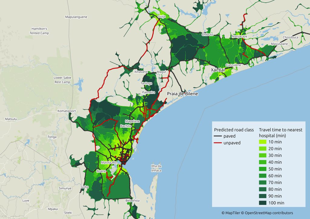
Combining accessibility data with flood and road surface analysis helps identify where disruptions are most likely to have the greatest impact. For humanitarian actors, this supports preparedness planning by highlighting communities where access to healthcare may become critically constrained during disasters.
Combining accessibility, flood, and road surface data helps identify where disruptions are most likely to constrain access, supporting preparedness planning.
Conclusion
The analysis presented here is exploratory and can be adapted to other regions facing similar challenges. Adjusting flood depth thresholds and incorporating historical flood patterns can further refine the results. Combining flood data with road surface information also opens the possibility for trigger-based approaches, helping to identify when key transport routes are likely to become impassable and require operational adjustments.
By combining datasets and focusing on operational questions such as access, exposure, and service reach, analyses like this can help bridge the gap between information and action. We encourage humanitarian actors to engage with these tools and provide feedback to ensure that data products remain relevant, and aligned with field needs.
Please be in touch at humanitarian_gi@heigit.org.
Reference
Identifying infrastructure gaps with road surface dataset
Randhawa, S., Randhawa, G., Langer, C., et al. (2026). The changing surface of the world’s roads. Nature Communications, 17, 9345. The changing surface of the world’s roads
Randhawa, S., Aygün, E., Randhawa, G., Herfort, B., Lautenbach, S., & Zipf, A. (2025). Paved or unpaved? A deep learning derived road surface global dataset from mapillary street-view imagery. ISPRS Journal of Photogrammetry and Remote Sensing, 223, 362–374. https://doi.org/10.1016/j.isprsjprs.2025.02.020
Petricola, S., Reinmuth, M., Lautenbach, S., Hatfield, C., & Zipf, A. (2022). Assessing road criticality and loss of healthcare accessibility during floods: the case of Cyclone Idai, Mozambique 2019. International Journal of Health Geographics, 21(1), 14. https://doi.org/10.1186/s12942-022-00315-2