Anticipatory Action

Leveraging Spatial Data to Act Before the Disaster Happens

Overview

Anticipatory Action (AA) offers a novel approach to humanitarian aid. Unlike traditional response methods that mobilize resources only after a disaster has struck, AA shifts the focus to proactive measures in humanitarian aid, using data analysis to trigger action in advance.

We support Anticipatory Action by providing scientific studies, geospatial data products, and risk assessment tools, as well as offering technical expertise for the development of trigger workflows and facilitating knowledge transfer to local humanitarian organizations.

Disaster Risk Composer

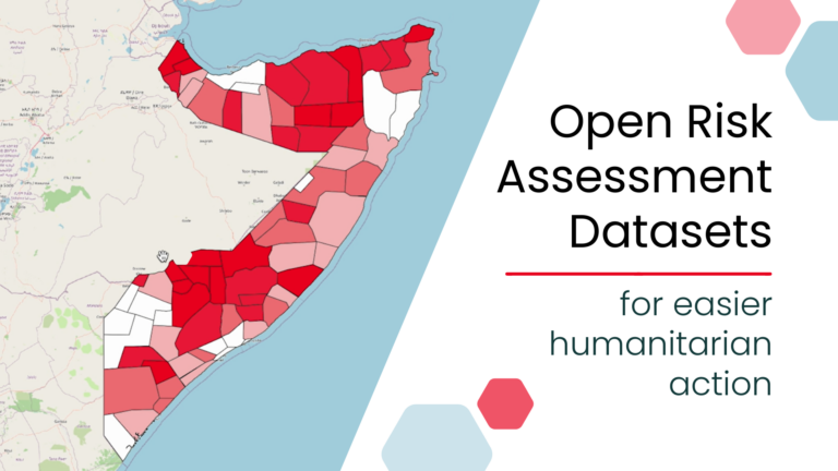
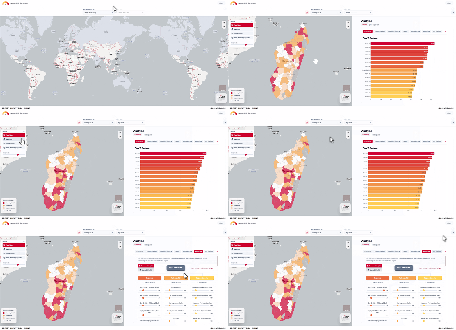
Ready-to-use dashboard: The Disaster Risk Composer enables decision-makers to rapidly identify priority areas for Anticipatory Action interventions, with a dashboard that visualizes the spatial distribution of risk from hazards such as floods, droughts, and cyclones.

Customizable risk data: We use open-source hazard, OpenStreetMap, and population data to assess exposure, vulnerability, and coping capacity, which are combined into an aggregate risk index. Users can work with the automatically provided disaster risk datasets or fully customize the assessment by adding their own data and adjusting the weighting of individual components. This allows them to set their own priorities and ensure that the resulting risk assessment reflects what matters most in their specific context.

Go to the dashboard → Disaster Risk Composer (LINK TBD)

Download the datasets → Humanitarian Data Exchange

Create your risk assessment on QGIS → QGIS Plugin

Supporting Global AA Projects with Technical Expertise

We support AA efforts globally by offering technical expertise grounded in scientific research and facilitating knowledge transfer to local partners, covering all phases of Anticipatory Action projects:


machine learning algorithm

Closing the data gaps

We offer mapping tools to collect local knowledge by involving local communities. We help digitize data and transform raw data into actionable, contextually relevant insights to support decision-making.
Developing AA framworks

Using geospatial methods, we conduct risk analysis, historical impact analysis, and trigger development and monitoring. We help develop Early Action Protocols to enhance disaster preparedness.

Building GIS capacity and data literacy

We offer tailored trainings to equip organizations and communities with essential GIS skills for disaster management, so that they can apply and update AA workflows autonomously. We share training materials, exercises, and methodologies on the IFRC Network GIS Training Platform, an open hub for building GIS skills in the Red Cross and Red Crescent Societies.
Conducting research and knowledge transfer

We do interdisciplinary research on community mapping, climate-related risk, land use, and other disaster-related fields. We bridge the gap between scientific communities and humanitarian practitioners, bringing the latest data and research into our work with organizations on the field.
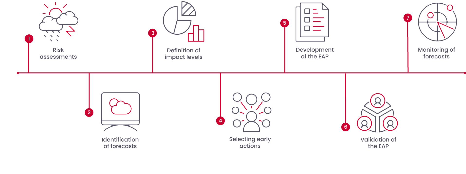

The implementation mechanism: 7 steps from analysis to activation

Risk Assessment Essential Steps

A high-quality risk assessment is an essential component of every AA project, requiring a tailored approach for each context to support rapid and accurate decision-making during activation. HeiGIT’s quantitative method emphasizes the integration of local knowledge and promotes sustainability by utilizing open-source software and open data.

Data Collection
Data Creation
Indicator Selection
Risk Calculation
Handover training

Collecting data is the cornerstone of our project, and it’s a meticulous process. The first step always involves identifying available datasets, whether open source on the internet or provided by the partner organisation. Additionally, we prepare a stakeholder map to facilitate reaching out to institutions that might have additional data in a structured way. All the data is then transferred to a database, and we meticulously assess its quality in terms of resolution, currentness, and more. At this point, we can precisely identify data gaps. These are addressed in the next step.

To bridge any data gaps discovered during the data collection phase, we can depend on the collective expertise and technical capabilities of HeiGIT. The datasets we generate range from accessibility analysis to advanced techniques such as document scraping and cutting-edge machine learning methods, as well as frequently employing satellite imagery.

During this stage, we rely heavily on local knowledge. We typically host workshops where we bring together a diverse group of people, including subject matter experts and community representatives. The objective is to identify the indicators and datasets that reflect the vulnerability, coping capacity, and exposure of at-risk communities. Workshop participants assign weights to the selected indicators based on their relevance, as some information is more crucial than others in a certain risk scenario.


Depending on the number of available indicators, we utilize different methods. A straightforward ranking exercise suffices when dealing with just a few indicators. However, if we have hundreds of indicators, we employ more advanced techniques, such as the analytical hierarchy process.

When everything is in place, we calculate this risk score alongside the vulnerabilities, coping capacity and Exposure score. During this step we also take care about missing values. The results are presented in map format.

One of our principal emphases is sustainability. We hand over the whole risk assessment package in the framework of a multiday GIS and risk assessment training. This ensures that the partner organisation can update and modify the initial risk assessment in the future.

Ongoing Projects

New projects are underway.

AA Somalia

April 2024 – December 2025

In Somalia, we conducted the first AA project on locusts within the Red Cross Red Crescent (RCRC) network. We assisted the Somali Red Crescent Society (SRCS) in warning vulnerable communities about locust swarms and safeguarding their livelihoods. We analyzed data to identify indicators of exposure, vulnerability, and coping capacity related to locust infestations. We investigated correlations between Land Use Land Cover (LULC), Vegetation Index, and various weather conditions with desert locust observations. Additionally, we implemented new tools for historical impact assessment (HIA), such as theDEEP, conducting “Tagatons” to tag reports from ReliefWeb and FAO Desert Locust Bulletins published monthly.

Locust

Image: Muhammet Mirik

January 2024 – December 2024

AA Madagascar

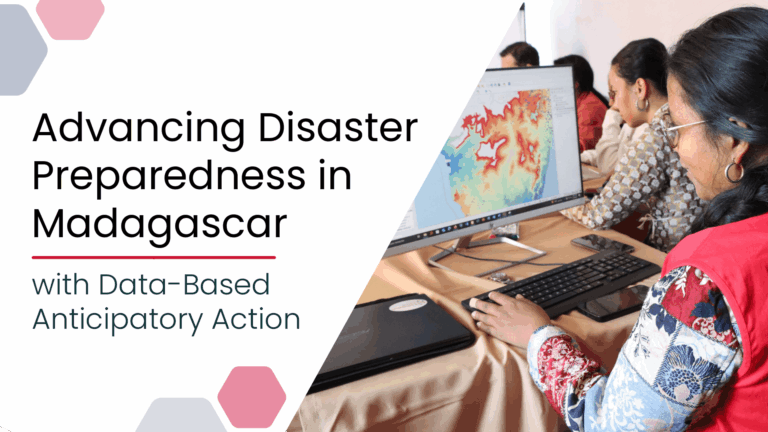
In Madagascar, we supported the development of a full EAP for tropical cyclones and the creation of the spatial risk assessment with the Malagasy Red Cross. We helped organise the local team organize a training session to equip more staff members with QGIS skills, knowledge on working with geodata, understanding and updating the risk assessment, and using mobile data collection techniques.


tropical cyclone

Image: Johannes Plenio

Completed Projects

01.03.2023 – 31.12.2023

Our AA journey began in 2022 with a collaborative effort alongside the Somali Red Crescent Society (SRCS), the German Red Cross (GRC), and the Red Cross Red Crescent Climate Center (RCRCCC), aimed at addressing the recurring droughts in Somalia. 

This additional stress exacerbates the existing fragility in the region, leading to food insecurity, livelihood losses, and widespread internal displacement. To confront these challenges, our team conducted spatial risk and historical impact assessments, devised monitoring and trigger mechanisms, incorporating feedback and local expertise at every stage. This collaborative effort culminated in the development of an Early Action Protocol (EAP) for drought in 2023, underscoring the importance of tive measures in combating humanitarian crises.

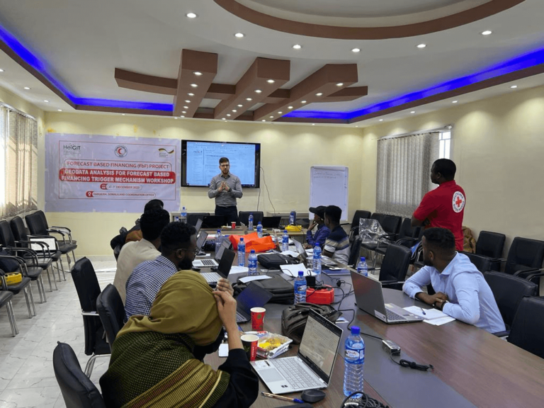
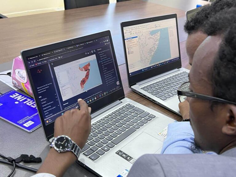
Somaliland GIS Training in December 2023

Somaliland GIS Training in December 2023

01.02.2023- 31.12.2023

In Sudan, we supported the efforts to identify the communities most vulnerable and exposed to riverine floods. We used historical flood data and rural area accessibility data, provided by the German Aerospace Center, our strategic partner.  The satellite imagery of past floods was essential for understanding their impact, while the accessibility analysis helped estimate the challenges of reaching affected people during flood events. We then transferred this knowledge to the GRC and the local team. However, due to the current conflict in Sudan, project activities could not be carried out as planned.

01.09.2023 – 31.12.2024

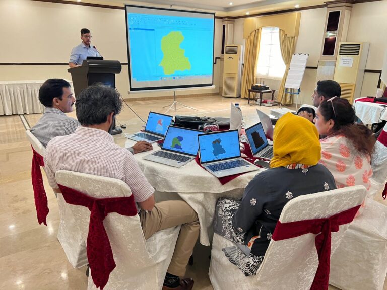
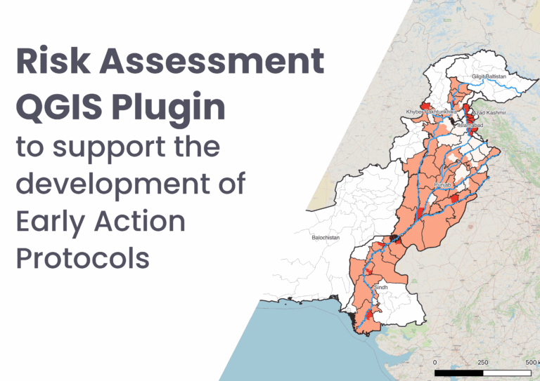
In Pakistan, we are developing an Early Action Protocol (EAP) for riverine floods in the Indus River Basin. Launched in 2023, the project focuses on data collection to create a framework for early action in flood-prone areas. We are developing innovative methodologies, like asymmetric mapping for better indicator redistribution, and conducting a spatial risk assessment at the tehsil level for the entire basin. Additionally, we are holding a GIS training and risk assessment workshop for the  Pakistan Red Cross Society (PRCS), ensuring local knowledge is included and ownership of services is transferred to local actors sustainably.

Risk Assessment Workshop and QGIS Training Islamabad, Pakistan

Risk Assessment Workshop and QGIS Training Islamabad, Pakistan

01.04.2024- 31.12.2025

In Somalia, we conducted the first AA project on locusts within the Red Cross Red Crescent (RCRC) network. We assisted the Somali Red Crescent Society (SRCS) in warning vulnerable communities about locust swarms and safeguarding their livelihoods. We analyzed data to identify indicators of exposure, vulnerability, and coping capacity related to locust infestations. We investigated correlations between Land Use Land Cover (LULC), Vegetation Index, and various weather conditions with desert locust observations. Additionally, we implemented new tools for historical impact assessment (HIA), such as theDEEP, conducting “Tagatons” to tag reports from ReliefWeb and FAO Desert Locust Bulletins published monthly.

Locust

Image: Muhammet Mirik

01.01.2024- 31.12.2024

In Madagascar, we supported the development of a full EAP for tropical cyclones and the creation of the spatial risk assessment with the Malagasy Red Cross. We helped organise the local team organize a training session to equip more staff members with QGIS skills, knowledge on working with geodata, understanding and updating the risk assessment, and using mobile data collection techniques.


tropical cyclone

Image: Johannes Plenio

Partner

The partnership between the German Red Cross (GRC) and HeiGIT enables us to develop geoinformatic data products, methods and technology for the implementation of humanitarian activities of the Red Cross and Red Crescent Movement. At the same time, the knowledge gained from this partnership is incorporated into the work of HeiGIT.

Press Reports

See all posts

Community Conversation: from concept to action

This community conversation explored the challenges faced during the process of writing the Somali Red Crescent Society’s Early Action Protocol (EAP) for Drought. The speakers shared some of the hurdles that had to be overcome, the information required to address all the relevant questions, and the technical solutions implemented to facilitate the monitoring of forecasts and triggering actions.

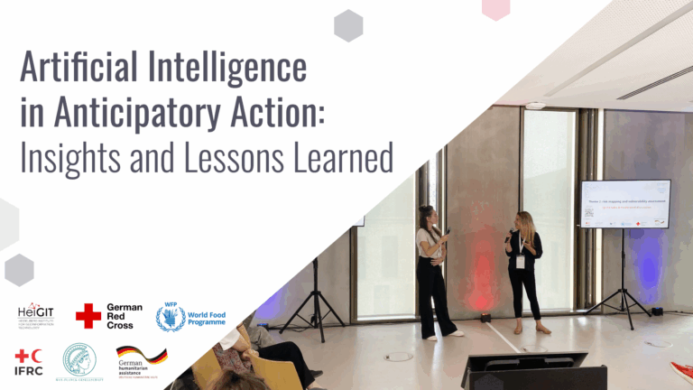
Demystifying artificial intelligence for anticipatory action

When workshop participants were asked what comes to mind when they hear ‘AI’, one response stood out: POTENTIAL.

Using geoinformation for anticipatory action frameworks

Anticipatory action involves taking proactive steps before a hazard occurs, which helps to mitigate its effects and optimize the use of resources.

Unleashing the Power of GIS, Together: The IFRC Network GIS Training Platform

The Red Cross Red Crescent Movement has long channelled innovation to enhance humanitarian efforts.

Contact