On 8th November 2020, the Anticipation Hub has been officially launched and we are happy to announce that the Heidelberg Institute for Geoinformation Technology (HeiGIT gGmbH) acts as as a…
What is the idea behind the Notebook? In the case of an emergency (e.g. floods, earthquakes, political crisis) it is important to know where the health facilities are located. Furthermore,…
As a user‐generated map of the whole world, OpenStreetMap (OSM) provides valuable information about the natural and built environment. However, the spatial heterogeneity of the data due to cultural differences…
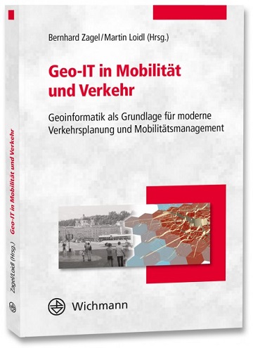
Ein neues Buch gibt in einem Buchkapitel einen Überblick der vielfältigen Aktivitäten von HeiGIT und GIScience im Bereich Routenplanung und Navigation. Neben Grundlagen (wie schnelle Routing-Algorithmen) zur Umsetzung werden vor…
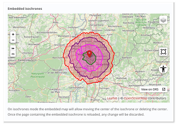
The new openrouteservice map client development is in the final phase and has now a new feature that allows to show routes, isochrones and other features from openrouteservice (ORS) integrated…
This Thursday, team members from HeiGIT will give a presentation at MSF’s Annual GIS Week. This is an internal event at MSF ( Médecins Sans Frontières (MSF) International, Doctors without…
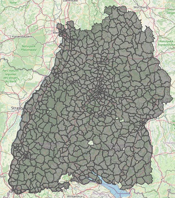
With the release of openrouteservice v6.3.0 at HeiGIT, we are presenting a new and improved speed-up technique that makes it possible to calculate much larger isochrones than with the existing…
Das Karlsruher Softwareunternehmen Disy Informationssysteme GmbH stellt die neue Version der Data-Analytics-, Reporting- und GIS-Plattform “Cadenza” vor. Die Erweiterung der Analytics-Funktionalitäten mit der Bereitstellung einer integrierten Routingfunktion und der POI-Suche…
After the latest update of openrouteservice to v6.2.1, we are pleased to announce that it is now possible to calculate long distance routes using all bike and pedestrian profiles whilst…
Recently openrouteservice has been updated to version 6.2 which has brought some pretty useful features to routing. One of the main “new” features is the re-introducing of the maximum_speed parameter…
#OpenStreetMap is turning 16! Happy Birthday from the HeiGIT team. After 16 years OSM is a reference of collaborative work and how we can give our best to create and…
Since some time the City of Karlsruhe uses the API of Openrouteservice (ORS) by HeiGIT for routing of pedestrians, bicycles and cars in the new online city plan and the…
GIScience methods are becoming more and more widespread in different domains. A current review article under involvement of HeiGIT researchers discusses the potential of ambulatory assessments and GIScience approaches for…
#Noise #pollution is one of the main stressors in urban environments, having negative impacts on people’s quality of life and health. For some groups of citizens, such as school children,…
Wo befindet sich dieser Spielplatz in Heidelberg? Wie komme ich zum nächst gelegenden Park und das möglichst auf einer Route mit viel Grün oder wenig Lärm? Wer das herausfinden möchte,…
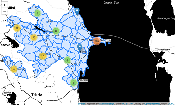
Using hospital locations and the ORS Isochrone service, we have created a method for comparing physical access to healthcare in Sub-Saharan Africa. Hospital locations were derived from OpenStreetMap and compared…
Today the time has come: The “meinGrün” web app for Dresden and Heidelberg is officially launched. With the mobile application you can (re-)discover known and unknown green spaces and find…
Sveriges Television AB (the public Swedish television company) has published a data journalism WebApp showing how far one can travel according to the recommendations from the Swedish Public Health Authority….
Am 19. Juni ist es soweit: Die „meinGrün“-WebApp für Dresden und Heidelberg geht offiziell an den Start. Mit der mobilen Anwendung lassen sich bekannte und unbekannte Grünflächen und der Weg…