Happy Birthday Missing Maps! On the occasion of the recently launched Missing Maps 5 Years Birthday Blog, that also highlighted our latest Missing Maps related HeiGIT and ohsome projects, we put together an overview of our years with and within the Missing Maps.
November 2014 the Missing Maps project was launched by the British and American Red Cross, MSF UK and the Humanitarian OpenStreetMap Team with the humble objective to put the world`s vulnerable people on the map. Since then, 14 organizations joined the founding members to support in achieving this goal- and more than 95, 000 mappers.
Already in 2015, GIScience Research Group and disastermappers heidelberg were invited to join the Missing Maps members. While the former were previously providing mapathon support and raising awareness of Missing Maps in academia in general and the own university networks, Heidelberg then already became the gathering place of Missing Maps members in May 2015- and was now the official location for our Missing Maps Gathering 2019.
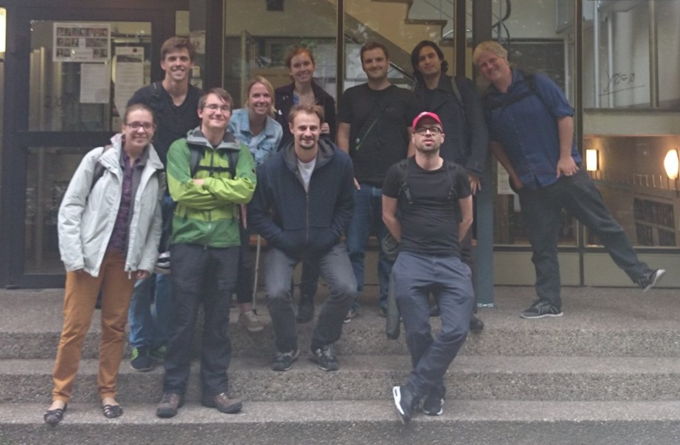
Missing Maps Meeting 2015
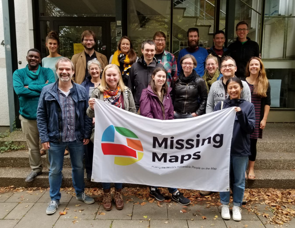
Missing Maps Meeting 2019
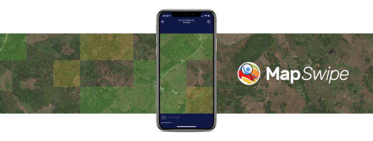
The 2015 meeting already lead to a first collaborative project- MapSwipe– building on related research and expertise of the GIScience group and showing the great potential of humanitarians and researchers working together.
Since then, several joint publications (see below), presentations, projects and partnerships followed. Presentations were, among others, given to audiences of medical sectors at MSF Scientific Days, of international humanitarian organizations at Global Platform for Disaster Risk Reduction and International Dialogue Platforms on Anticipatory Action and the GIScience and research community at the Geospatial World Forum and ISCRAM. Previous projects to date include MapSwipe and MapSwipe Analytics, Micro-mapping in the scope of MS Wissenschaft, as well as developments around the openrouteservice for disaster management and the use of machine and deep learning to support humanitarian mapping.
Regarding Missing Maps related partnerships, apart from our close link to other Missing Maps members, the formalized partnership with German Red Cross can further be highlighted. Starting with mapathons and meetings at GRC and beyond in 2017, the groups signed a Memorandum of Understanding in 2018, and now have a joint HeiGIT/GRC position to further strengthen the collaboration. GRC is furthermore currently in the process of joining Missing Maps as a formal member.
But what about our current and future Missing Maps involvement? Apart from already listed and still ongoing projects, the HeiGIT team supports Missing Maps in monitoring and visualizing its achievements and impact using the HOT Tasking Manager API and their own ohsome framework. This work is also highlighted in the recently launched Missing Maps birthday blog and will be further extended with the Missing Maps members. Among other project ideas for sure…
We are looking forward to learning what we will collaboratively achieve in the next 5+ years. So make sure to stay tuned!
Happy Birthday Missing Maps!
Herfort, B., Li, H., Fendrich, S., Lautenbach, S., Zipf, A. (2019): Mapping Human Settlements with Higher Accuracy and Less Volunteer Efforts by Combining Crowdsourcing and Deep Learning. Remote Sensing 11(15), 1799. https://doi.org/10.3390/rs11151799
Li, H., Herfort, B., Zipf, A. (2019): Estimating OpenStreetMap Missing Built-up Areas using Pre-trained Deep Neural Networks. Proceedings of the 22nd AGILE Conference on Geographic Information Science, Limassol, Cyprus.
Scholz, S., Knight, P., Eckle, M., Marx, S., Zipf, A. (2018): Volunteered Geographic Information for Disaster Risk Reduction: The Missing Maps Approach and Its Potential within the Red Cross and Red Crescent Movement. Remote Sens., 10(8), 1239, doi: 10.3390/rs10081239.
de Albuquerque, J. P., Eckle, M., Herfort, B., Zipf, A. (2016): Crowdsourcing geographic information for disaster management and improving urban resilience: an overview of recent developments and lessons learned. In: Capineri, C, Haklay, M, Huang, H, Antoniou, V, Kettunen, J, Ostermann, F and Purves, R. (eds.) European Handbook of Crowdsourced Geographic Information, Pp. 309–321. London: Ubiquity Press. DOI: http://dx.doi.org/10.5334/bax.w. License: CC-BY 4.0.
Herfort, B., Eckle, M., de Albuquerque, J. P. (2016): Being specific about geographic information crowdsourcing: a typology and analysis of the Missing Maps project in South Kivu. 13th International Conference on Information Systems for Crisis Response and Management. ISCRAM 2016. Rio de Janeiro, Brazil.
Porto de Albuquerque, J., Herfort, B.,Eckle, M. (2016): The Tasks of the Crowd: A Typology of Tasks in Geographic Information Crowdsourcing and a Case Study in Humanitarian Mapping. Remote Sensing. 2016, 8(10), 859; doi:10.3390/rs8100859.