Volunteered Geographic Information (VGI) is a valuable resource for an effective disaster management. This article presents five free tools to enhance humanitarian work using VGI.
What is VGI and why it matters for disaster management
Volunteered Geographic Information (VGI) refers to user-generated geographic content contributed voluntarily by the public. It represents a form of crowdsourcing in which individuals share georeferenced data about the Earth’s surface. One prime example of VGI is OpenStreetMap, often referred to as the „Wikipedia for maps”, which plays a crucial role in making geographic information accessible globally. In disaster management, such community-driven data can enhance the effectiveness of humanitarian response and preparedness, especially in data-scarce regions.
Five open-source tools to integrate VGI into disaster management
HeiGIT researches and develops solutions that facilitate the use of community-based geographic data for disaster and risk management, together with many project partners and organizations. The results are fully open source and very often rely on OpenStreetMap data.
We have selected 5 key services and resources that enable more efficient collection, analysis, and use of VGI, thereby supporting data-based risk management and informed decision-making in crisis contexts:
- openrouteservice: routing and accessibility analysis for disaster management
The openrouteservice (ORS) is an extensive routing service based on OpenStreetMap data which can be used to plan routes and transport logistics with high customization. ORS supports routing for various transport modes, including walking, cycling, driving, and wheelchair routes. It provides also features such as isochrone-based accessibility analysis, time-distance matrices, elevation profiles, and multi-stop route optimization. The openrouteservice can also be use to calculate routes in regions affected by disasters such as earthquakes or floods. It allows to account for disrupted infrastructure like blocked roads, bridges destroyed by earthquakes, or borders blocked due to conflict. These features can automatically avoided when generating routes or isochrones. Read more about the openrouteservice.
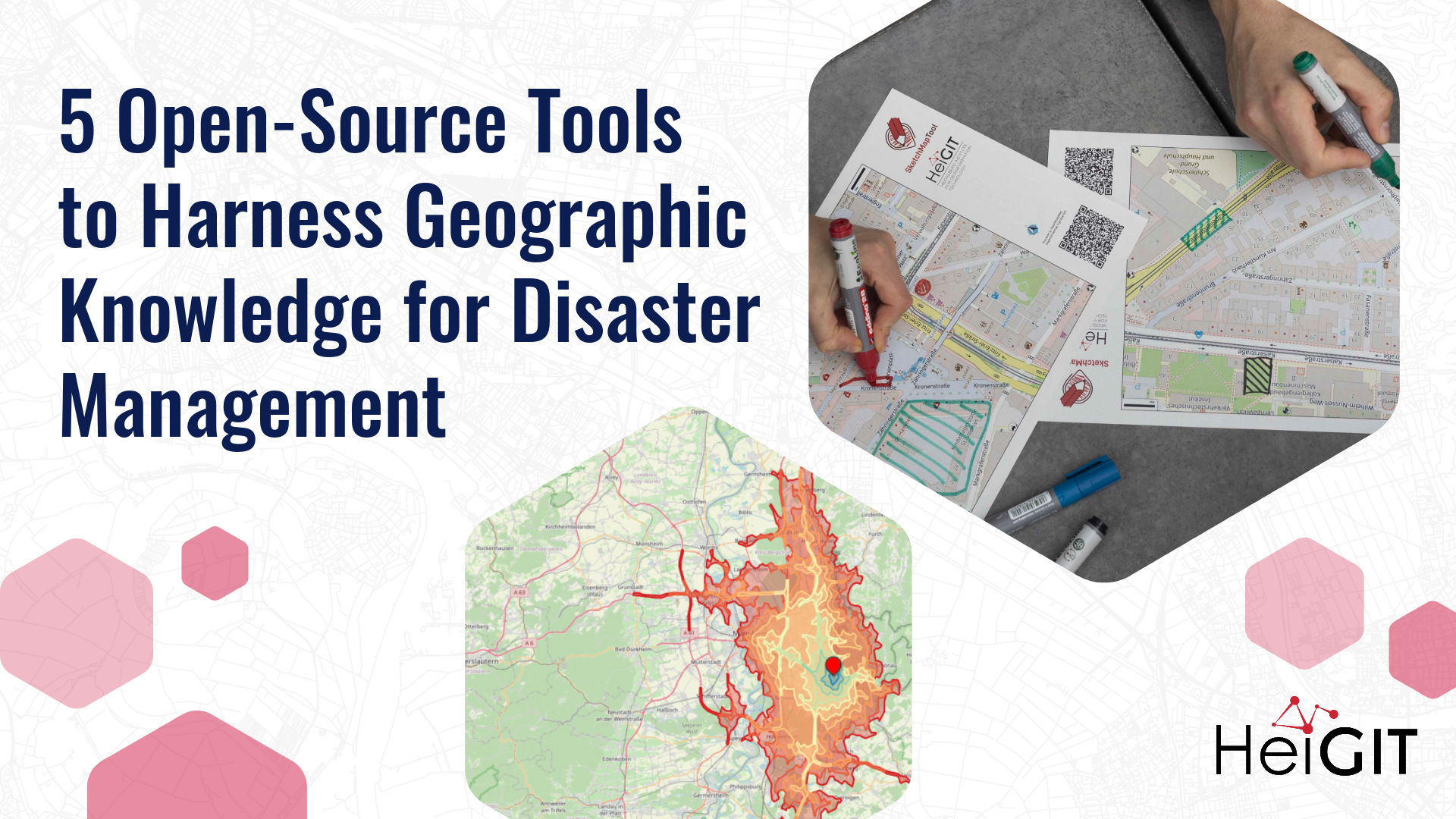
2. Sketch Map Tool: harnessing the knowledge of local communities
The Sketch Map Tool is an easy-to-use tool for participatory mapping through offline collection, digitisation and georeferencing of local data. This low-tech solution simplifies the gathering and analysis of spatial knowledge and perceptions using pens and paper maps that integrate OpenStreetMap and satellite data. The Sketch Map Tool can be particularly useful in all situations where harnessing knowledge from the local community is essential, e. g. for identifying areas susceptible to flooding or drought and pinpointing critical infrastructure and civil facilities within vulnerable zones. Read more about the Sketch Map Tool.
3. MapSwipe: crowdsourcing to improve map data across the world
MapSwipe is an open-source app that enables volunteers to map missing geodata anywhere in the world from their phones or computers, harnessing the “power of the crowd” to make global mapping efforts more coordinated and efficient. Using a simple mobile app or web app, volunteers can contribute to delivering the missing data by swiping through a series of images and tapping on the requested features, e. g. identifying buildings. This can provide free, reliable geodata where it is most needed, enhancing humanitarian efforts and disaster management. Read more about MapSwipe.
4. IFRC Network GIS Training Platform: training materials to teach Geoinformation System (GIS) skills tailored to the humanitarian sector
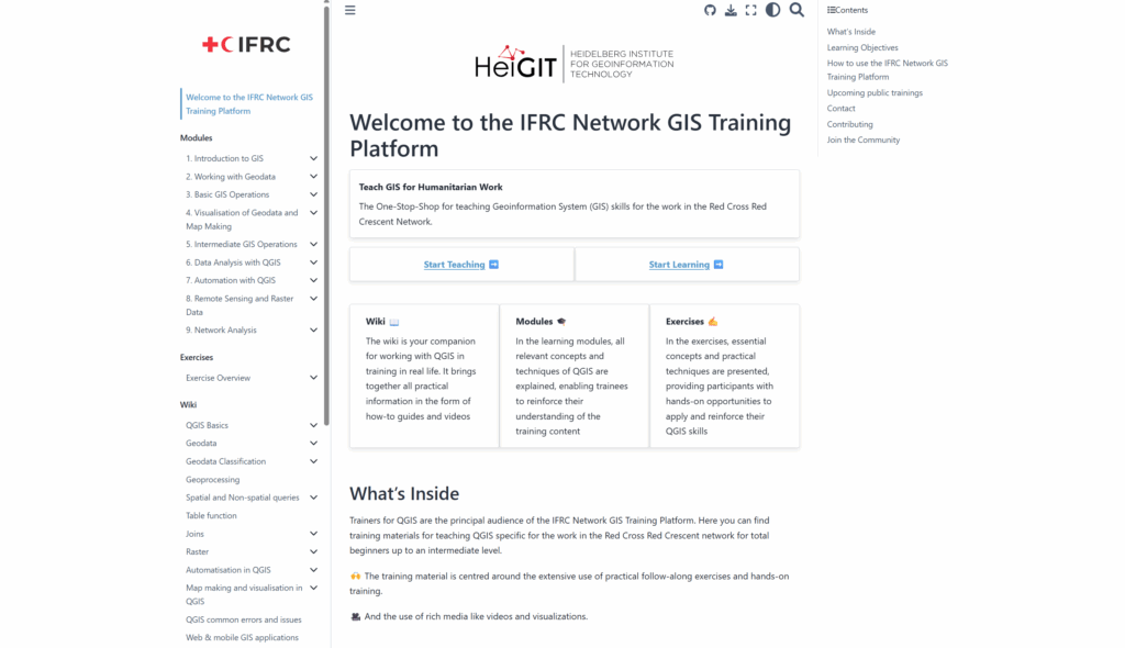
The IFRC Network GIS Training Platform is a one-stop-shop for teaching Geoinformation System (GIS) skills, with training materials that are tailored to the needs and context of the Red Cross and Red Crescent Societies. The training material is highly practical, focusing on humanitarian GIS use cases like disaster impact mapping, with video content and other visualizations to facilitate the follow-along lessons and exercises. Designed for users from beginner to intermediate levels, the training plans provide guidance while enabling individual modules to be used independently. Read more about the GIS Training Platform.
- Road Surface Dataset: worldwide data on whether roads are paved or unpaved
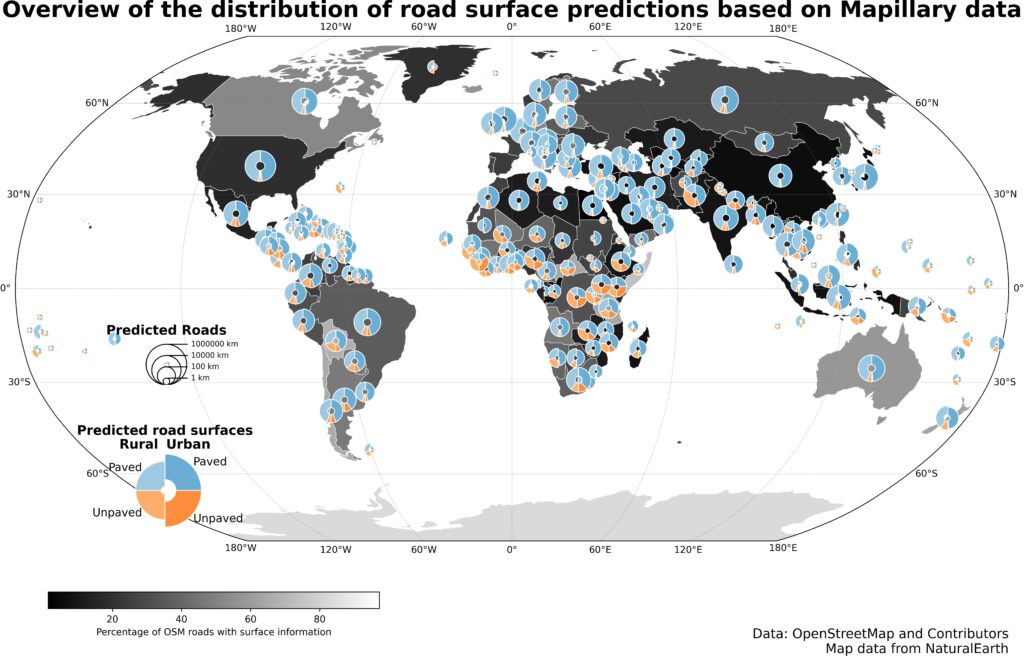
The Road Surface Dataset provides global information about whether roads are paved or unpaved, covering 36.7 million kilometers of roads worldwide. Knowing the road surface type can impact decision-making for route planning and emergency responses. For instance, unpaved roads, especially when poorly maintained or affected by weather, increase the risk of accidents. This dataset, accessible via the Humanitarian Data Exchange, provides detailed information on road surfaces, distinguishing between paved and unpaved surfaces. It is derived from OpenStreetMap data and enhanced with predictions from a hybrid deep learning approach. Read more about the Road Surface Dataset and find out how to identify infrastructure gaps by combining road surface data with population information with this tutorial.
What´s next
The availability of free, VGI-based resources empowers humanitarian professionals and disaster management institutions to integrate community-generated data into their workflows, contributing to more effective, data-driven interventions. As we continue to advance research and develop practical tools to leverage VGI in disaster management, we thank all the invaluable partners, organizations and volunteers that makes this work possible.
Questions? Write us at communications@heigit.org. To keep up with future developments and releases related to VGI for disaster management as well as other efforts to advance geospatial technology in the humanitarian aid field, follow our social media channels and stay up to date on our bl


