Two weeks ago, as part of a seminar on GIS for Disaster Risk Reduction led by HeiGIT employees, students from Heidelberg University tested several HeiGIT services in a field test. The focus was on the following applications: openrouteservice, the disaster portal and the Sketch Map Tool.
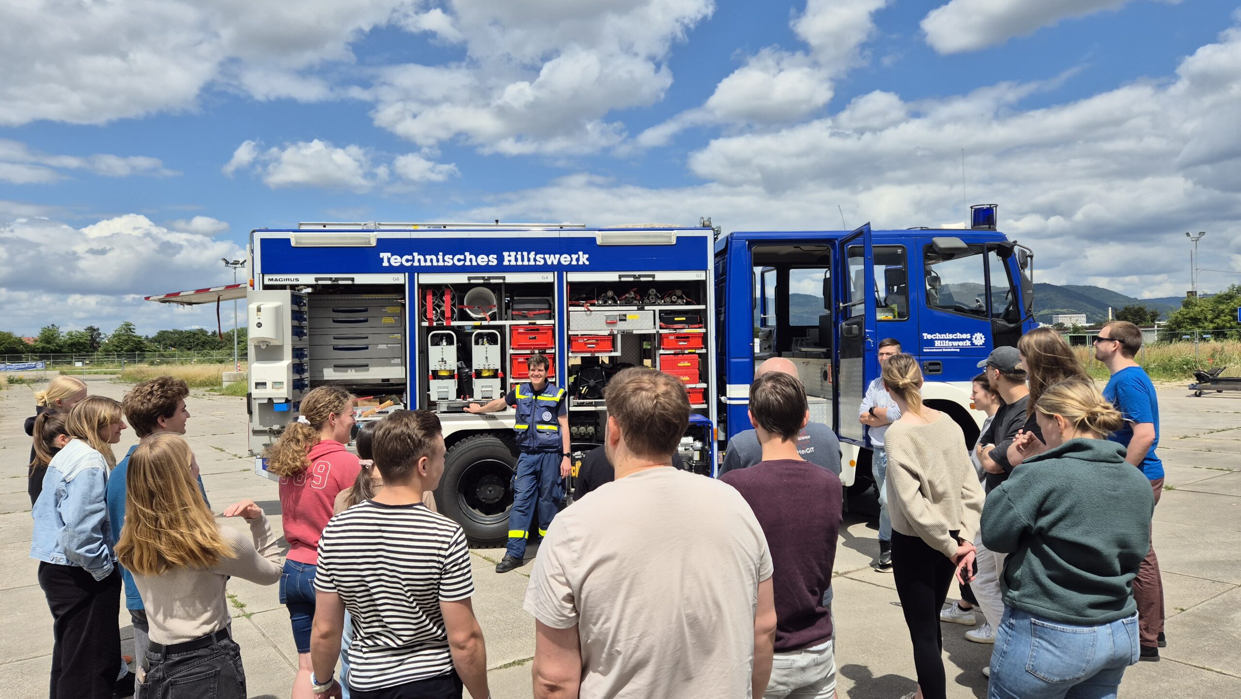
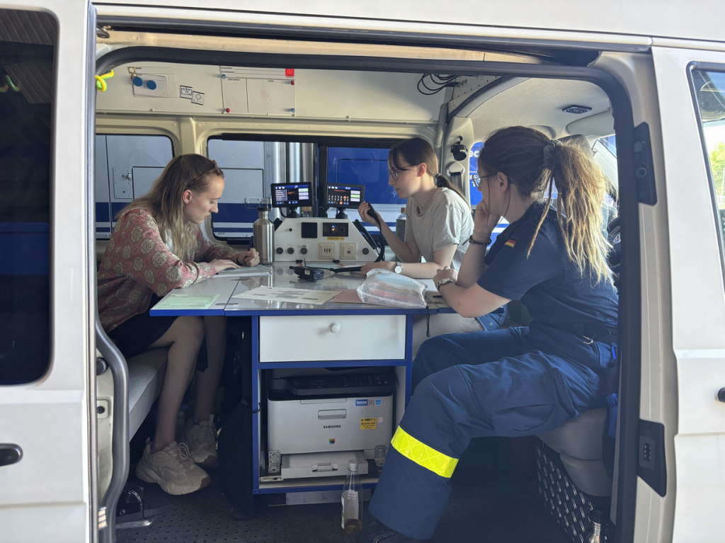
In cooperation with the THW local branch in Heidelberg, an operation in a heavy rain scenario was simulated. The students were divided into small groups and took on the typical tasks of the THW in such a situation, such as investigating building damage, presenting the situation and directing units in the area of operation. The aim was to test the usability and effectiveness of various GIS applications under realistic conditions and to compare them with other tools. In addition to the classic hand sketch, digital mapping using Kobo Toolbox, QField and the Sketch Map Tool was tested and compared for the reconnaissance. Routes were planned using Google Maps and the openrouteservice to guide the units in the deployment area, avoiding flooded roads.
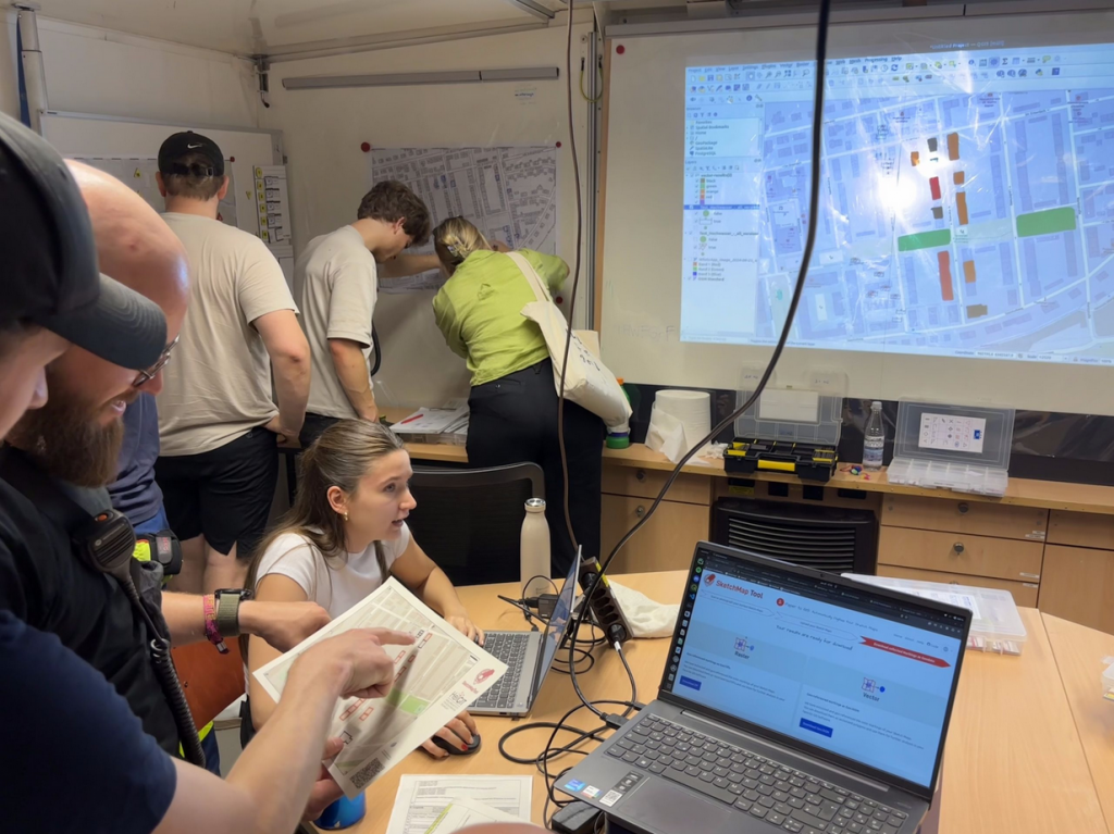
During the field test, the students were able to gain practical experience and use the tools in various situations. After completing the operational simulation, the results were recapitulated and the individual applications evaluated. The feedback from the students is of great importance for the further development and optimization of the GIS tools and for the THW.
The evaluation of the field test revealed both advantages and challenges of the GIS applications. In particular, the disaster portal was highlighted as a good alternative to Google Maps for avoiding the simulated obstacles on the access routes. The ease of use when creating the obstacles was rated as positive. However, there were also points of criticism and potential for improvement was identified. In the case of the mobile mapping applications, inaccurate positioning and the need for a stable internet connection were some of the limiting factors for their operational use. The students also identified opportunities to simplify the usability of the disaster portal and improve the recognition of mapped areas in the Sketch Map tools.
The learnings from this operational simulation are essential for further improving our services and adapting them specifically to the needs of civil protection. At the same time, students gained insights into civil protection and disaster control as well as experience in the practical application of GIS. We would like to thank everyone involved for their dedicated participation and look forward to further hands-on tests and courses.