This study develops a framework integrating satellite observations with spatial proxy data to produce high-resolution urban carbon emission maps. The method is applied to Urumqi, China, demonstrating accurate and timely estimations compared with traditional inventories.
Reducing carbon emissions is a global priority, but conventional inventory methods based on administrative statistics fail to capture fine-scale spatial variability. Spatial modeling of emissions, particularly using satellite-based observations, provides a way to uncover urban emission patterns for more effective global warming mitigation.
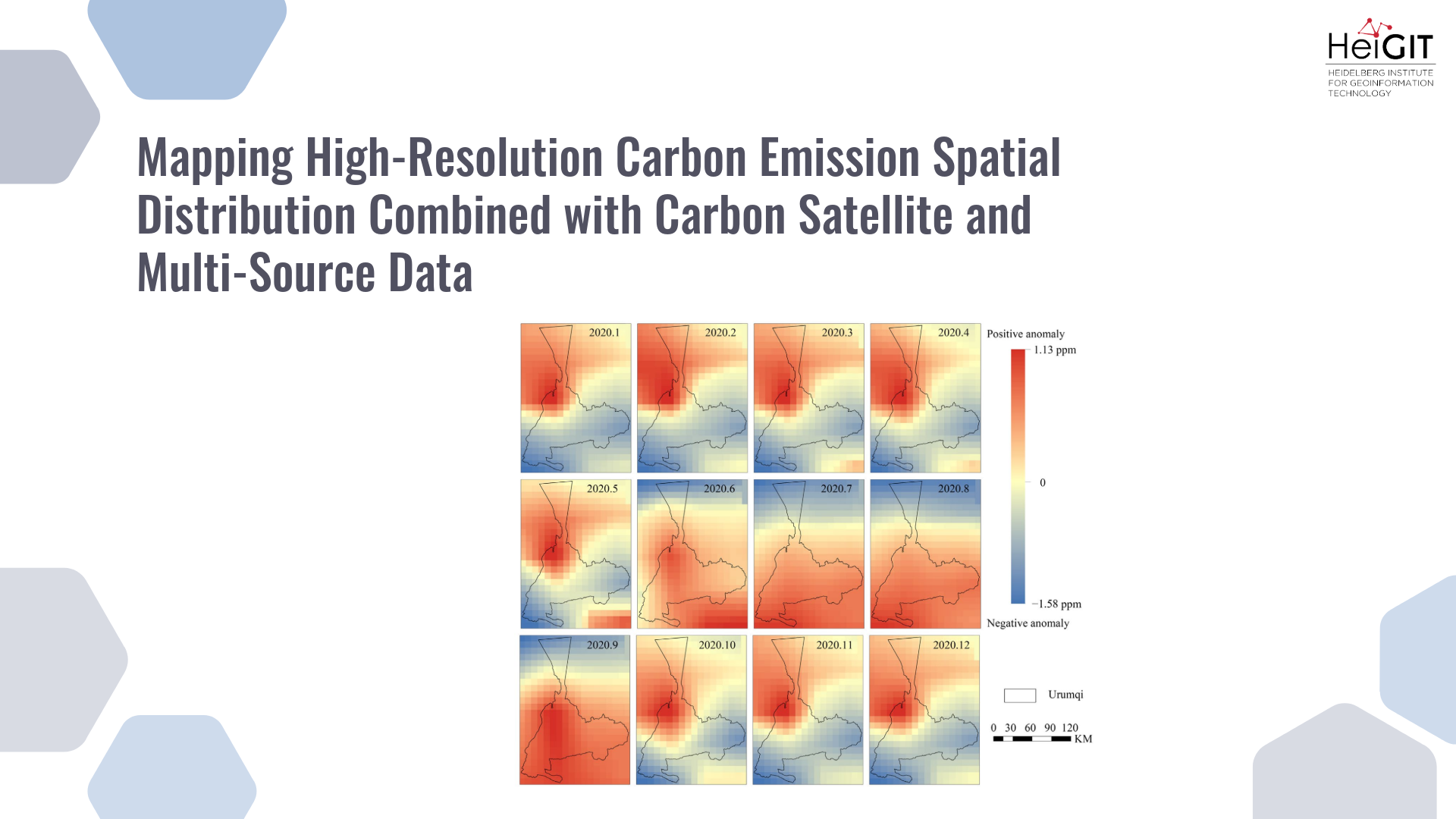
In this study, OCO-2 satellite XCO₂ observations were combined with multiple spatial proxy datasets, including points of interest (POI), population density, and road distribution. After preprocessing, a local adaptive model was constructed to generate a carbon emission map at a 10 km spatial resolution. This output was then downscaled using a spatial redistribution model to achieve a resolution of 1 km and a monthly temporal scale. The approach provides both fine-grained spatial detail and timely emission estimates. Validation was conducted using EDGAR and ODIAC datasets: the estimated total emissions for Urumqi in 2020 differed from EDGAR by only 20 tons, with monthly relative errors generally within ±10%. The analysis also showed seasonal deviations, with positive biases in spring and summer and negative ones in autumn and winter. While the redistributed emissions showed limited spatial agreement with ODIAC (Pearson r = 0.192), comparison with urban land use maps confirmed that the derived emission patterns were reasonable.
Title image: The distribution of Δ𝑋CO2 from January to December 2020.
Reference: Cui, L., Yang, H., Martin, M., Qiao, Y., Ulrich, V., & Zipf, A. (2025). Mapping High-Resolution Carbon Emission Spatial Distribution Combined with Carbon Satellite and Muti-Source Data. Remote Sensing, 17(17), 3125. https://doi.org/10.3390/rs17173125