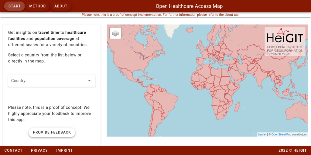
Last year we started the Open Healthcare Access Map. Initially, only a few countries and later on continents were featured. Today, we are pleased to announce that we are releasing a number of previously missing countries, achieving global coverage.
The Open Healthcare Access Map uses healthcare facilities extracted from OpenStreetMap, the isochrone method from openrouteservice and population distribution from WorldPop. Isochrones represent an area that can reached from a location within a specified time and means of transport. The isochrones from each facility are intersected with population data. This way, statements can be made about how many people potentially live within how much time distance from a health facility.
The web application is available here: https://apps.heigit.org/healthcare_access/.
Please note that this is still a prototype and feedback on improvements and desired functionalities is very welcome.
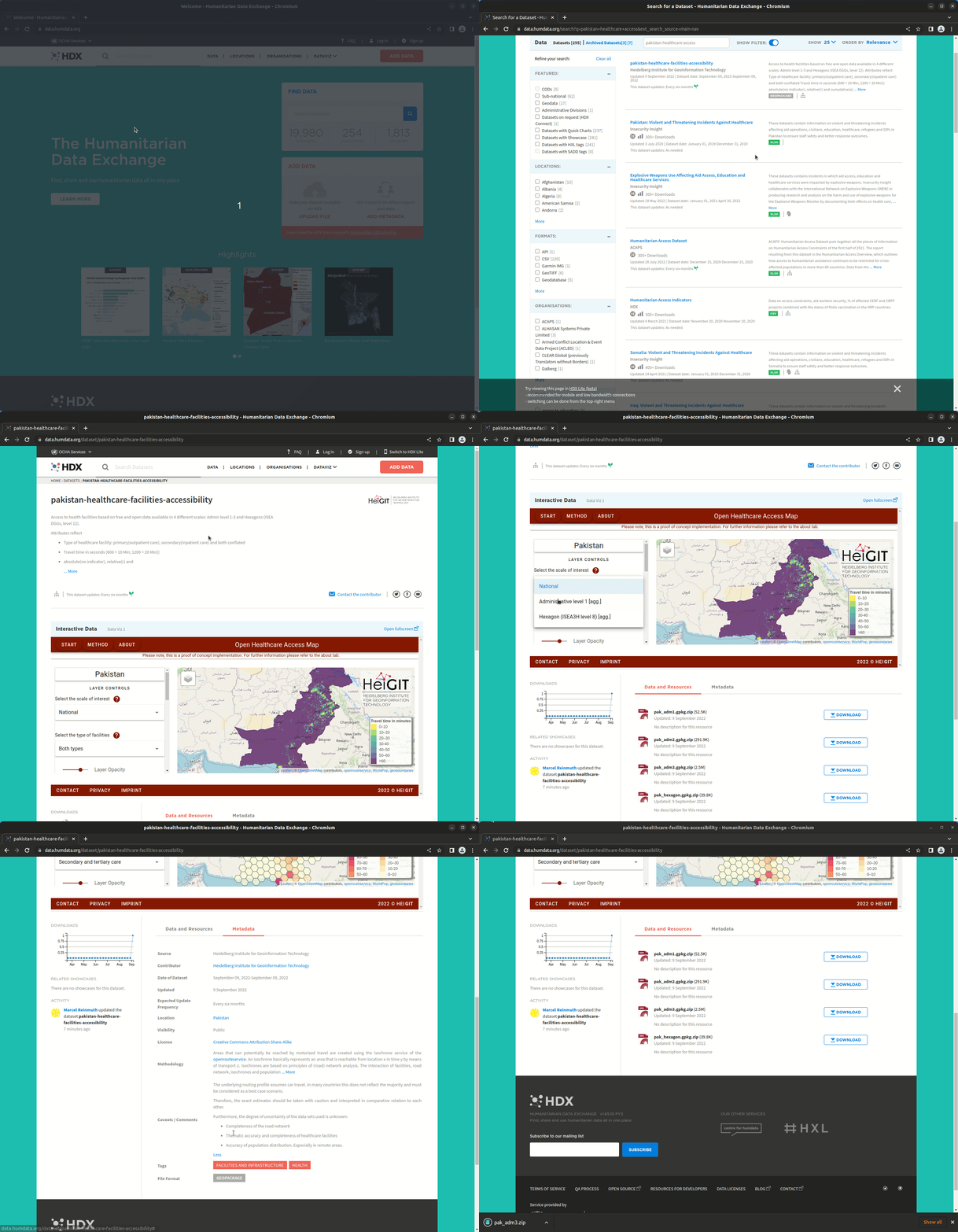
A key objective of the project is to make the data more accessible to users. Therefore, we make the data available on the Humanitarian Data Exchange (HDX). Please refer to our organizational page on HDX here: https://data.humdata.org/organization/heidelberg-institute-for-geoinformation-technology. HDX, is an open platform for sharing and disseminating data across crises and organizations. It is managed by the United nations Offfice for the Coordination of Humanitarian Affairs (OCHA) and features more than 19,000 datasets from more than 300 organizations.
The first country we are publishing data for is Pakistan. Pakistan has been hit by severe flooding over the past few weeks.The published datasets provide aggregated information at different scales(administrative and regular hexagons) on the coverage of the population with health services. The data can be used to compare the coverage of different regions and identify potential gaps in coverage.
Here is the directlink to the Pakistan dataset: https://data.humdata.org/dataset/pakistan-healthcare-facilities-accessibility
Related works:
- Accessibility of covid-19 vaccination centers in Germany
- Introducing the Open Healthcare Access Map
- Mapping physical access to health care for older adults in sub-Saharan Africa and implications for the COVID-19 response: a cross-sectional analysis
- Flood Impact Assessment on Road Network and Healthcare Access at the example of Jakarta, Indonesia

