Open-source tools that incorporate open geospatial data, such as openrouteservice (ORS), prove to be beneficial for both academic research and practical applications. These tools enable researchers to pursue innovative approaches aimed at addressing complex societal challenges and beyond.
A great illustration of this is presented in the journal paper titled “Modeling health and well-being measures using ZIP code spatial neighborhood patterns.” This study carries out a nuanced examination of well-being at the ZIP Code Tabulation Area (ZCTA) level, surpassing the limitations of conventional large spatial units like counties. Through a spatially informed statistical modeling framework, the research incorporates individual-level well-being indices and ZCTA-level effects, with a focus on spatial neighborhood structures.
Instrumental to this analysis is the openrouteservice R package, which is used to obtain driving times between ZCTA population centroids as a measure of spatial neighborhood. With the help of ORS, the study achieves a more granular understanding of how individuals experience distance and access resources, particularly within diverse urban and rural contexts. This approach not only enhances the accuracy of spatial representations but also ensures a more nuanced appraisal of community well-being dynamics.
Coupled with individual-level health data sourced from Sharecare and demographic insights from the U.S. Census Bureau, this analysis seeks to furnish ZCTA-level rankings of well-being. Such insights are poised to empower local decision-makers and policymakers with actionable intelligence to devise targeted interventions and policies aimed at bolstering community health and wellness. Through the convergence of technology and academic inquiry, this research underscores the transformative potential of geospatial data in advancing public health agendas and fostering societal well-being.
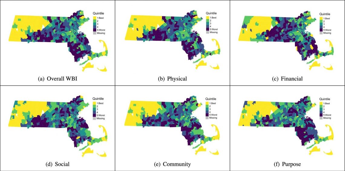
The study finds spatial disparities in well-being scores across ZCTAs, with some regions closer to major urban centers generally exhibiting higher scores. Detailed analyses of Overall Well-Being Index (WBI) and subscale scores reveal distinct patterns in different regions of Massachusetts and Georgia, highlighting the importance of local context in shaping community well-being.
We are dedicated to continuing supporting research with our services, either by providing free access to our hosted services or with guidance on how to use your infrastructure. Stay connected with us through our social media channels and blog to be abreast of future developments and releases related to ORS and advancements in geospatial technology. If you are interested in finding out what we can provide for your use-case, please feel free to check out openrouteservice.org or reach out to us.
Figure source: Modeling health and well-being measures using ZIP code spatial neighborhood patterns
Reference:
https://www.nature.com/articles/s41598-024-58157-w
https://pubmed.ncbi.nlm.nih.gov/?cmd=search&term=Kimberly%20Dukes
https://pubmed.ncbi.nlm.nih.gov/?cmd=search&term=Shariq%20Mohammed
Leave a Reply