HeiGIT, the Colombian Red Cross (CRC), Colombia’s National University in Manizales (UNAL) and UBDC successfully ran the international workshop “Digitalizing Paper-based Participatory Risk Mapping with the Sketch Map Tool” at the IDRiM 2024 in Cartagena, Colombia on 29th of September 2024. This was the first time the conference was held in South America, with over 800 participants. Within the conference’s theme, “Disaster resilient communities for life,” the team welcomed about 26 participants. It provided an interactive space to explore the Sketch Map Tool and its practical applications in digitizing community-generated maps.
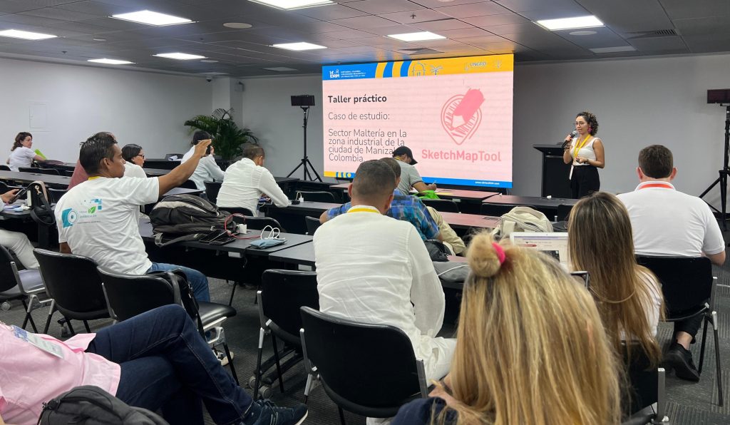
This workshop turned into a demonstration of the strong capacities built in Colombia through the work led by HeiGIT and the Urban Big Data Centre. The three local facilitators, Maria Jimena Henao S. (UNAL), Natalia Cardona (UNAL) and Eduard Ruiz Morales (CRC), together with Anne Schauss (HeiGIT), shared their experiences and introduced the Sketch Map Tool to a mixed audience of Colombian and Latin American practitioners and experts on disaster risk management. They exchanged ideas about potential use cases and the challenges of mapping local knowledge. The team opted for mapping the risk areas in the Malteria neighborhood located in the city of Manizales, Colombia. An area of interest where the Waterproofing Data and UNAL have worked in the past years.
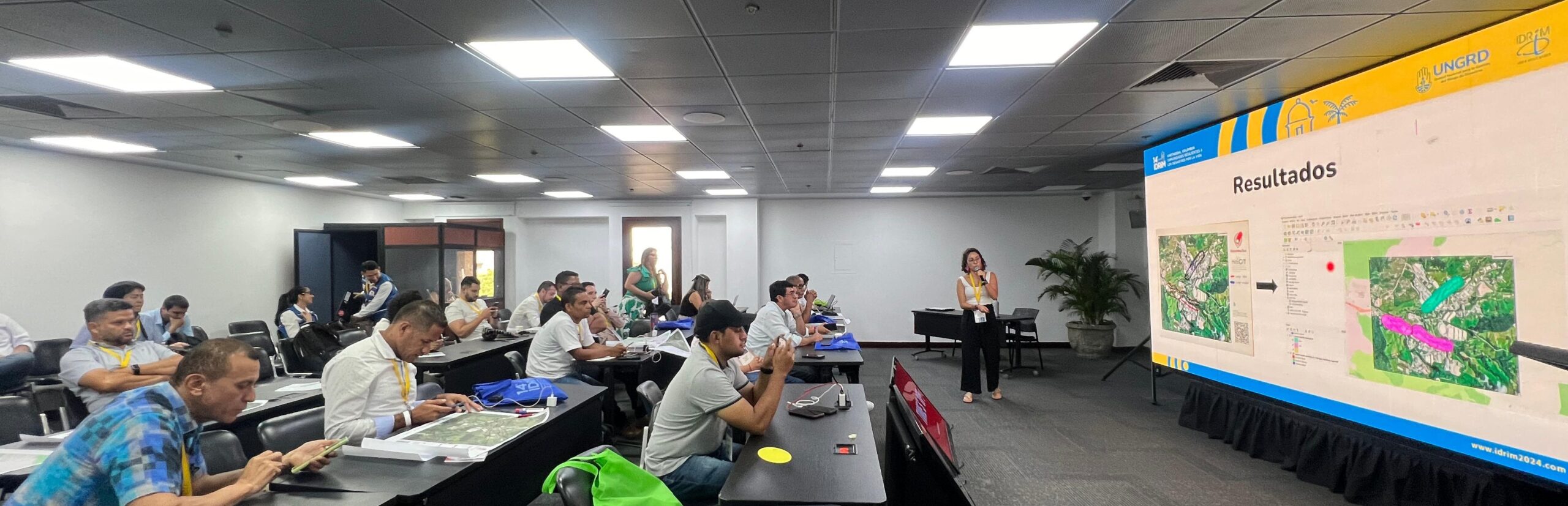
Natalia Cardona Gómez and Maria Jimena Henao Salgado (Universidad Nacional de Colombia) together with Edward Ruiz Morales hosted the mapping session
This session allowed attendants to experience a mapping scenario firsthand. Especially, they reflected on the challenges faced by communities in Malteria, an area affected by flash floods and landslides in 2011 and 2017. This interactive segment sparked discussions on the potential and limitations of the Sketch Map Tool in addressing real-world scenarios. Several participants, who had already conducted participatory mapping activities without supportive technology, expressed their appreciation for the tool’s potential. As one participant noted, ‘I wish I knew the tool before. Now I have my analogue maps and don’t know how to digitize and georeference them.” Another participant mentioned, “The tool is fantastic and very helpful cause normally these participatory results stay on paper, therefore it is not possible to share them in a digital way with other partners, until now.”
Some of the issues faced were related to the tool’s ease of use, particularly for participants without GIS knowledge. For instance, several participants successfully uploaded their analogue maps but struggled to visualize the geodata output. The extensive feedback provided during the lively hands-on workshop are invaluable insights that guide HeiGIT in refining the tool to better meet user needs.
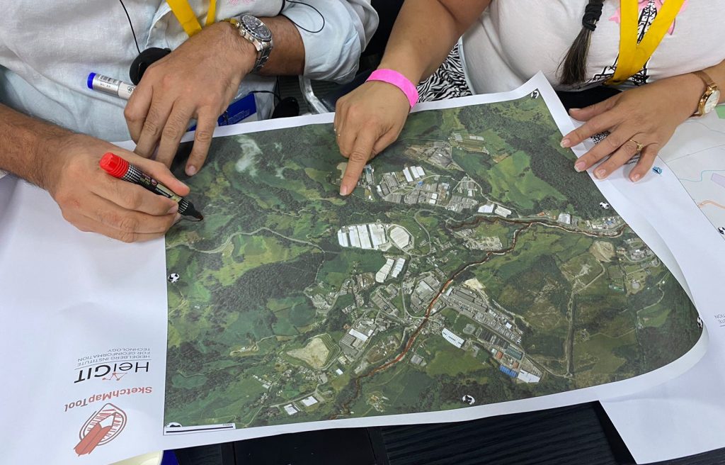
A mapping session using Sketch Maps in coordination with Anne Schauss and Diego Pajarito Grajales (Urban Big Data Centre) as part of the expansion of the Waterproofing Data project across Latin America
We are committed to continuing this dialogue in future events and fostering collaboration among researchers, practitioners, and technology providers. We aim to foster partnerships, enhance data and map literacy, share experiences, and build a dynamic community passionate about participatory mapping and beyond.
Ultimately, our goal is to continue building a collaborative environment with you all. We want to bridge the gap between risk management practitioners, researchers and the communities that face challenges in the field. Also to encourage new audiences in Latin America to use tools like Sketch Map Tool and Waterproofing Data.
Apart from the workshop on participatory mapping, Edward Ruiz Morales (Cruz Roja Colombiana) spoke about the digitization of community cartography in the Enhanced Vulnerability and Capacity Assessment (EVCA) of the Colombian Red Cross. Anne Schauss (HeiGIT) gave a talk on the potential and limitations of the Sketch Map Tool for humanitarian organizations, based on findings by Kimon Letzner.
For further information on the Sketch Map Tool, visit our website or reach out to sketch-map-tool@heigit.org. For updates and case studies, you can subscribe to the Sketch Map Tool Newsletter.
The idea of the Sketch Map Tool is based on experiences from research about flood risk perception including participatory mapping with Field Papers(https://fieldpapers.org/?locale=de) in various case studies (Klonner, Usón, et al. 2021). These studies show the need for the combination of analogue and digital mapping to bridge the gap between involved stakeholders and facilitate data collection and analysis. The Sketch Map Tool prototype combining map creation, quality analysis and georeferencing was developed during the Waterproofing Data Project ((Klonner, Hartmann, et al. 2021), (Porto De Albuquerque 2023), (Klonner et al. in preparation)) and refined through feedback from case studies, for example, in Mozambique (Klonner and Norze 2023). The Sketch Map Tool was developed to provide an easy-to-use and inclusive tool for capturing local knowledge and enabling usage in geoinformation systems.
Klonner, Carolin, Maximilian Hartmann, Rebecca Dischl, Lily Djami, Liana Anderson, Martin Raifer, Fernanda Lima-Silva, Lívia Castro Degrossi, Alexander Zipf, and João Porto De Albuquerque. 2021. ‘The Sketch Map Tool Facilitates the Assessment of OpenStreetMap Data for Participatory Mapping’. ISPRS International Journal of Geo-Information 10 (3): 130. https://doi.org/10.3390/ijgi10030130 .
Klonner, Carolin, and Jeantyl Norze. 2023. ‘Sketch Map Tool’. In Evaluating Participatory Mapping Software, edited by Charla M. Burnett, 149–66. Cham: Springer International Publishing. https://doi.org/10.1007/978-3-031-19594-5_7 .
Klonner, Carolin, Leonie Schuchardt, Maximilian Hartmann, Lima-Silva, Fernanda, Anderson, Liana, Cunha, Maria Alexandra, Mohammed Rizwan Khan, et al. in preparation. ‘Bridging the Gap for Improved Disaster Risk Reduction: How to Combine Authoritative Data and Local Knowledge’.
Klonner, Carolin, Tomás J. Usón, Nicole Aeschbach, and Bernhard Höfle. 2021. ‘Participatory Mapping and Visualization of Local Knowledge: An Example from Eberbach, Germany’. International Journal of Disaster Risk Science 12 (1): 56–71. https://doi.org/10.1007/s13753-020-00312-8 .
Porto De Albuquerque, João. 2023. ‘Waterproofing Data Project: Participatory Flooding Maps for Flood-Prone Neighbourhoods, 2020-2021’. UK Data Service. https://doi.org/10.5255/UKDA-SN-856620 .