The Colombian Red Cross’s Disaster Risk Management (DRM) team works to mitigate the impact of emergencies and enhance community resilience throughout the country. Coordinating actions at both national and regional…
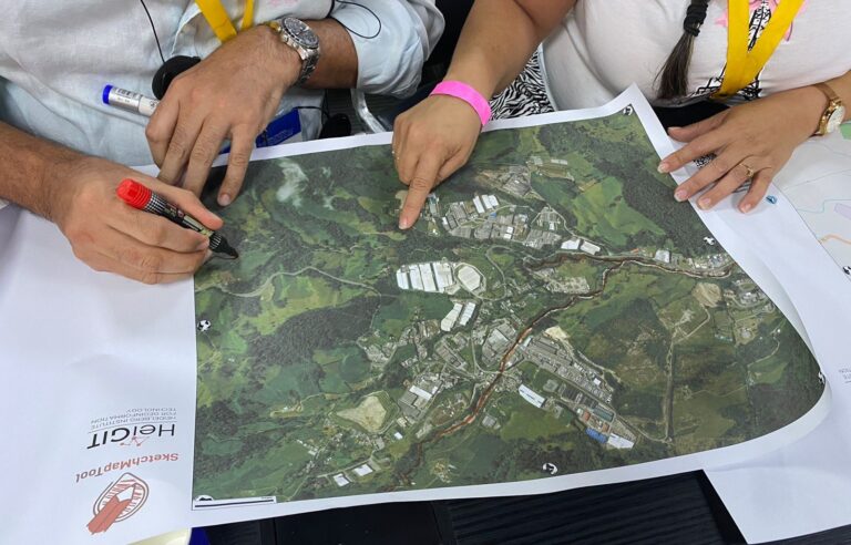
The Sketch Map Tool was strategically used within Colombia’s National Disaster Management System to steer community mapping in the southern city of Cali. The National Unit for Disaster Risk Management…
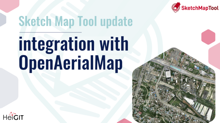
The latest update to the Sketch Map Tool introduces a direct integration with OpenAerialMap (OAM), making it easier to bring drone and aerial imagery into community and humanitarian mapping….
Last week, the “Global Digital Health” Research Alumni Project Week 2025 brought together international researchers and local experts to discuss advancements in global digital health. HeiGIT joined the discussion on…
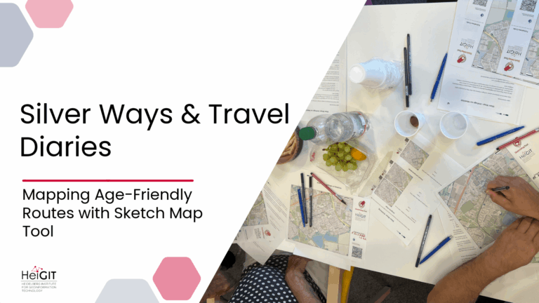
The Silver Ways project aims to make it easier for older adults to get around cities by creating a routing system targeted to their needs. To ground this system in…
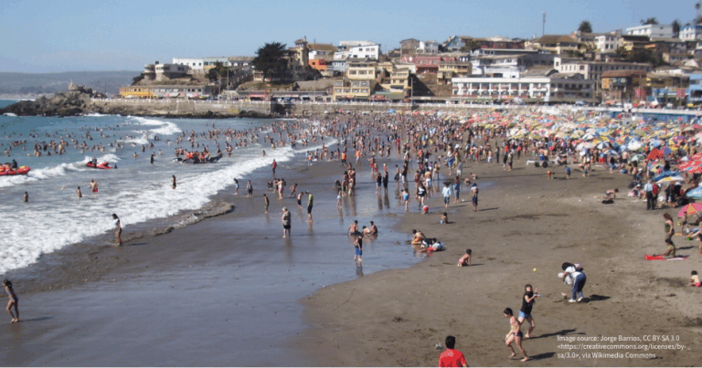
The Sketch Map Tool was used in Cartagena, Chile, to collect geographic information for effective disaster risk reduction. It is an easy-to-use tool for participatory sketch mapping through offline collection,…
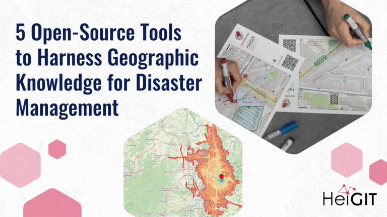
Volunteered Geographic Information (VGI) is a valuable resource for an effective disaster management. This article presents five free tools to enhance humanitarian work using VGI. What is VGI and why…
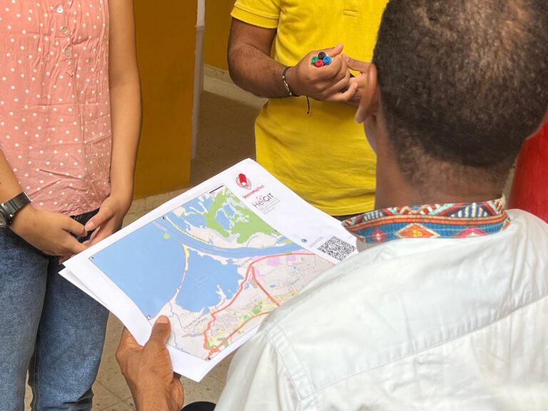
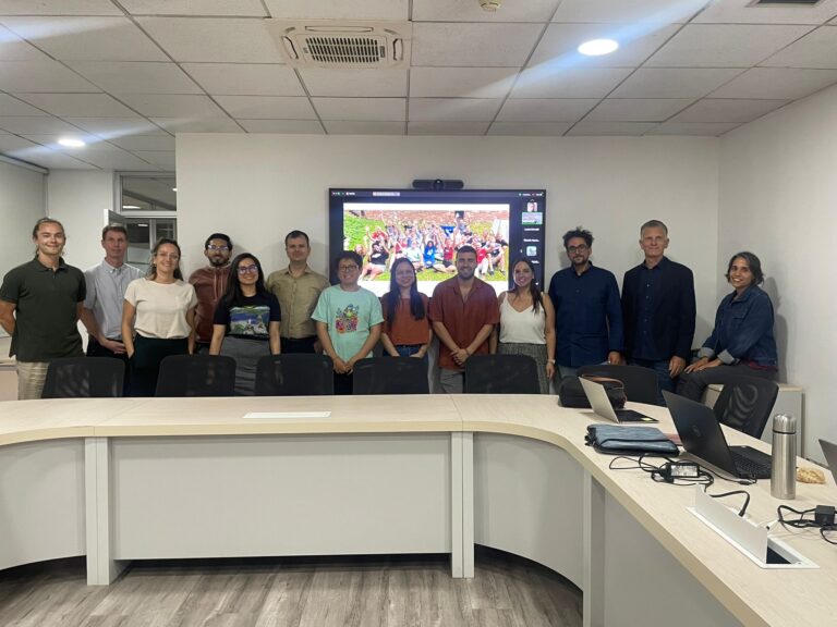
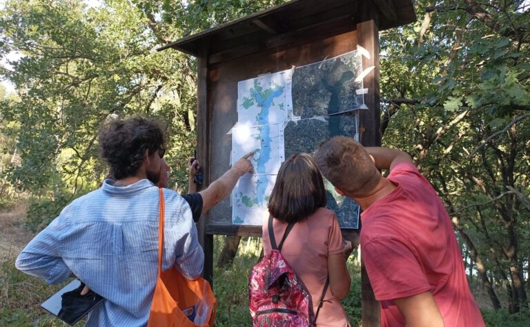
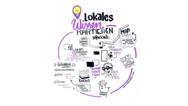
In June 2025, researchers from the Urban Big Data Centre (UBDC) and HeiGIT (Heidelberg Institute for Geoinformation Technology) carried out a joint field trip to Colombia to strengthen participatory mapping…
The Sketch Map Tool was used in a joint effort between the Honduran Red Cross and the municipal government to update the municipal response plan and develop an annex focused…
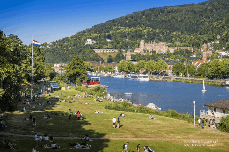
Students of the Institute of Geography at Heidelberg University explored local perceptions of urban heat in Heidelberg’s old town as part of a 2024 seminar on GIS for Disaster Risk…
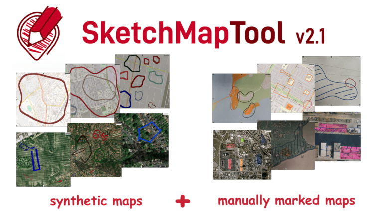
The newly released Sketch Map Tool v2.1 features a higher accuracy in digitizing hand-sketched markings on Sketch Maps, thanks to a larger training dataset and an updated machine learning model…
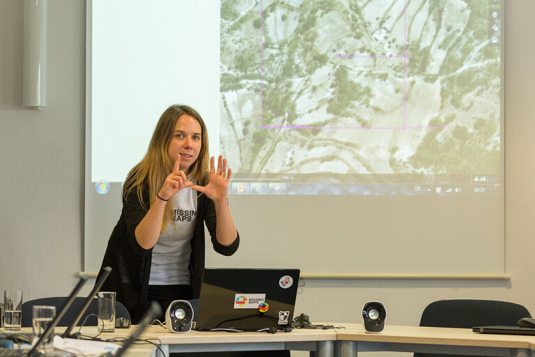
Recently, our colleagues traveled to Chile as part of our ongoing collaboration with the Heidelberg Center Latin America. During their visit, they hosted a block course, met with local research…
A few days ago, we had the pleasure of welcoming our longtime partners from the German Red Cross (GRC) to HeiGIT. Together, we not only mapped out our future priorities…
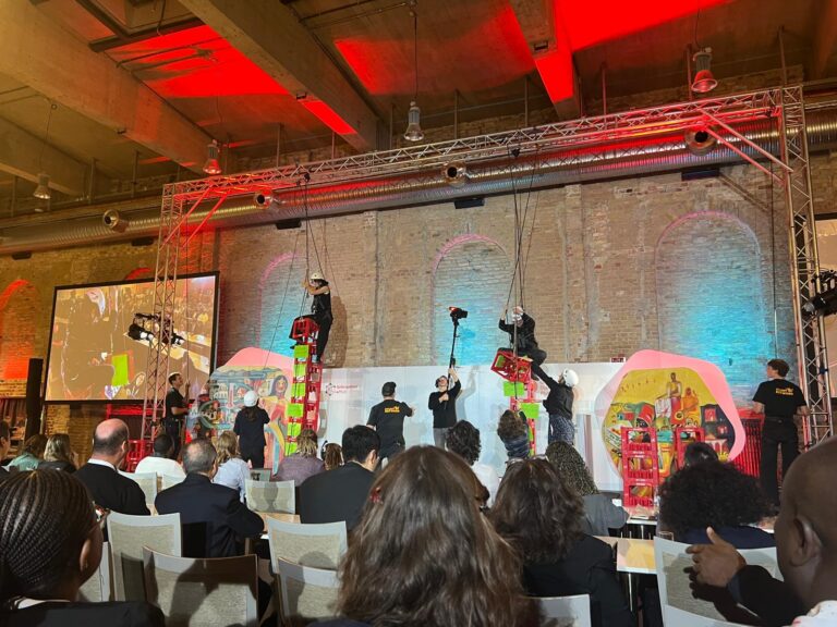
Stuntmen, jugglers, humanitarians stacking and climbing boxes, wildcard sessions – not the usual things you would expect at a conference. But all of these shaped this year’s Global Dialogue Platform…
We are happy to share new developments on our ongoing work with the Sketch Map Tool! To help you better understand the tool, its key functionalities, and potential applications, we…
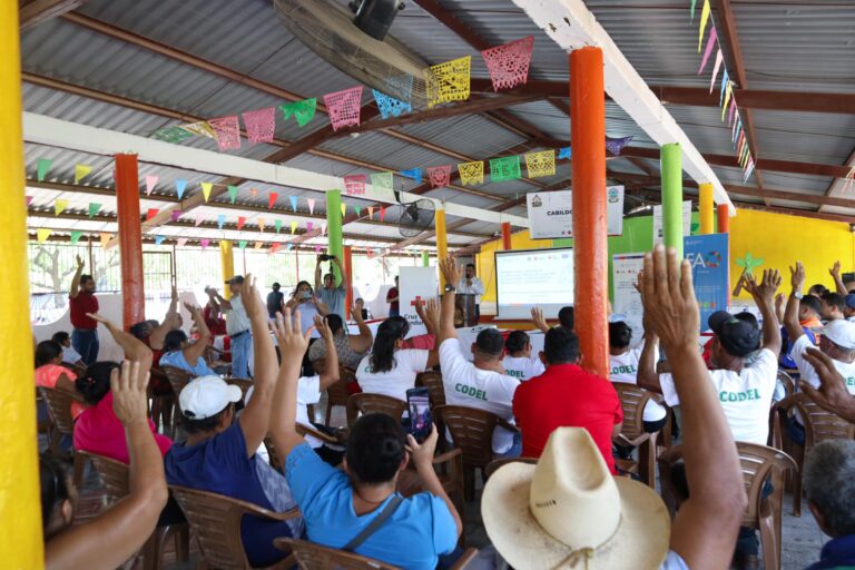
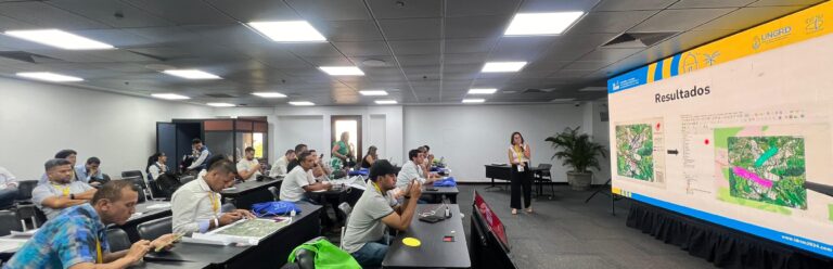
HeiGIT, the Colombian Red Cross (CRC), Colombia’s National University in Manizales (UNAL) and UBDC successfully ran the international workshop “Digitalizing Paper-based Participatory Risk Mapping with the Sketch Map Tool” at…
Claudio Sossio De Simone is a PhD candidate at the University of Rome Tor Vergata in the field of Cultural Heritage, Education and Territory. His research interests include GIS science…
HeiGIT is celebrating its fifth anniversary today, July 1st! To commemorate this occasion, we invite you to join us on a little walk down memory lane….
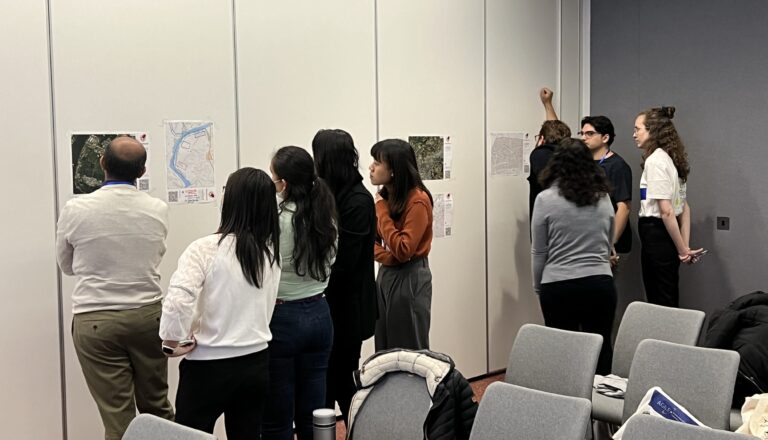
HeiGIT and Urban Big Data Centre (UBDC) hosted a successful international workshop entitled ‘Mapping with Communities’ at the AGILE 2024 conference in Glasgow, Scotland, UK. Responding to the conference theme…
The 2024 Fachtagung Katastrophenvorsorge (Disaster Risk Reduction Symposium) centered around the theme “On the Edge? Disaster risk reduction in uncertain times.” Held in a hybrid format on April 22 and…