At Explore Science 2026, young students experimented with computer vision for humanitarian mapping: an occasion to learn how AI models are trained and why human input remains essential for generating…
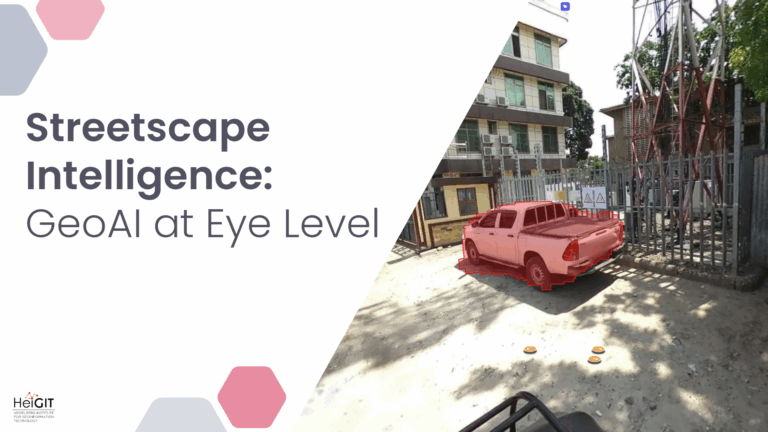
Crowdsourced street-level imagery can be used to detect and map humanitarian-relevant features in near real time. We have developed a machine-learning-based analytical pipeline that integrates with the open-source imagery catalogue…
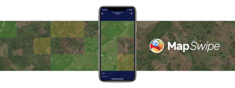
The crowdmapping app MapSwipe now integrates also street-level imagery. This new feature enables even mapping efforts that require the highest level of detail, such as detecting waste on the street….
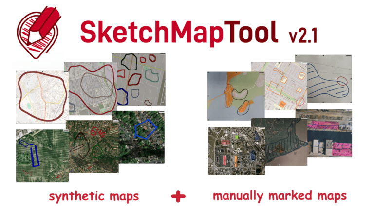
The newly released Sketch Map Tool v2.1 features a higher accuracy in digitizing hand-sketched markings on Sketch Maps, thanks to a larger training dataset and an updated machine learning model…
Under the main theme “Spatial data for design” the 26th AGILE conference will be held this week in Delft, Netherlands. Besides a variety of geo-spatial related themes, disaster mapping still…
In the context of the United Nations World Data Forum 2021 organised by theUnited Nations Statistics Division and UN member states a series of blogposts has been published by UNSTATS….
The impact of climate change is particularly strong in higher latitudes. The Arctic is currently warming up at a much higher pace than the global average. This leads to thawing…
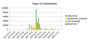
Humanitarian mapping activations show increasing numbers of contribution. This blog post illustrates the specific potential of the OSHDB API [1] for detailed analyses of such activations by means of a…
The Center for Spatial Studies, Department of Geography at the University of California, Santa Barbara is hosting the Spatial Data Science Symposium 2019 this coming week with the title “Setting…
Gerade beendete die MS Wissenschaft ihre Tour durch 31 Städte zwischen Berlin und Wien in diesem Wissenschaftsjahr zum Thema “Künstliche Intelligenz“. 85.000 Menschen – Schulklassen, Familien und Interessierte aller Altersklassen…
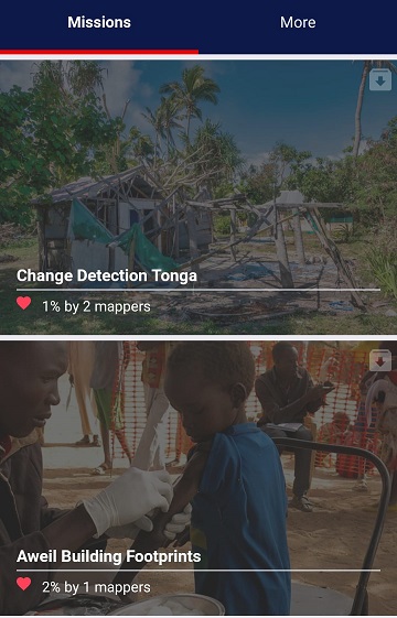
In 2015, MapSwipe began as a solution to a complex question: how do we better identify where communities and populations are, allowing mapping to be more efficient and effective? Using…
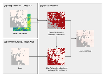
Our new paper on Machine Learning and Humanitarian Mapping Nowadays, Machine Learning and Deep Learning approaches are steadily gaining popularity within the humanitarian (mapping) community. New tools such as the…
Mitmach-Exponate geben auf der MS Wissenschaft in Heidelberg vom 28. August bis 1. September Einblicke in die Entwicklung und Anwendung Künstlicher Intelligenz (KI). Mit auf dem zu einer schwimmenden Ausstellung…
19th-22nd of May, the 16th Information Systems for Crisis Response and Management (ISCRAM) conference is taking place in Valencia. Likewise to previous years, the GIScience Research Group/HeiGIT are taking part…
The 11th Information Communications Technology for Development (ICT4D) Conference brings together hundreds of public, private and civil society organizations, eager to share practical insights on applying digital technology to development,…