The impact of climate change is particularly strong in higher latitudes. The Arctic is currently warming up at a much higher pace than the global average. This leads to thawing the permafrost (permanently frozen soil) with severe consequences for the Arctic ecosystem. Permafrost makes up about 25 % of the land area in the Northern Hemisphere and stores large amount of carbon. Thawing of permafrost can further amplify global warming by releasing significant amounts of the greenhouse gases CO2 and methan.
Unlike glaciers, permafrost is not directly visible on the earth’s surface and difficult to monitor. How could one possible gather reliable and up-to-date data on permafrost thaw for scientific climate impact assessments? The team at HeiGIT – and our partners at the Alfred Wegener Institute (AWI) Helmholtz Centre for Polar and Marine Research and the German Aerospace Center (Deutsches Zentrum für Luft- und Raumfahrt, DLR) – count on citizen scientists to help out in the upcoming project “UndercoverEisAgenten”.
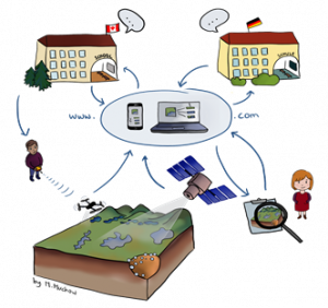
Students in Canada and Germany work together to capture and analyse imagery of the Arctic (by Marek Muchow).
The Idea: A Citizen Science Approach
School classes both in Canada and in Germany will work together to generate and classify data on land surface disturbances caused by thawing permafrost. Members of the community and students from Aklavik (in the Inuvik Region of the Northwest Territories, Canada) will operate drones to capture high-resolution imagery of the Arctic land surface. The imagery is processed and divided into manageable batches of simple mapping tasks (“micro tasks”) that can be solved by students (and other citizen scientists) — even on a smartphone. Through the citizen scientists’ contribution, a unique reference data set is created – and will be very valuable for improving the quality of remote sensing based permafrost degradation monitoring and prediction.
Not only will this process lead to providing important data, but also involve citizens in the scientific process of permafrost research. Students in Germany will exchange with their peers in Canada and gain a much more immediate understanding of climate change and its consequences.
The project will start out in close cooperation with the school in Aklavik and three schools in Germany — in Jena, Heidelberg and Berlin. Later on, the approach will be disseminated to extracurricular learning places, the interested public and the scientific community.

Capturing high-resolution imagery of Arctic land surface with drones (source: AWI/DLR).
The Project: “UndercoverEisAgenten”
The project is one of 15 new citizen science projects funded by the German Federal Ministry of Education and Research. The institutional partners bring in strong expertise in different relevant areas. AWI’s Permafrost Research Section in Potsdam has a large portfolio of projects aimed at early detection and forecasting of permafrost degradation. DLR’s Department for Citizen Science in Jena offers valuable experience with the development of IT based strategies for Citizen Science, with the utilization of open data, the evolution of formats for participation and innovative educational concepts as well as with the development of tools for knowledge and data management.
HeiGIT’s contribution
The HeiGIT is supported by the Klaus Tschira Foundation (KTS) and has the goal of transferring knowledge and innovative technologies from geoinformatics research into practice. Together with the GIScience group at Heidelberg University as an associated partner, it will substantially contribute to this project by developing a method for crowdsourcing-based permafrost mapping. A mobile app will enable citizen scientist to identify and map surface disturbances caused by thawing permafrost in the Arctic from remote sensing imagery. The web platform “UndercoverEisAgenten” will provide scientific information and access to the results of the mapping project to the public.
In this task, the HeiGIT team will rely on its vast experience with the development of tools for Volunteered Geographic Information (VGI), data quality assessment and micro-tasking – first and foremost the Global Mobile Award winning smartphone app MapSwipe. The app was originally created as part of the Missing Maps project and used in crowdsourcing data for humanitarian purposes – one swipe at a time. In cooperation with AWI, MapSwipe was adapted for permafrost mapping and presented to the public as part of the exhibition on the MS Wissenschaft.
The HeiGIT team is looking forward to implementing this exciting and very relevant project together with the partners and stakeholders!