At Explore Science 2026, young students experimented with computer vision for humanitarian mapping: an occasion to learn how AI models are trained and why human input remains essential for generating…
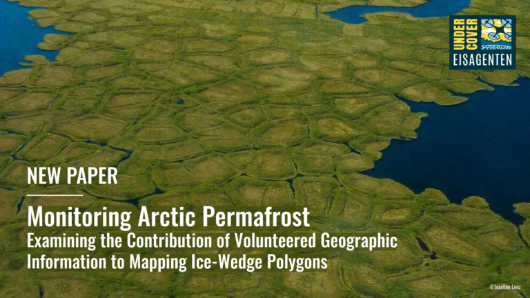
A recent study within the UndercoverEisAgenten project demonstrates that citizen science can effectively support Arctic permafrost research. Volunteers mapped ice-wedge polygons in Alaska and Canada with high accuracy, enabling geomorphological…
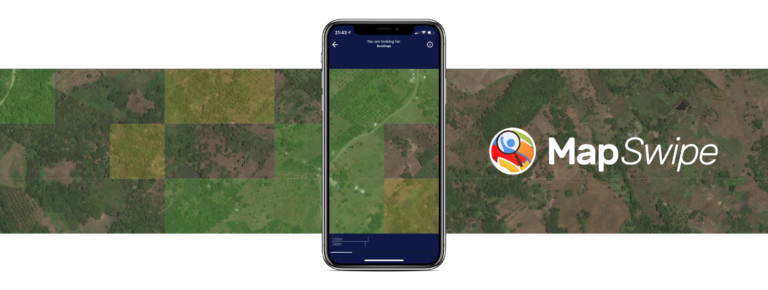
The crowdmapping app MapSwipe now integrates also street-level imagery. This new feature enables even mapping efforts that require the highest level of detail, such as detecting waste on the street….
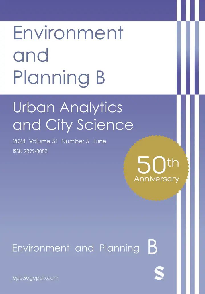
Together with collaborators from Urban Analytics Lab Singapore and CICI Lab, we are organising a special issue in Environment and Planning B: Urban Analytics and City Science, on the topic…
The IDEAL-VGI research project is nearing its end. And while that won’t be the end of our research into social data sources, data quality analyses and land-use information, we are…
Under the main theme “Spatial data for design” the 26th AGILE conference will be held this week in Delft, Netherlands. Besides a variety of geo-spatial related themes, disaster mapping still…
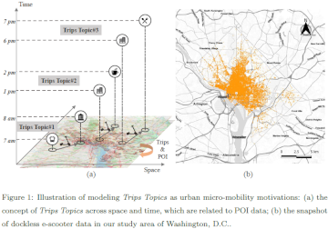
Over the last two years, we have witnessed the ever-fast growth of micro-mobility services (e.g., e-bikes and e-scooters), which brings both challenges and innovations to the traditional urban transportation systems….
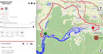
Underpasses, stairs, and high curbsides are a challenge for people with impaired mobility, but these can be circumnavigated using a customized route planner for increasing mobility by calculating routes with…
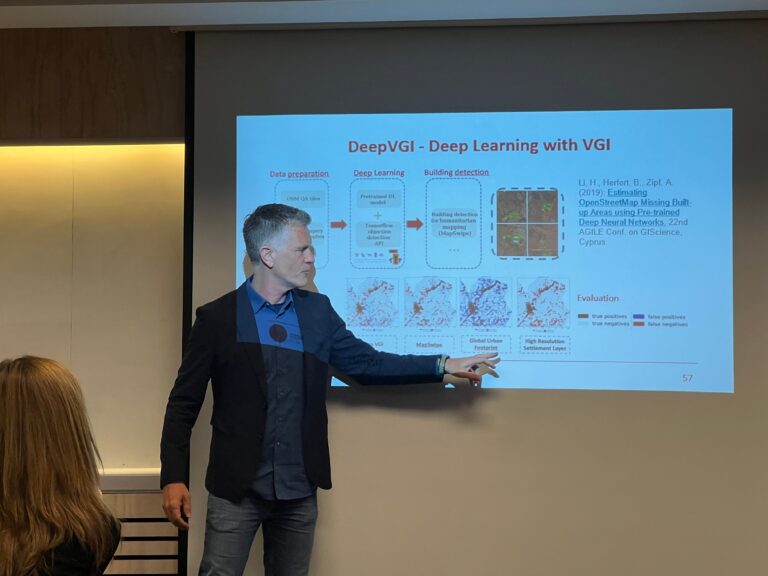
Large-scale mapping activities can benefit from the vastly increasing availability of earth observation (EO) data, especially when combined with volunteered geographical information (VGI) using machine learning (ML). High-resolution maps of…
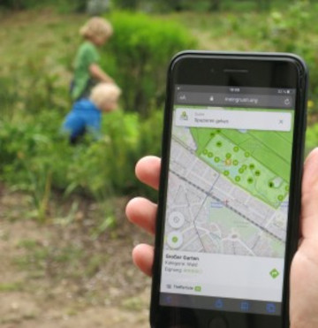
Urban green spaces (UGSs) can provide important ecosystem services for citizens and their well-being. To make use of these services according to UGS user demands, urban residents, tourists, and city…
The AGILE 2021 conference is taking place this week. It is the the 24rd AGILE conference on GIScience. AGILE is the Association of Geographic Information Laboratories in Europe and the…
The impact of climate change is particularly strong in higher latitudes. The Arctic is currently warming up at a much higher pace than the global average. This leads to thawing…
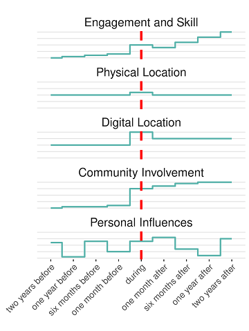
Online knowledge projects such as OpenStreetMap (OSM) and Wikipedia have gained high importance, trust and even economic value. These projects and their content are maintained and enhanced by online communities…
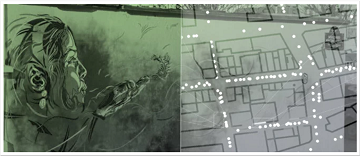
Flooded parking area in Eberbach in January 2019 (Picture: C.Klonner) Worldwide, more and more people are affected by flooding. Local knowledge provides a valuable source of information for disaster risk…
A recently published paper provides a bibliometric review between integration of authoritative and volunteered geographic information (VGI) for the specific purpose of cartographic updating of urban mappings. The adopted methodology…
We are pleased to share that because of the response to our work, ISPRS IJGI selected our paper on Detecting Graffiti with Street View Images and Deep Learning to be…
More than 10 years have passed since the coining of the term volunteered geographic information (VGI) in 2007. A recently published article presents the results of a review of the…
Already in October 2019 Prof. Zipf was invited to give a keynote on “User Generated Geoinformation for Smart Cities” at the “Smart Cities, Smart Data, Smart Governance” ISPRS Conference at…
The Center for Spatial Studies, Department of Geography at the University of California, Santa Barbara is hosting the Spatial Data Science Symposium 2019 this coming week with the title “Setting…