What is ORSTools?
With ORSTools, most of the functionalities of openrouteservice are directly accessible in QGIS. The plugin offers a toolset, including routing, isochrone generation and matrix calculations. These functions can be used interactively in the map canvas or applied to point files within the processing framework. Output files come with rich attribute data such as duration, length and start/end locations.
New version 2.0.0
The release of the new ORSTools 2.0.0 version introduces several significant improvements. It is now fully compatible with the upcoming QT6 changes, ensuring a smooth experience with future QGIS updates. Users can now drag-and-drop vertex markers on the map. Moreover, the plugins’ provider configuration has been simplified and remains unchanged when the dialog is closed.
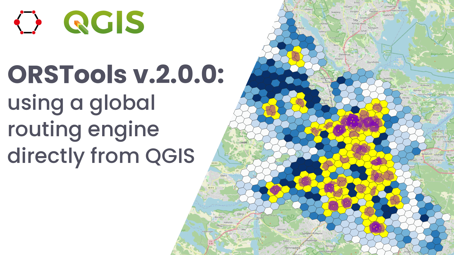
Use case: Isochrone-based analysis
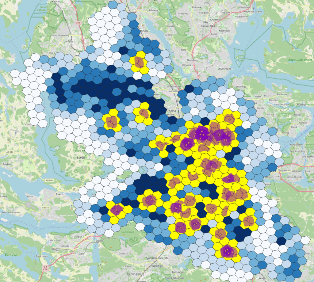
The new version of ORSTools introduces several different features, including enhanced reachability analysis using isochrones. These polygons define the area within which all points are reachable from a given location within a specified time. In this use case, we explored what percentage of Stockholm’s population can reach a doctor’s office on foot when they are sick.
The simplest way to calculate this is by using the Isochrones from Point Layer processing tool. This tool generates service or reachability areas for multiple locations and specified time or distance ranges. Using a dataset containing the locations of all doctors’ offices in Stockholm (represented as single points) as the input layer, we calculate foot-walking isochrones for 650 metres. We set the Location Type to destination, as we wanted to identify the population that can reach a doctor’s office, rather than the reverse.
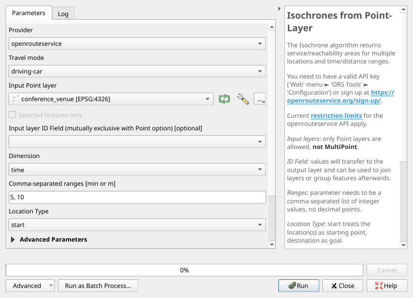
Isochrones from Point-Layer user interfaceNext, we analyzed how much of Stockholm’s population lives in these isochrones. We used a dataset consisting of a 400m radius hexagon grid covering the city, where each hexagon contains population data. By summing the population within the isochrone areas, we obtained a precise estimate of how many residents have easy walking access to a doctor’s office.
ORSTools at the QGIS User Conference 2025
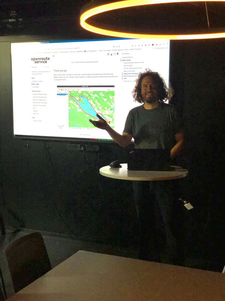
The new version was presented at the latest QGIS User Conference, held from 2nd to 3rd of June in Norrköping, Sweden. Jakob Schnell and Till Frankenbach introduced ORSTools 2.0.0 in two hands-on workshop sessions. The first session focused on integrating openrouteservice directly into QGIS via ORSTools, offering participants a deeper understanding of ORS data structures, core functions and limitations. The second session provided more detailed insights into the plugin’s capabilities, covering reachability analyses using isochrones, the calculation of large-scale time and distance matrices and the automation of these processes. Various analyses were conducted using sample data sets.

If you want to learn more about the new features, get the new plugin version here: QGIS plugin v2.0.0 released
Workshop resources, providing a step by step guide: ORSTools – Harnessing the Power of Routing inside QGIS — ORSTools – Harnessing the Power of Routing inside QGIS