
The ohsomeNow Stats dashboard has been updated to enhance its visual and functional elements. This facilitates the exploration of OpenstreetMap (OSM) mapping activities across space and time.
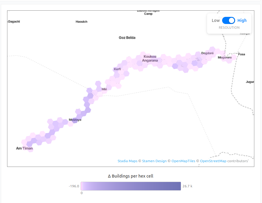
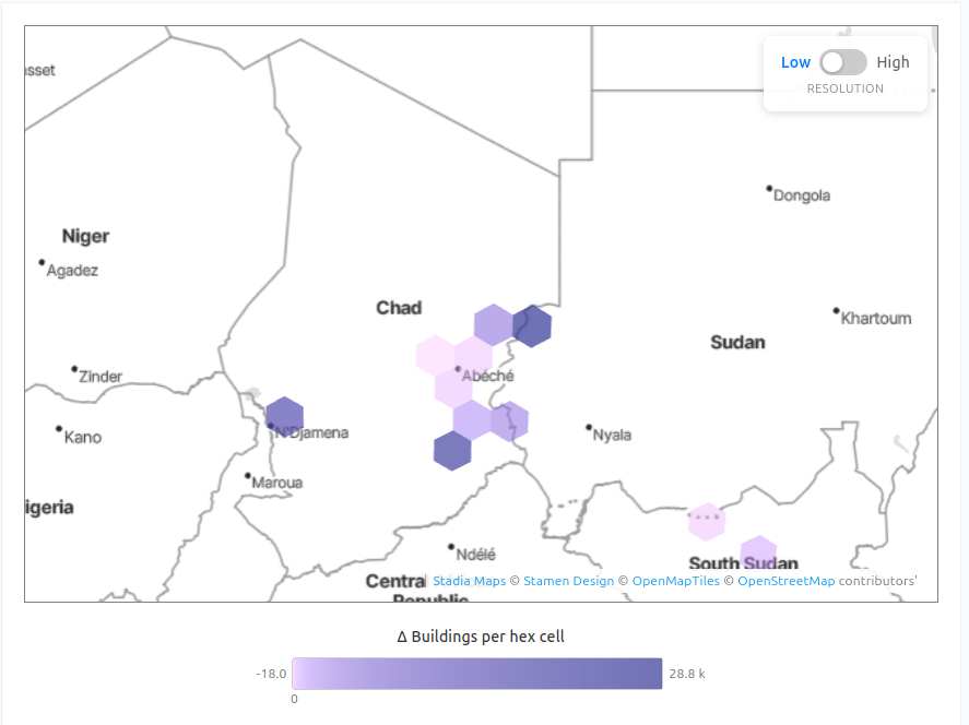
New H3 hexagon maps at high and low resolution
One of the most notable improvements is the new mapping interface. Previously, country-level visualizations were limited and lacked spatial clarity. With the new release, we have integrated H3 hexagon grids for a more accurate, multi-resolution view of where mapping happens within countries. You can now differentiate between H3 zoom level 3 with a low resolution and zoom level 6 with a higher resolution. Resolution 3 hexagons cover an area of about 12,500 km², while resolution 6 hexagon cells offer more detail (~35 km² per cell). The new visualizations show patterns that were previously hard to detect, helping users better understand how OSM contributions are distributed geographically.
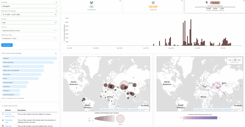
Power Grid Mapping
Power Grid Mapping is a new thematic topic that has been added to the dashboard. It is used to track contributions related to electrical infrastructure, which is relevant for humanitarian mapping and development planning. This feature has been added in response to a request made by MapYourGrid. Simply enter #ohmygrid to access information related to electrical infrastructure.
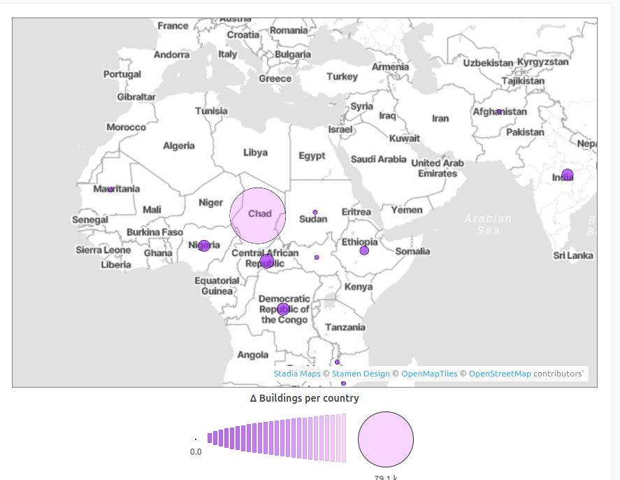
Example: High-resolution maps of MSF mapping activities
For instance, you can examine specific mapping activities in more detail. In this particular case study, our focus has been on MSF (Doctors without Borders) activities within the last 30 days. The dashboard displays a country map, which clearly demonstrates that a significant amount of mapping has been conducted in Chad. The low-resolution hex map illustrates the specific area of the mapping, which is located in the south-eastern region at the border to Sudan. The high-resolution H3 map even shows this at the village level. By copying the URL and creating a permanent link that includes all user-defines settings like filters by country, hashtag, or data range, it is possible to share the exact dashboard configurations with other people.
OSM Road Monitor
The updates of ohsomeNow Stats are part of the OSM Road Monitor, a project dedicated to the real-time monitoring of the quality and updates of the OpenStreetMap (OSM) road network. It aims to address the challenges of keeping road data up-to-date for applications such as navigation, routing, logistics, and fleet management. The project is particularly focused on scenarios where rapid updates to road data are critical, such as during natural disasters, where roads may be blocked or destroyed.The project is in collaboration with TU Munich and GIScience Research Group at Heidelberg University.
Try ohsomeNow stats here: ohsomeNow Stats


