Ready-To-Use Risk Assessment Data for Anticipatory Action
Risk assessments are a cornerstone of anticipatory action. They support humanitarian organizations and administrations in identifying and evaluating potential vulnerabilities. Reliable risk information enables better decision-making and the timely triggering of early actions based on data-driven insights.
However, developing a robust risk assessment can be a complex task. It requires the integration of multiple datasets on exposure, vulnerability, and coping capacity, followed by statistical and geospatial analysis. While these indicators can be generated through automated scripts from publicly available data sources, this step still represents a significant technical barrier for practitioners in the humanitarian field.
To address this and make the data more easily accessible, HeiGIT has openly published worldwide risk assessment datasets that can be directly used in combination with HeiGIT’s Risk Assessment QGIS Plugin. This way, users can focus on risk analysis and interpretation rather than data preparation.
With these datasets and the Risk Assessment QGIS Plugin, users can easily produce analysis to support evidence-based anticipatory action, risk communication with stakeholders, resource allocation and planning, as well as monitoring how risk evolves over time.
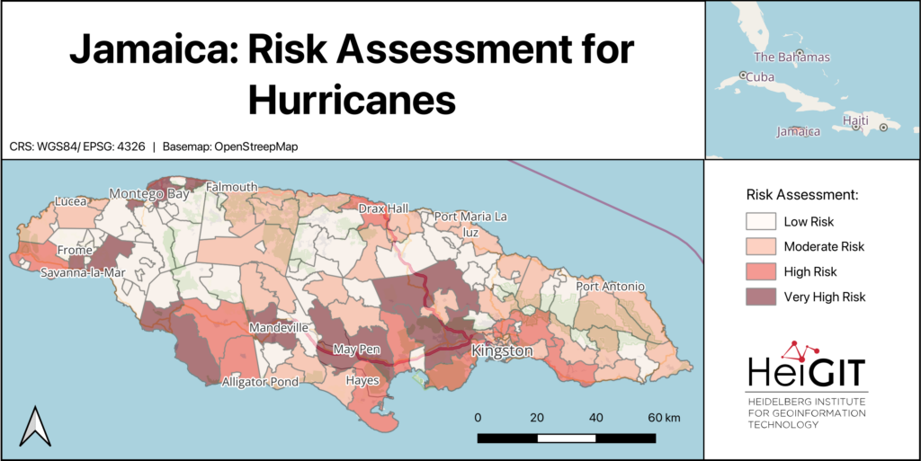
The Risk Assessment Datasets
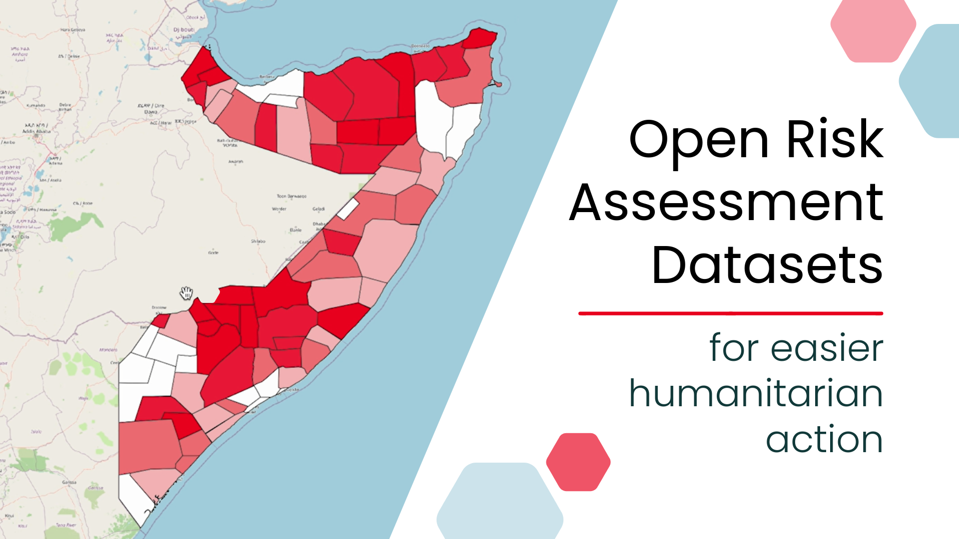
The published datasets provide comprehensive risk assessment indicators for several countries, covering multiple countries where administrative boundaries and place codes (PCODEs) are available on HDX. All indicators are aggregated at administrative level 2, enabling structured and comparable analysis across countries.
All datasets are openly available on the Humanitarian Data Exchange (HDX).
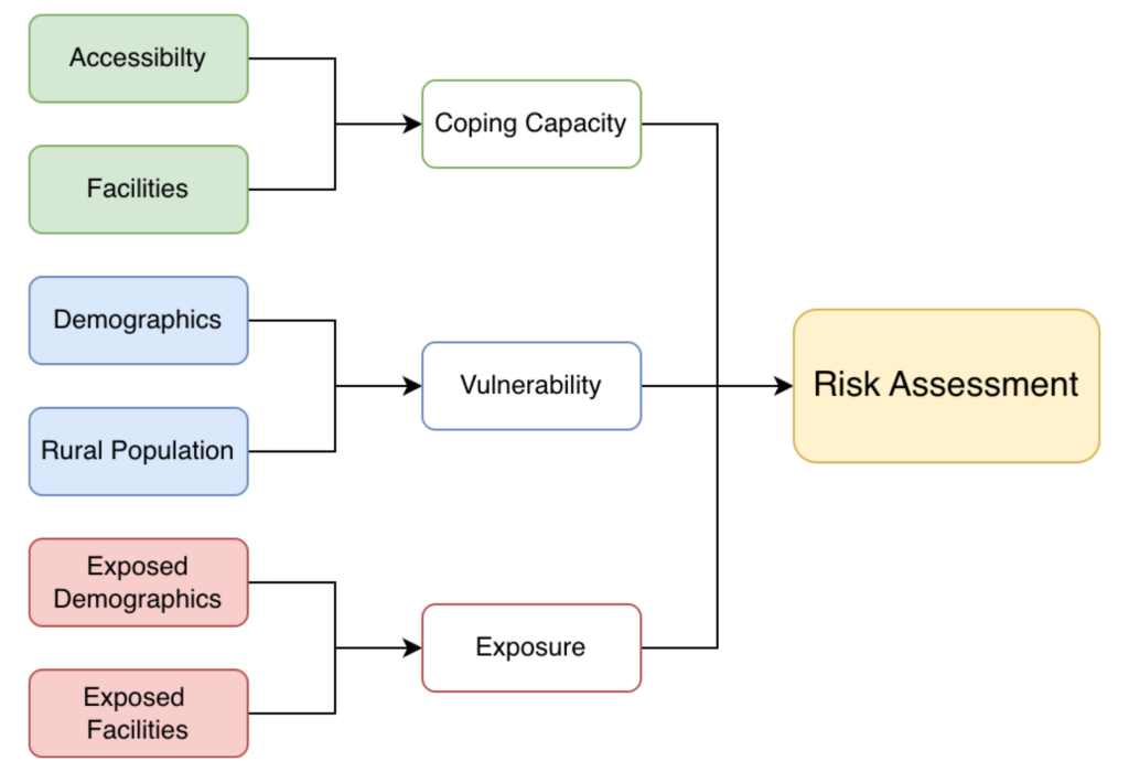
The datasets are designed to support multi-hazard risk assessments and include a standardized baseline set of indicators for Vulnerability and Coping Capacity that are applicable across all hazards and all included countries. In addition, we provide specific exposure indicators for flood and cyclone hazards, leveraging available global datasets to assess populations and assets at risk for these events.
These indicators are derived from open data sources, such as spatially explicit population data from Worldpop or information on schools and health facilities from OpenStreetMap. Other sources include openrouteservice (ORS), Global Human Settlement Layer (GHSL), The Joint Research Centre (JRC), and IBTrACS – NOAA International Best Track Archive for Climate Stewardship.
All indicators are fully compatible with HeiGIT´s Risk Assessment QGIS Plugin. In addition, the data can be downloaded and used independently for other analytical purposes or extended with additional, context-specific indicators. This approach allows humanitarian stakeholders to use the provided datasets as a baseline and gradually refine the assessment by adding local data or additional indicators.
How to Use the Dataset with the Risk Assessment Plugin
The Risk Assessment QGIS Plugin provides a user-friendly interface that allows practitioners to conduct risk assessments without advanced technical or coding skills. When used together with the published datasets, a basic risk assessment can be completed with minimal setup.
The typical workflow includes three main steps. First, users screen and review available datasets for their specific context and hazard scenario. Second, indicator weighting is defined, ideally in collaboration with local actors, to reflect the relative importance of different risk factors. Finally, the plugin performs the risk calculation and visualization.
The followingtutorial video guides the user through all important steps to set up and use the plugin:
Further materials on how to use the plugin and conduct risk assessments can be found on the training platform and previous blogpost.
Outlook (and More Datasets)
The plugin and datasets are under continuous development, and feedback from practitioners is essential to guide future improvements, including the integration of additional hazards and indicators. We encourage interested organizations to explore the datasets, apply them in their own contexts, and reach out to our team via humanitarian_gi@heigit.org for feedback and support in developing pilot case studies.
The risk assessment datasets are the latest addition to the HeiGIT dataset collection, which includes open global data on road surface, education and healthcare accessibility datasets, climate action indicators, and more.