Numbers alone do not show whether a child can reach school or a patient access medical care in time. This is where maps add context, helping to make sense of diverse data at a glance. Education and healthcare are among the most fundamental public services, but uneven infrastructure and long distances can turn basic rights into unreachable goals.
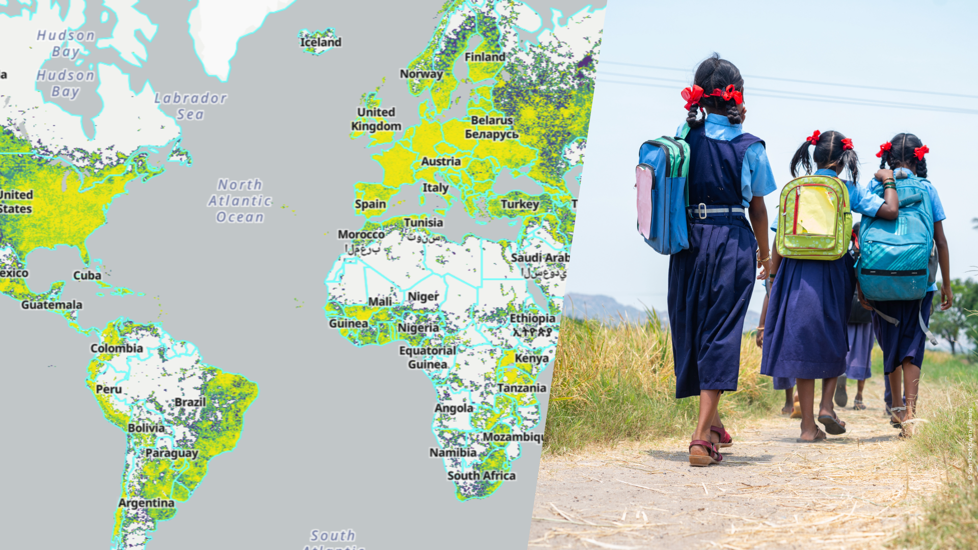
To make these inequalities visible, researchers at HeiGIT have developed OpenAccessLens, an open dataset platform that visualizes physical access to education and healthcare services worldwide. It shows how far people are from the nearest schools and hospitals, expressed in travel time or distance.
Making global disparities visible
Despite progress in recent decades, physical access to education and healthcare remains uneven across the world. National averages often conceal substantial geographic differences, let alone variations in age accessibility. In many parts of the world, children may never attend school or patients may struggle to get medical care because essential services are too far away.
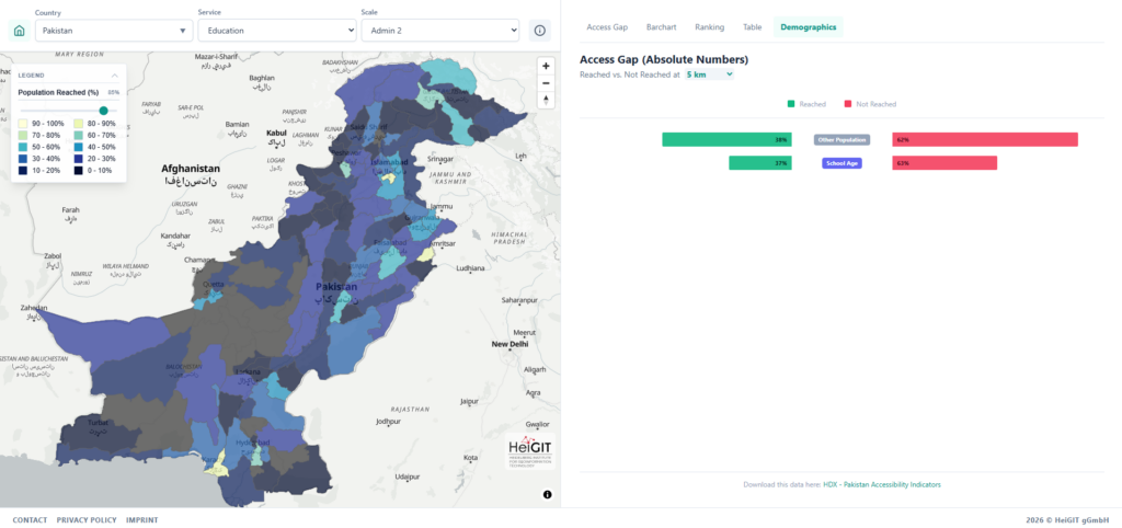
In countries facing structural challenges and repeated climate-related disasters, every additional kilometer can become a serious barrier to school attendance. In Pakistan, for example, accessibility data shows that fewer than 40 percent of schools are located within a five-kilometer reach, pointing to pronounced spatial disparities in access.
A similar picture emerges for healthcare. Rural areas in low- and middle-income countries often lack timely access to medical service. In Germany, reaching a hospital within 30 minutes is almost guaranteed nationwide, where as in Sierra Leone, only around 60% of the population can reach hospital care within the same timeframe.
From data to decisions
By translating spatial accessibility data into differentiated indicators, the platform supports decision-makers, researchers, and practitioners with an evidence base. It shows where access gaps exist and how many people are affected, supporting targeted decisions. For education planning, the data can highlight districts where large numbers of school-age children live beyond reasonable travel distances to the nearest school. In healthcare, identifying areas with limited accessibility can help local authorities plan mobile clinics or other interventions.
“Building on our earlier collaboration with UNICEF, the platform supports more equitable planning and helps monitor progress toward Sustainable Development Goals 3 and 4,” says data scientist Marcel Maurer from HeiGIT.
The reliability of these insights depends on the quality of the underlying data. OpenAccessLens combines travel-time and distance-based accessibility measures with WorldPop population data, and is created using open-source tools, primarily openrouteservice and OpenStreetMap. As an open dataset, its quality and relevance can continuously improve through community contributions.
The full OpenAccessLens dataset is freely available and can be downloaded as country-level data via the Humanitarian Data Exchange (HDX), operated by the United Nations Office for the Coordination of Humanitarian Affairs (OCHA).
This work was supported by the Klaus Tschira Stiftung, whose funding enables HeiGIT to advance open geospatial technology for climate action and humanitarian aid.
Contact person for the dataset:
Marcel Maurer
Email: marcel.maurer@heigit.org