As part of a transdisciplinary collaboration, the Heidelberg Institute for Geoinformation Technology (HeiGIT), the GIScience research group and the TdLab Geography at Heidelberg University are jointly developing adaptation strategies to support and protect at-risk groups during hot weather conditions. Individual needs of heat-sensitive people and near-real-time sensor data are combined in a heat-stress-avoiding routing application and will be provided via analogue maps and interactive web applications. The project “Heat Adaptation for Vulnerable Population Groups”, funded by the Baden-Württemberg Foundation with more than 600,000 € as part of the research programme “Innovations for Adaptation to Climate Change”, is a pioneer in the field of adaptation measures to climate change-related heat events due to the combination of the chosen methods.
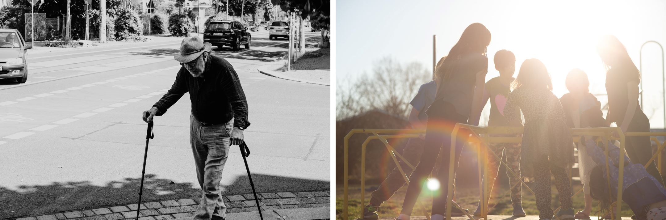
Heat waves, severe weather events, droughts – extreme weather conditions are occurring more and more frequently caused by anthropogenic climate change. Heat events in particular are increasing in intensity and frequency, especially in cities, where surface sealing and low greenery further contribute to heat stress. The health and well-being of citizens can suffer under these conditions: Circulatory problems, exacerbation of illnesses and heat stroke are just some of the health hazards to which at-risk groups such as the elderly, people with pre-existing conditions and young children are particularly exposed. Furthermore, some research indicates that there is a systematic link between prolonged and intense periods of heat and mortality.
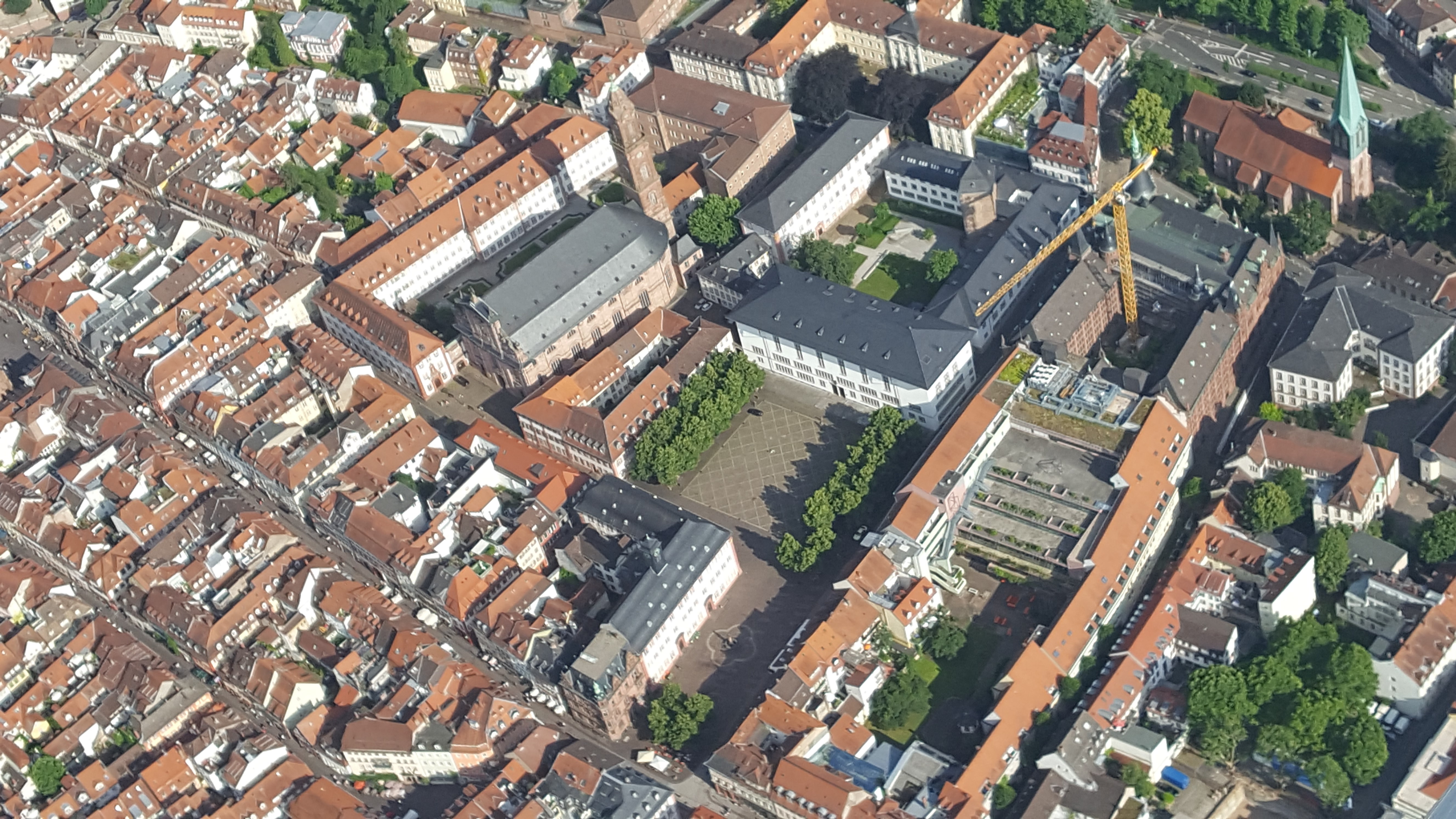
In Heidelberg, too, the increasing heat stress can be measured and perceived: data collected by geographers at Heidelberg University have shown that some squares and city districts are affected by particularly strong overheating. This can significantly impair the quality of life for citizens (Foshag et al. 2020). Therefore, the development of adaptation concepts and protection strategies is also urgently needed in the urban area of Heidelberg. In addition to urban planning aspects, individual strategies adapted to the needs of the affected groups are essential to support and ensure everyday life and mobility in the city even under heat stress conditions.
HEAL addresses this challenge: The project is a transdisciplinary cooperation of the Heidelberg Institute for Geoinformation Technology (HeiGIT), the GIScience Research Group of Heidelberg University, both headed by Prof. Dr. Alexander Zipf, and the TdLab Geography of Heidelberg University, headed by Dr. Nicole Aeschbach, and is funded by the Baden-Württemberg Foundation as part of the research programme “Innovations for Adaptation to Climate Change”. The implementation of the transdisciplinary design is realised through the involvement of affected groups of people (senior citizens, people with pre-existing conditions, families with young children), the organised civil society (senior citizens’ clubs, family networks) as well as the city administration of Heidelberg.
“In addition to providing information and adaptation concepts on heat stress in general, the aim of HEAL is to enable heat-adapted mobility for people in risk groups in particular via an app,” states Prof. Dr. Alexander Zipf. For this purpose, the project will use near-real-time sensor data to identify and model areas of increased heat stress. Based on the data and existing climate analysis maps, statistical prediction models will be developed. The results will be incorporated into navigation along shaded routes. The information obtained will be processed and made available via an interactive application, as analogue materials and maps.
“In this manner, the knowledge base on the effects of heat events on risk groups will be expanded for the Heidelberg area, individual adaptation strategies will be explored and implemented using near-real-time data, and administrative measures will be developed together with the city administration.” explain Dr. Kathrin Foshag und Johannes Fürle, co-initiators of the research project.
The project focuses on two aspects:
Involving stakeholders and target groups in the research process.
By directly involving at-risk groups, their needs can be identified in a focused manner and the research process can be individually adapted. Examples include key parameters for heat-avoiding routing, such as slope, noise and greenness. “This transdisciplinary approach decisively increases the effectiveness and feasibility of the measures,” states Dr. Nicole Aeschbach, head of TdLab Geography.
Integration of public smart city data into a routing system
By using an app, a routing application is to be implemented based on near-real-time data. This will enable users to calculate shady and heat-stress-avoiding routes. In addition to the needs determined by the target groups themselves, an extensive LoRaWAN sensor network in the city of Heidelberg will provide additional input factors. For this purpose, the team is cooperating with the digital agency of the City of Heidelberg as an external partner to implement new sensors in the city area. These record parameters such as air temperature and humidity, can be integrated into the routing and allow the highest flexibility for route planning. The approach thus goes far beyond existing models: “The use of dynamically updated indicators and the high spatial resolution of the merged routing weights makes it possible to plan routes and evaluate sensor data and indicators with regard to optimal mobility and activity periods,” emphasises Dr. Sven Lautenbach.
About HeiGIT
The aim of the Heidelberg Institute for Geoinformation Technology (HeiGIT) is to improve the transfer of knowledge and technology from basic geoinformatics research into practice by using innovative geoinformation technologies. It is scientifically directed by Prof. Dr. Alexander Zipf and funded by the Klaus Tschira Stiftung gGmbH. As an affiliated institute of Heidelberg University, there is close cooperation with the staff of the Department of Geoinformatics at the Institute of Geography. Hence, innovative solutions can be realised at the cutting edge of research and technology.
About GIScience Research Group
The GIScience Research Group at Heidelberg University focusses on innovative basic and applied research as well as on the latest technology at the interface between geography and computational sciences. Due to the very close cooperation with the HeiGIT, it is possible to realise state of the art research. The HeiGIT/GIScience team has been running and developing the openrouteservice (ORS) for more than ten years, which will be used as a backend for the routing application.
About TdLab Geography (Transdisciplinarity Lab)
The team of the TdLab Geography (Transdisciplinarity Lab) at Heidelberg University, led by Dr. Nicole Aeschbach, develops climate change mitigation and adaptation measures in co-design with stakeholders from industry, public authorities, politics and civil society. For this purpose, natural and social science research is linked with requirements and knowledge from practice. Characteristic of the transdisciplinary research process are innovative methods that aim to effectively integrate the different perspectives.
Contact
GIScience Research Group
Institute of Geography
Heidelberg University
Im Neuenheimer Feld 348
DE 69120 Heidelberg
Email johannes.fuerle [AT] uni-heidelberg.de
Phone +49 6221 54-5525