
Students of the Institute of Geography at Heidelberg University explored local perceptions of urban heat in Heidelberg’s old town as part of a 2024 seminar on GIS for Disaster Risk Reduction and Humanitarian Aid. The project, supported by Heidelberg Institute for Geoinformation Technology (HeiGIT), tested participatory mapping using the Sketch Map Tool combined with KoboToolbox.
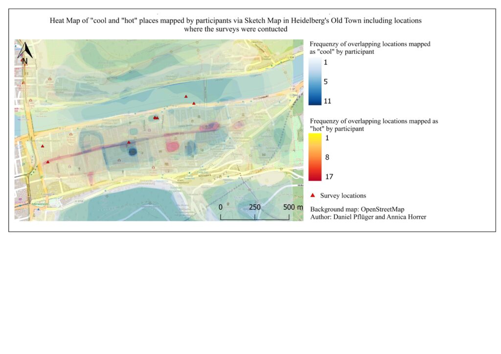
The Sketch Map Tool is an easy-to-use tool for participatory mapping through offline collection, digitisation and georeferencing of local data. It simplifies the gathering and analysis of spatial knowledge and perceptions using pens and paper maps, the so-called Sketch Maps. In this small-scale case study, 19 residents were asked to mark perceived hot (red) and cool (blue) areas on printed maps and complete a short questionnaire. The old town of Heidelberg was chosen due to its dense structure and known urban heat island effect.
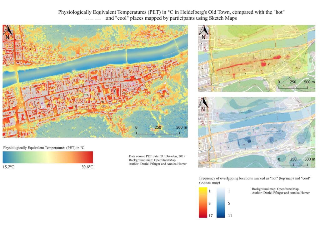
The Sketch Maps were analyzed in ArcGIS. Overlapping markings were visualized in heat maps and compared to modelled physiologically equivalent temperature (PET) data provided by the city of Heidelberg. Results showed that popular areas were often marked as both hot and cool, highlighting the subjective nature of perception. In addition, there are differences in the modelled and perceived hot spots, emphasizing that participatory mapping is a valuable addition to urban climate models for urban planning.
The mapping supported the final phase of the HEAL (Heat Adaptation for Vulnerable Population Groups) project in summer 2024, a transdisciplinary initiative by the Heidelberg Institute for Geoinformation Technology (HeiGIT), the GIScience research group and the TdLab Geography (Transdisciplinarity Lab). The results helped inform the development of the HEAL routing app, which suggests cooler paths through the city. In addition, the various surveys, publications and events helped to raise individual awareness of heat in the city and provided important insights for municipal heat adaptation.
References:
Term paper: Annica Horrer, Daniel Pflüger 2024: Untersuchung des Hitzeempfindens von Heidelberger Bewohner*innen mithilfe des SketchMap Tools und KoboToolbox – Eine Analyse zur Nutzerfreundlichkeit der Tools
More information about the Sketch Map Tool & this use case: https://sketch-map-tool.heigit.org
Try the HEAL Routing App: https://heal.openrouteservice.org/#/place/@8.685808181762697,49.41442144045737,15


