From assessing CO2 emissions from residential heating to urban active mobility infrastructure, the Climate Action Navigator helps identify where targeted action is most urgently needed to counteract climate change. The newly added Rooftop Solar assessment tool shows which buildings have solar panels on their rooftop, detecting them from aerial imagery.
The presence and distribution of solar panels on building rooftops is a relevant factor for climate- friendly urban planning, as rooftop solar panels reduce dependence on non-renewable (high-emissions) energy sources. In particular, using solar panels generates no emissions onsite and reduces scope 2 emissions (i. e. indirect emissions from purchased or acquired energy) by reducing the need to consume electricity generated elsewhere from non-renewable sources.
Rooftop Solar: Which Buildings Have Solar Panels on the Roof?
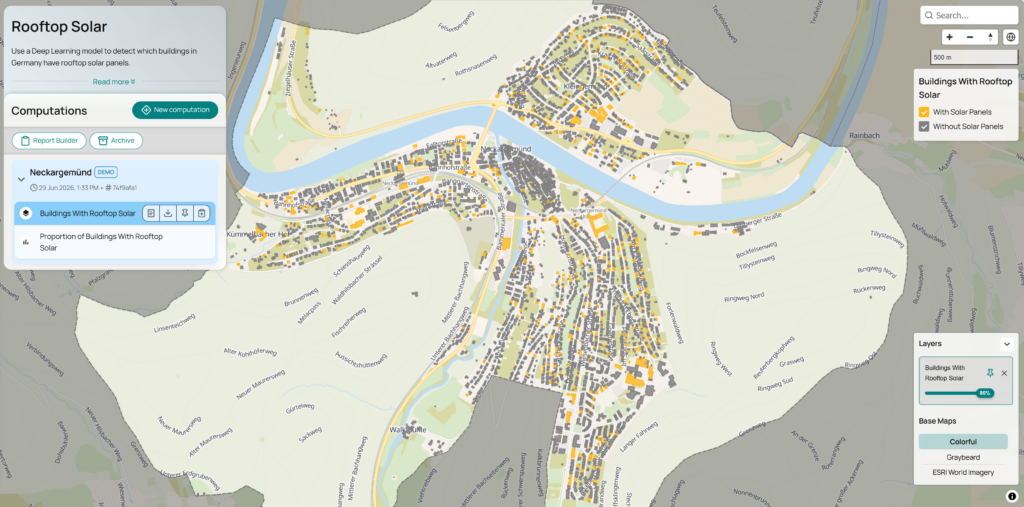
With the Rooftop Solar assessment tool, users can visualize solar panels on rooftops in a given neighborhood, city, or custom area. The dashboard offers maps in a very high resolution, giving extremely precise insights on which buildings already have solar panels, and which buildings don´t (fig. 1).
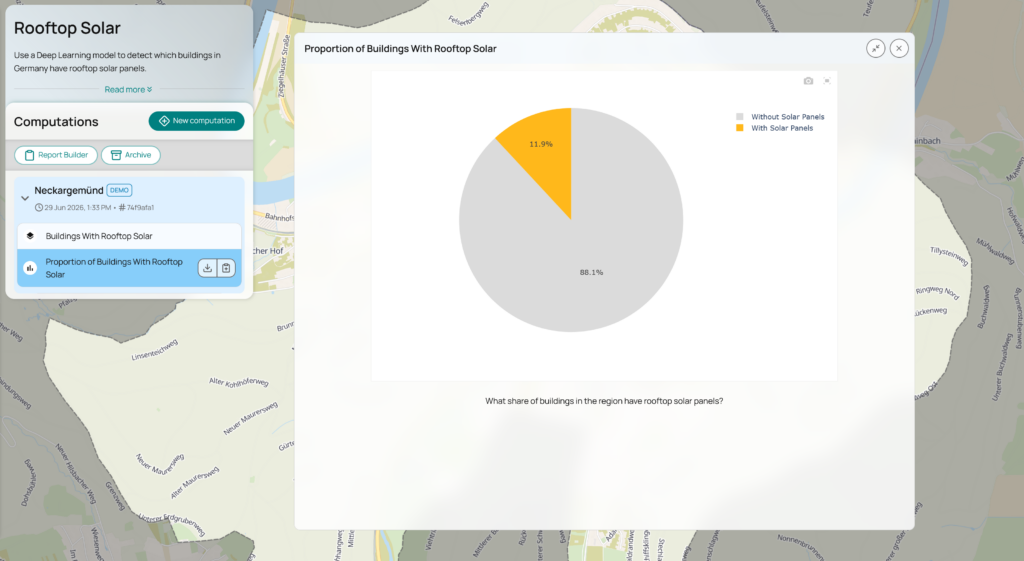
Moreover, the assessment tool also calculates and visualizes statistics about the share of solar panels in the area of interest (fig. 2), which gives a fast overview of how well a district or region fares and where the most potential for adding solar panels lies.
These insights can be used to assess available and consumed solar potential of buildings and to form targeted strategies for reducing dependency on high-emissions electricity.
Data and Methodology: Deep Learning Detection of Solar Panels
The Rooftop Solar assessment tool is based on a computer vision model that automatically detects solar panels from aerial imagery. The underlying infrastructure is a deep learning model trained from convolutional neural network EfficientNetV2: When given an aerial image of a building, the model recognizes whether or not there are rooftop solar panels on the image. The buildings are identified using building outlines in OpenStreetMap. The model was trained on 23 cities across Germany and achieved 94 % accuracy.
The model requires aerial imagery with an extremely high resolution (~20 cm). For data availability reasons, the assessment tool is currently available only for Germany, as all German states provide public aerial imagery of sufficient resolution. If suitable aerial imagery is available, this model can be extended to other countries. However, the model should be validated before transferring to other locations, especially if they have different architectural roof styles.
From Insight To Action: The Climate Action Navigator
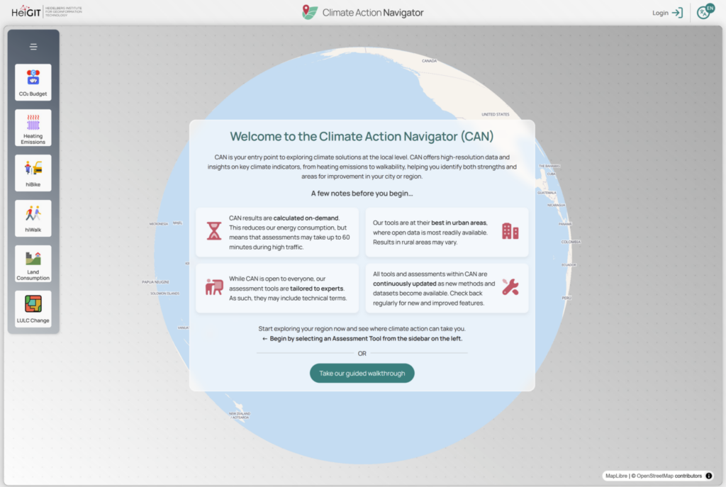
The Climate Action Navigator (CAN) offers several climate action assessment tools on walkability and bikeability, land consumption, land use and land cover (LULC) change, residential heating emissions, CO₂ budgets, and traffic emissions. These are designed to help stakeholders such as NGOs, city administrations, and citizens’ initiatives to identify strengths as well as gaps of climate mitigation in different areas. As CAN’s assessment tools visualize data at street-level resolution, interventions and improvements can be targeted and consider the specific local context.
What’s Next?
The Climate Action Navigator is always in progress, as the assessment tools are constantly improved and developed further to meet the needs of our partner organizations.
We have just added new indicators for shade and slope to our indicators for walkability and bikeability. As a next step, we are planning to release a new transitability tool, which will assess the availability and quality of public transport options.
Get started with the Climate Action Navigator by creating a free user account and exploring your neighborhood with the assessment tools. If you want to contribute to the development of the indicators, we welcome collaboration with NGOs, citizens’ initiatives, or city administrations with specific use cases. We also invite research institutions interested in contributing to the scientific foundation of our tools. Contact us at climate-action-navigator@heigit.org.
More information on the Climate Action Navigator and its assessment tools can also be found on the project webpage, in our blog, and, of course, on the Climate Action Navigator dashboard itself.