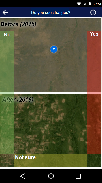
The Humanitarian OpenStreetMap Team (HOT) , the Heidelberg Institute of Geoinformation Technology (HeiGIT) , and the wider MapSwipe Community started working on an MapSwipe extension to monitor changes in satellite imagery. The goal of the two-month project is to extend the app with new functionalities that would allow the users to compare two satellite images (e.g. from before and after) and indicate area which changed. By crowdsourcing the development of land cover or built-up areas the project will help humanitarian organizations to address the challenges posed by the Sustainable Development Goals (SDGs).
HOT with funding from NASA, has partnered with Development Seed and Oregon State University on a project called “Missing Millions” , with the objective to create an open global database of informal settlements, using crowdsourced data, machine learning, and multi-sensor satellite imagery. The absence of an open database for informal settlements globally means that many millions of the worlds most vulnerable populations are missing and unaccounted for. As part of this project, HOT wants to explore crowdsourced mapping methods for analyzing large areas and identifying potential presence of informal settlements. And here MapSwipe comes into play. Imagery with high temporal resolution and global coverage offered by Planet, Landsat and Sentinel satellites provides an opportunity to analyze large areas and detect change with a crowdsourcing approach in MapSwipe. While the “Missing Millions” project will only focus on mapping informal settlements, the methods and tools we develop for MapSwipe could be applied for other humanitarian applications, such as for rapid damage assessment tasks or flood mapping.
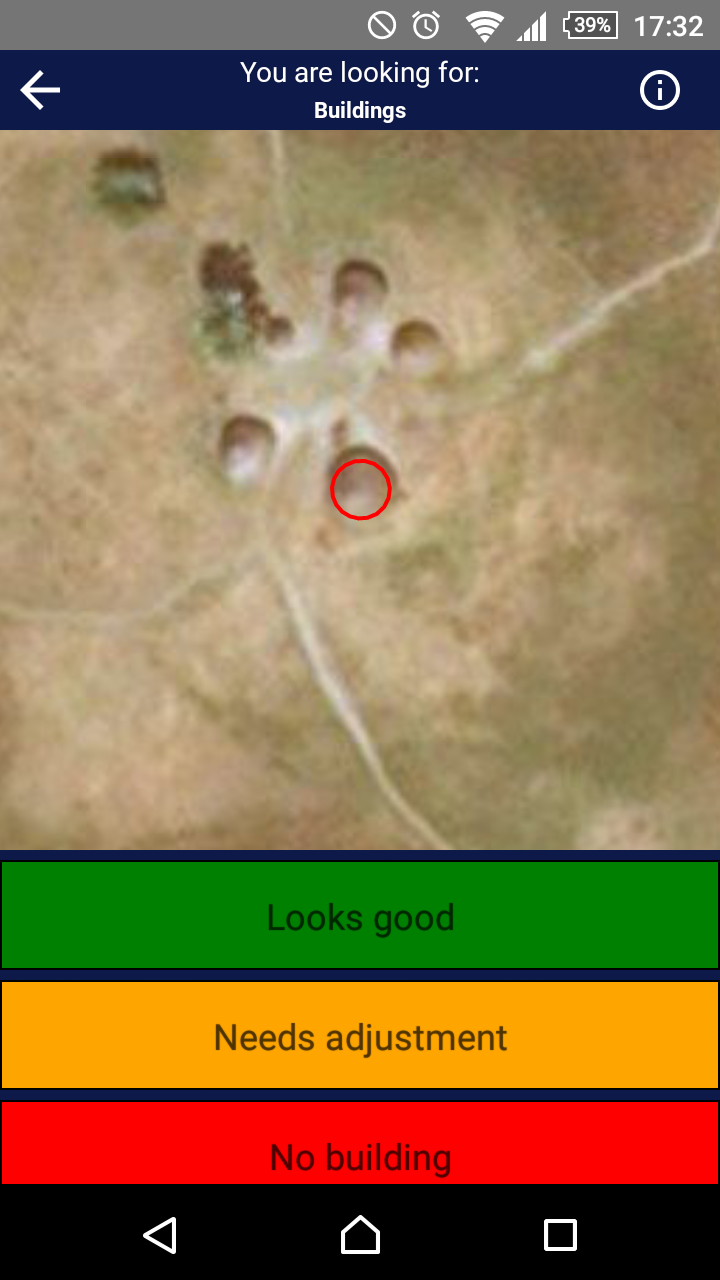
The basis for this MapSwipe development lies in recent improvements we made towards opening, cleaning and updating the source code of MapSwipe. As a community we envision to bring our mapping tool to the next level. Therefore, we are also working on yet another mapping type: building footprint validation. If you are interested in finding out more about what’s going on take a look at GitHub and /or at the OSM Wiki Page . The MapSwipe Working Group meets every second week and always welcomes fresh minds. Furthermore, MapSwipe will be presented at MSF Scientific Days in London and the Global Platform for Disaster Risk Reduction in Geneva.
|
 |
|
|
Figure: Screenshot for the current MapSwipe project type (left) and mockups for new project types: building footprint validation (center) and change detection (right) |
||