This study presents an environment-driven, open-data approach to infer and spatially complete urban traffic speed classes at the citywide scale.
As cities grow and urban mobility demands intensify, accurately forecasting traffic speed has become increasingly important for optimizing transportation networks and urban efficiency. Traditional methods, reliant on sensors and traffic flow data, face limitations in coverage and scalability. While platforms like Google Maps offer real-time traffic data, they are often costly and restricted due to privacy and licensing concerns. To address these challenges, this paper proposes an alternative, low-cost approach for traffic speed prediction and spatial completion using open data, focusing on the integration of OpenStreetMap (OSM) features and Street View imagery (SVI).
The study adopts an environment-driven modeling strategy, particularly suited to urban areas where conventional observations are sparse or uneven. By classifying traffic speeds into distinct categories instead of continuous values, the model emphasizes long-term patterns and improves interpretability. This approach makes it more applicable for route planning, policy formulation, and emissions assessments. The model also breaks away from heavy reliance on real-time speed data and uses contextual features from OSM and SVI to predict traffic conditions across a broader urban network, including suburban areas and roads with limited or no observations.
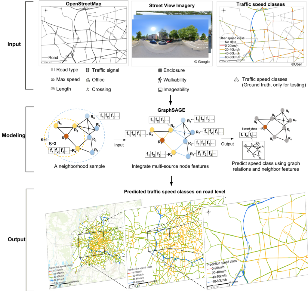
Workflow of the proposed speed class prediction framework integrating multi-source open data, spatial graph representation, and supervised learning to produce complete urban traffic speed class maps.
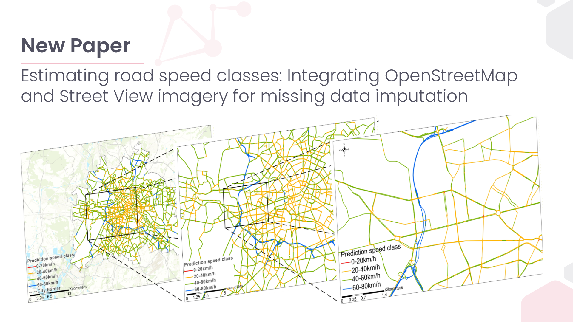
Berlin is selected as the case study due to its heterogeneous urban structure and well-developed transportation system shaped by long-term sustainable mobility policies. Road-related characteristics are primarily derived from OSM, with data quality assessed using the ohsome dashboard. In Berlin, OSM covers approximately 96 % of the Microsoft Roads-defined network, with a mapping saturation of 97.09 %, indicating sufficient data quality for the analysis.
Key findings highlight the significant improvements in predictive performance when combining multi-source features. Integrating OSM features and SVI data boosted model accuracy, with notable gains in F1 score, precision, and recall. Contextual OSM features showed robust performance across different traffic periods and speed classes, while SVI contributed complementary information, albeit with some redundancy. The model’s ability to generalize across space makes it scalable, and a cost-effective solution for urban traffic speed estimation.
The study’s main contributions include proposing a reproducible framework for large-scale traffic speed classification, demonstrating the value of combining environmental data sources, and offering insights into the effectiveness of different features in traffic prediction. These findings suggest that open and standardized data sources can support transferable traffic speed inference frameworks, with potential applicability in different urban contexts.
Reference: Tang, S., Randhawa, S., Rui, J., Ludwig, C., Knoblauch, S., Hatfield, C., & Zipf, A. (2026). Estimating road speed classes: Integrating OpenStreetMap and Street View imagery for missing data imputation. Computers, Environment and Urban Systems, 125, Article 102392. https://doi.org/10.1016/j.compenvurbsys.2025.102392