A new version of ohsome-planet (codename “Sjælland”) has been released. It is the newest version of HeiGIT´s command line tool, which transforms OpenStreetMap (history) PBF files into into an analysis-ready data format. We illustrate what ohsome-planet can do by assessing how many OSM edits used Bing Imagery as reference source.
What is ohsome-planet?
Working with raw OSM data presents several challenges due to its complex structure. Typically, users require data that is readily compatible with GIS applications. ohsome-planet simplifies this process, providing a structured and GIS-ready dataset for improved usability.
With ohsome-planet, we can convert OSM (history) PBF files into GeoParquet format, which can be used to perform a wide range of geospatial analyses, e.g. using DuckDB, GeoPandas or QGIS. The tool also enriches OSM element data by integrating information from OSM changesets and administrative boundaries. This additional contextual data allows for more efficient and straightforward spatial analysis, further improving the utility of OSM datasets.
The ohsome-planet dataset can support the analysis of various aspects of OSM, including its evolution, data quality, and mapping activity. As GeoParquet is optimized for cloud storage, working with this format allows users to efficiently process and analyze large-scale spatial data in cloud environments, while also having the flexibility to visualize and interact with the data locally using QGIS.
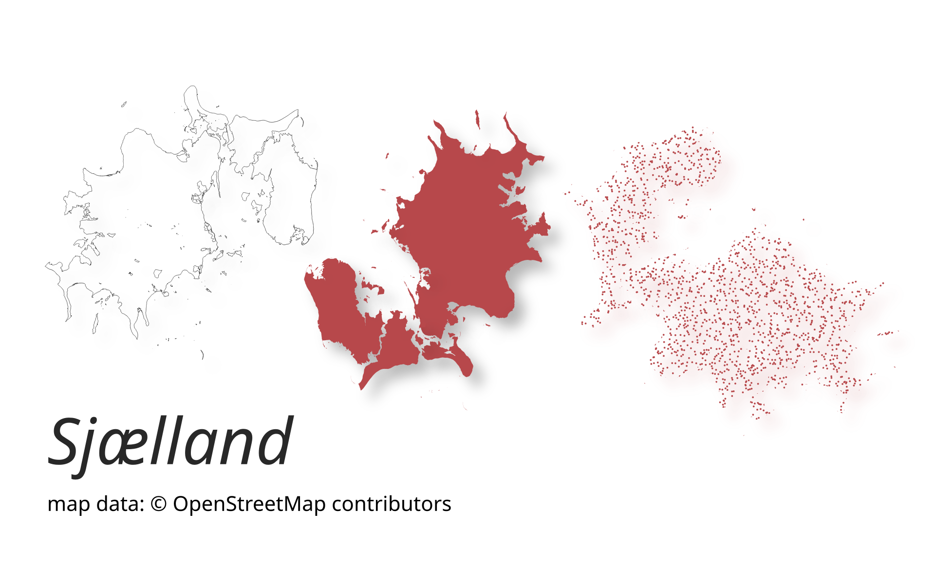
Version 1.1.0 “Sjælland”
The latest release of ohsome-planet delivers significant performance upgrades, especially when processing complex multipolygon relations. These are essential elements in OpenStreetMap, being used to represent administrative boundaries, large lakes, forests, and many other key map features. With the new improvements, the full history of OSM edits can be now processed in less that 6 hours, even including the computationally expensive part of geometry building.
The newest version of ohsome-planet, named “Sjælland“ after the Danish region, is now available. You can find the software library on GitHub.
Use case: How many OSM edits used Bing Imagery as reference source?
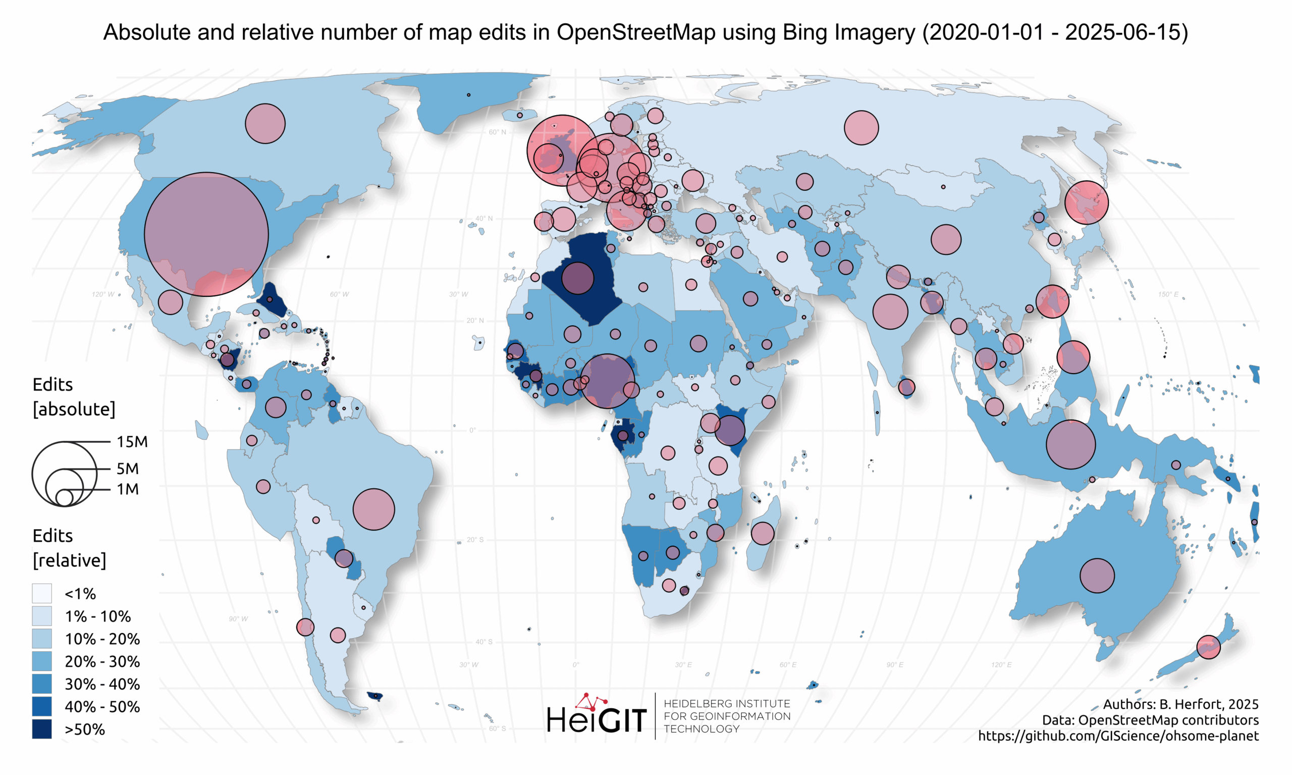
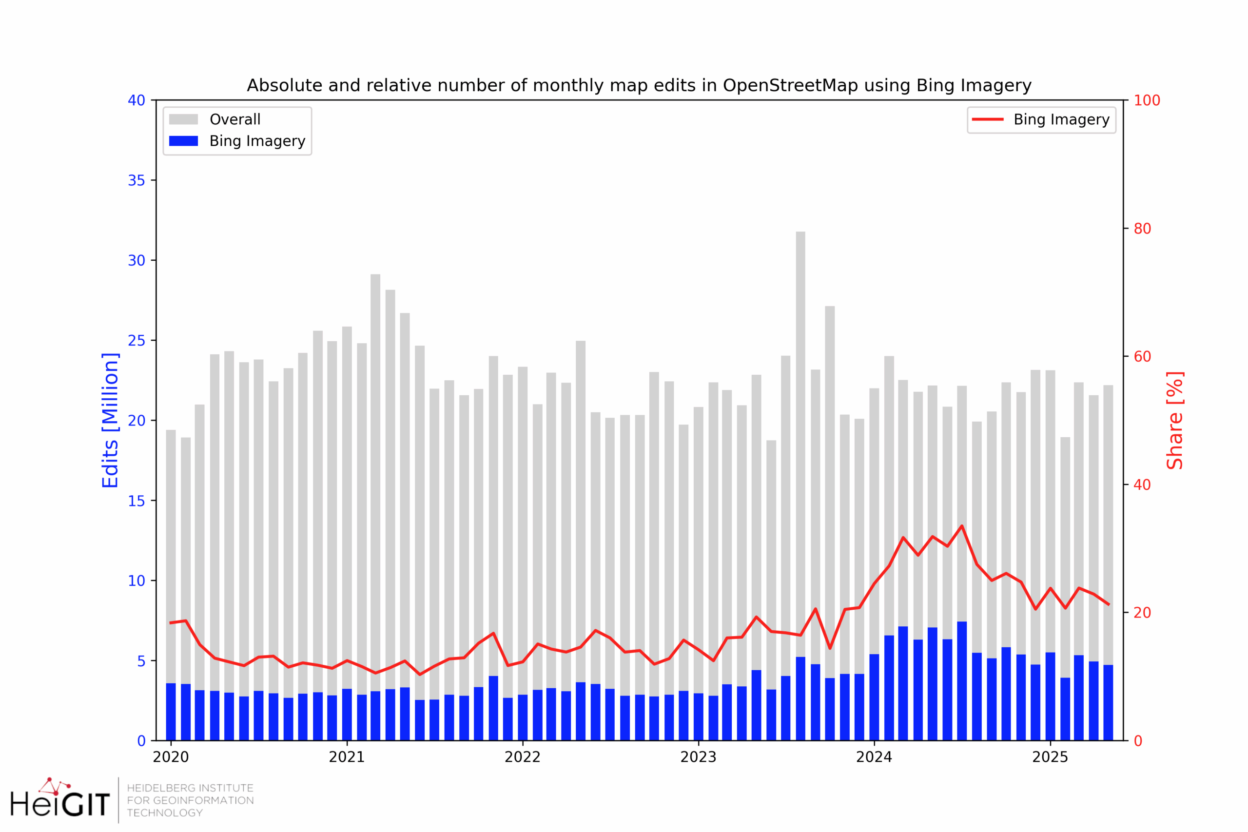
At HeiGIT, we use ohsome-planet data to support our global scale research on OpenStreetMap mapping activity and data quality. One of our latest case studies focused on assessing the importance of Bing Maps imagery for OSM mapping. Specifically, we wanted to find out how many OSM edits used Bing Imagery as the reference source.
In OSM, the information on the imagery source is not attached to the element itself, but to the changeset. This typically requires joins between changesets and OSM elements to get the imagery source information. With ohsome-planet, this turns out to be an easy exercise! The tool transforms OSM PBF files into GeoParquet files, which can be easily analyzed using programs such as DuckDB.
The results of this analysis show that Bing Imagery plays a major role in global OSM mapping. A particularly high absolute number of map edits based on Bing Imagery was observed in several countries, including Brazil, Germany, Indonesia, Nigeria, the UK, and the USA. This is visualized by the size of the circles in the map below, which also shows where Bing Imagery is the primary source for mapping by using a darker blue color.
In 2025, about 20% of all OSM map edits have used Bing Imagery as the reference. This corresponds to about 5 Million edits every month!
To keep up with future developments and releases related to this project as well as other efforts to advance geospatial technology in the mobility, humanitarian aid, and data analytics areas, follow our social media channels and stay up to date on our blog.