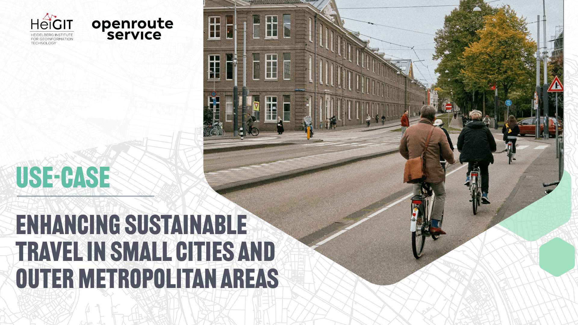
The ENHANCE project explores how 15-minute city principles can be applied beyond dense urban hubs, using mapping, behavioral research, and simulation tools to design more sustainable and inclusive mobility systems.
The ENHANCE project, funded by Driving Urban Transitions to a Sustainable Future (DUT) under JPI Urban Europe, addresses the challenges of implementing 15-minute city (15mC) principles in outer metropolitan areas and smaller urban communities. Unlike dense city centers, these areas often face car dependency, fragmented infrastructure, and dispersed services that limit sustainable mobility options.
The project seeks to strengthen the empirical foundation of the 15mC concept by developing methods to map local service provision and assess opportunities for short-distance active travel. It also examines actual travel behavior to understand differences in mobility needs across social groups and evaluates to what extent daily needs can be met locally. In addition, ENHANCE is creating a simulation environment to explore the potential impacts of various strategies to achieve 15mC objectives, with particular attention to equity and inclusion.
Methodology
Combining spatial analysis, behavioral research, and scenario modelling, the project brings together expertise from multiple countries. For instance, Vrije Universiteit Amsterdam (VU) has developed open-source accessibility indicators to measure walking and cycling access to key facilities, while the University College London (UCL) has created a cycling index incorporating both cycling infrastructure and user preferences using the Level of Traffic Stress framework. VU and the Universidade NOVA de Lisboa (UNL) are assessing how urban form, socio-demographic factors, and travel preferences influence the adoption of the 15mC concept, as well as its potential to reduce car dependency. VU has also partnered with a Dutch company to analyze individual GPS-tracked travel behavior, providing deeper insights into real-world mobility patterns.
To capture the relationship between built environments and people’s travel behavior within the 15mC framework, VU utilized openrouteservice to calculate 15-minute isochrones for active travel modes (i.e., walking and cycling) at the postcode level. These isochrones provide a realistic representation of the areas people can reach within a short time, enabling the project to link accessibility measures and the environment directly with behavioral data. This provided the team with nuanced insights that underpin analyses, helping to shape the planning of more sustainable and inclusive cities.
In this study, the centroids of six-digit postal codes (PC6) served as origin points for isochrone computation, making ORS well-suited for city- and regional-scale accessibility analysis.
The workflow, implemented in R and Python, involved the following steps:
- Isochrone generation: The research team first generated 15-minute walking and cycling isochrones for each PC6 centroid, explicitly accounting for the different travel speeds of these two modes.
- POI extraction: These isochrones were then enriched with spatial information from OpenStreetMap and other datasets (e.g., land use, BAG, Top10NL), allowing the team to characterize the potential accessibility of each origin in terms of points of interest (POI) and physical environment.
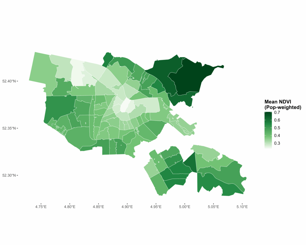
- Environmental variable calculation: NDVI (Normalized Difference Vegetation Index) was calculated within each isochrone using satellite imagery, enabling the researchers to quantify green space accessibility and assess whether greener environments encourage active travel behavior.
- Population-weighted aggregation: The resulting indicators were subsequently linked with travelers’ socioeconomic attributes and behavioral data, enabling the team to examine how built environment features shape the likelihood of undertaking sustainable trips (walking or cycling) within 15 minutes. By identifying environmental factors that consistently exhibit positive associations with short-distance travel, the workflow provides an empirical basis for evaluating the feasibility of the 15-minute city concept and for formulating evidence-based recommendations for urban planning.
Preliminary findings
Based on our preliminary findings (currently for Amsterdam only), socio-demographic characteristics appear to have a stronger influence on 15-minute cycling compared to 15-minute walking. Origins with higher potential accessibility are associated with a greater likelihood of engaging in sustainable 15-minute travel. Furthermore, the richness and balance of POI categories increase the probability of people undertaking such trips. Walking and cycling infrastructure also contribute to higher levels of 15-minute walking and cycling. In addition, population density shows a positive association with 15-minute walking but no significant influence on 15-minute cycling. These findings highlight that the built environment influences walking and cycling in distinct ways, emphasizing the importance of treating them as separate modes rather than grouping them under active travel in transport and urban planning for the 15mC concept.
Are you applying openrouteservice in research or projects on sustainable mobility or disaster management? Get in touch with communications[at]heigit.org to be featured on our blog.