The Silver Ways project aims to make it easier for older adults to get around cities by creating a routing system targeted to their needs. To ground this system in lived experience, the team conducted a series of workshops with elderly groups across Mannheim.
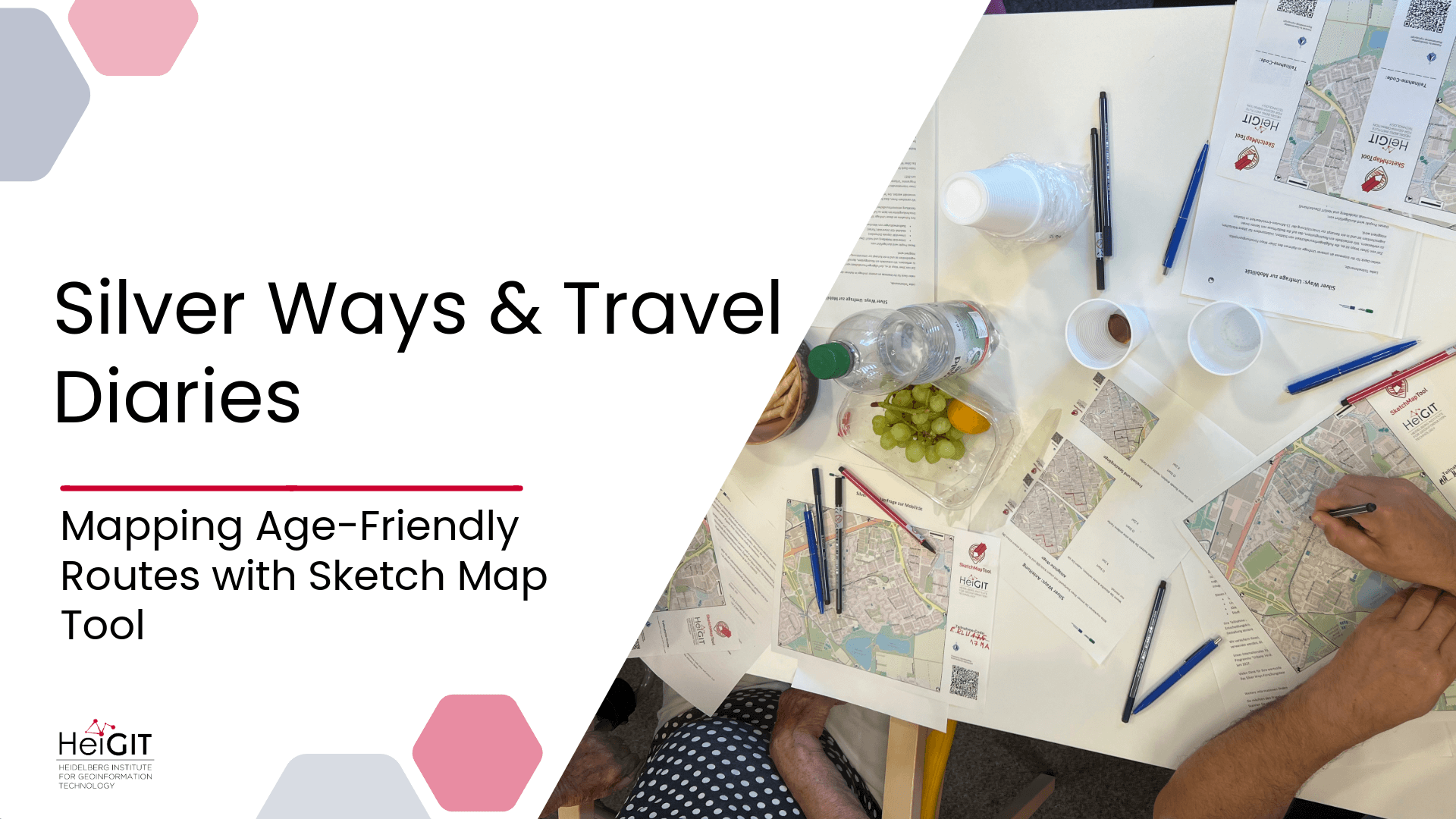
The Silver Ways project develops a routing system that is designed specifically for older adults, taking into account their needs and preferences. To understand how seniors move through their neighborhoods, the project begins by mapping walking routes for older adults in three urban areas in Mannheim, Uppsala and Kayseri. In Mannheim, the team conducted a series of participatory mapping workshops with different elderly groups across the city, ranging from women’s gymnastics groups to active seniors living together in the same apartment complex.
Participants were asked to map their personal walking routes, preferences, and obstacles. They also mapped places that are enjoyable to walk as well as challenges such as uneven sidewalks, missing benches, or heavy traffic. These maps, once digitized, preserved not only geographic information but also the human stories and perspectives behind it.
These route choices are modeled using an econometric approach to quantify trade-offs between attributes such as distance and elevation. By combining travel diary data with econometric models, Silver Ways analyzes route choices and validates its system in Urban Living Labs. This process results in a 15-Minute Neighborhood Index, which identifies locations where essential services are accessible within a short, age-friendly walk.
Using Sketch Map Tool to capture mobility needs
Collecting travel diaries remains a challenge in mobility research. While these diaries provide valuable insights, traditional methods like paper, phone, or online surveys face declining response rates. Smartphone-based approaches can help but often exclude digitally marginalized groups, especially older adults. The Sketch Map Tool offers an innovative and inclusive way to capture human-centered travel diaries.
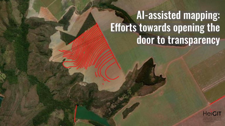
Unlike GPS-based “Track & Trace” datasets, which primarily record where people move, the Sketch Map Tool captures how people experience those movements. Participants are not limited to tracing routes; they can also sketch abstract or experiential aspects of their journeys. This qualitative richness adds an essential layer of meaning to mobility data, embedding personal perceptions of comfort, safety, and accessibility that conventional tracking methods cannot reveal.
The tool itself is open-source and user-friendly. Participants annotate printed maps, which are based on OpenStreetMap or satellite imagery. The sketches are first scanned or photographed and automatically digitized and georeferenced. Turning lived experiences into structured geospatial data. The method is intentionally low-threshold and accessible: no prior technical knowledge is required, making it especially suitable for seniors with limited digital skills. With only pen and paper, mobility experiences can be collected quickly and effectively during participatory workshops. At the same time, AI-assisted processing ensures accurate conversion of hand-drawn inputs into GIS-compatible formats.
By transforming printed sketch maps into geospatial data, the Sketch Map Tool bridges the gap between analogue and digital solutions. It also empowers seniors to shape their neighborhoods and make cities more walkable and livable for different groups.
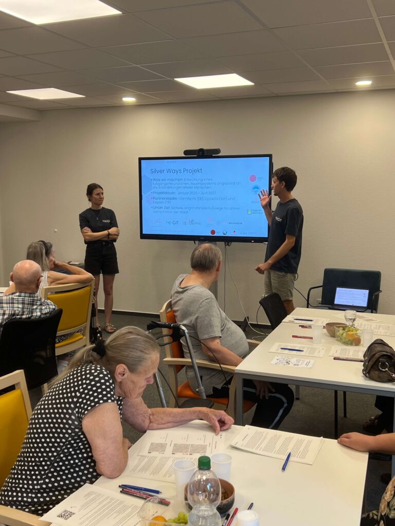
The workshops created a space for participants to share their everyday mobility experiences, helping researchers identify both the preferences and the obstacles that shape walking in later life. These insights provide a foundation for refining routing algorithms, informing urban planning, and ensuring that the resulting mobility solutions are grounded in the actual experiences of older citizens.
For more information about the project, visit the Silver Ways website.