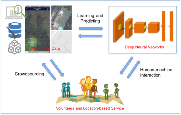
Satellite images are widely applied in humanitarian mapping which labels buildings, roads and so on for humanitarian aid and economic development. However, the labeling now is mostly done by volunteers….
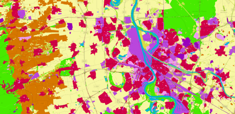
Land use data created by humans (OSM) was fused with satellite remote sensing data, resulting in a conterminous land use data set without gaps. The first version is now available…